Trans-Zion With Masses and Nightly Solitude
I have hiked Zion National Park since teen years in Las Vegas, Nevada. We rarely saw anyone on most of our 1970s-80s trips to West Rim from Lava Point, Kolob Canyons, and—in December—a snowy slog up from Zion Canyon. The Park was busy only in the spring season.
Not so in 2018! Our November Trans-Zion backpack from west to east offered staggering views, cold weather, and hundreds of hikers. (The third most popular park in the U.S., Zion had 4.5 million visitors in 2019, prompting Park Service to consider limiting visitor numbers with inevitable political pushback.
Zion’s popularity was foreshadowed when we left Interstate-15 on curvy scenic SR-17 to the park. Southern Utah has been discovered! What I remembered as hamlets enroute to the park were booming. On the edge of LaVerkin, I saw subdivisions. (At end of trip we passed through wall-to-wall new houses in Hurricane which grew from 10,0000 to 20,000 between 2010 and 2020 censuses.)
We stopped at our reserved bed and breakfast (B&B) inn (one of three options in Rockville), a few miles from the park. A bit closer in Springdale, rustic motels had been replaced by luxurious mega-hotels; and a cottage industry of outfitter shops offered transport for hikers and climbers to West Rim, East Rim and The Narrows. At Zion Outfitters we confirmed trailhead transport the next morning and tried on “dry pants” and canyoneering boots for cold water hiking in The Narrows at end of the week. We planned to do this after our Trans-Zion Trek and second night at our B&B with ride from outfitter to far end of The Narrows and one campsite reserved. We then would take a shuttle to Zion Lodge for a night in the main canyon,
Our last stop for evening was Zion Visitor Center. The Park Service allowed reserving most backcountry campsites online, but you had to show up in person for a wilderness permit. Even in mid-November, the visitor center parking lot was packed, and cars lined Mt. Carmel Highway another mile. Only visitors with reservations at Zion Lodge can drive into the canyon; day hikers must use free park shuttles—monster buses that deposit clumps of 15-20 hikers at every trailhead.
As it turned out, we would encounter masses of people—day hikers, joggers, canyoneers—near every trailhead during our four-day trek. Later in the main canyon we noticed large groups or “pulses” of hikers arriving on the shuttles. On the way to our trailhead, we saw many vehicles parked at the mouth of a popular canyon hike/rappel—and saw many footprints and social trails near the route to its upper end.
However much of our trek through wilderness was in solitude, even during the day. We saw only a total 10 individuals backpacking and we camped by ourselves in official camp areas every night.
Zion Wilderness covers more than 124,000 acres within Zion National Park, the third most visited national park in the U.S. Designated in 2009, the wilderness encompasses high plateaus, a maze of narrow, deep sandstone canyons, and striking rock towers and mesas. The arid climate and sparse vegetation reveal the park’s geologic history.
Zion history includes indigenous human presence dating back 8,000 years. John Wesley Powell called the area Mukuntuweap, an indigenous Paiute name meaning “straight canyon.” Mormon settlers renamed it “Zion” referring to the Kingdom of Heaven or a happy, peaceful place. High water volume in wet seasons maintains the stark geology, as the Virgin River transports about 3 million tons of sediment annually.
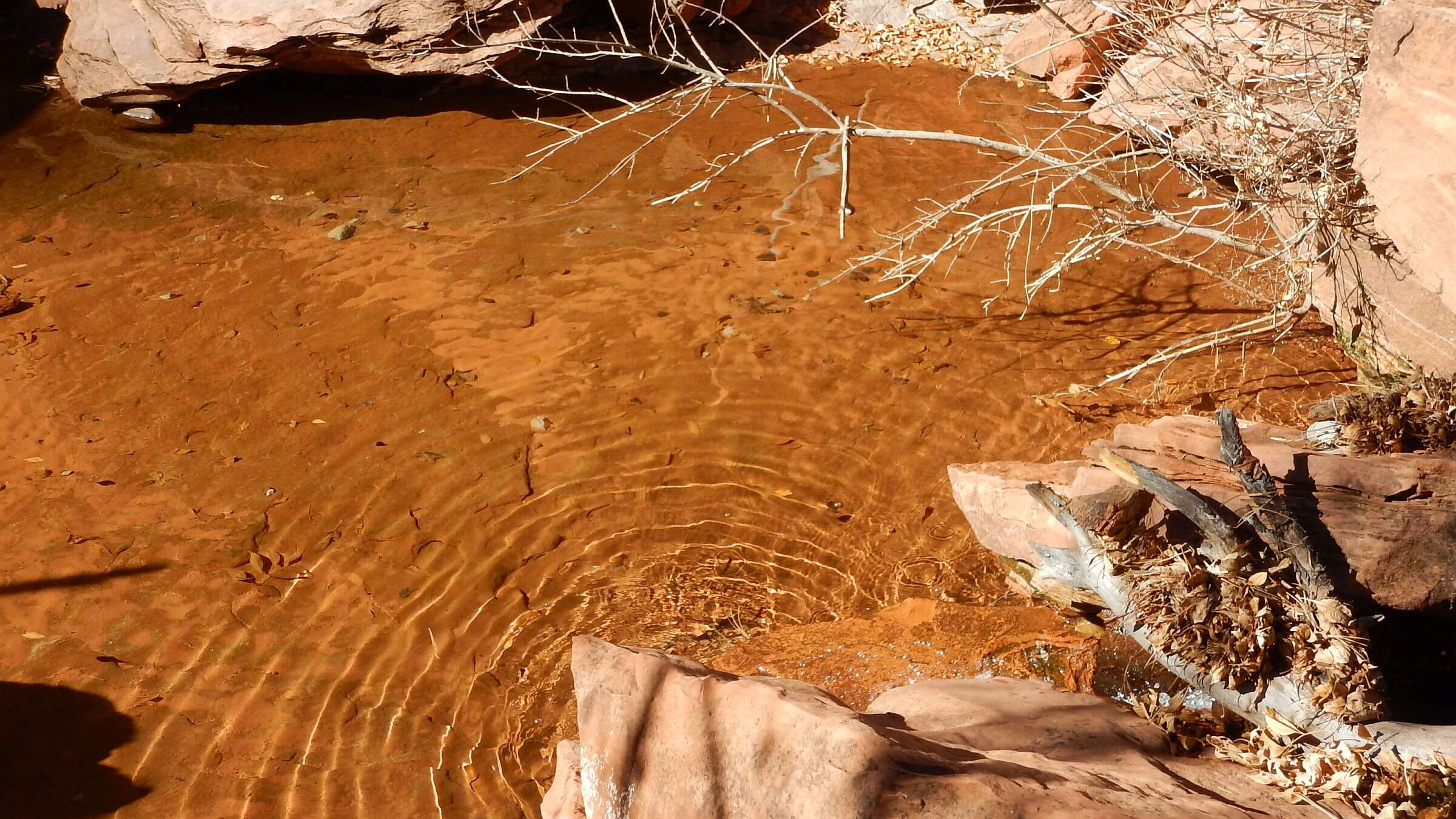
Biggest challenges backpacking Zion Wilderness are obtaining permits for limited wilderness campsites and finding ample water. Park Service is helpful with both, but permits should be obtained months in advance for best options. Water was adequate for our November visit, but Virgin River water flow was only about 15% below normal with a storm event a couple weeks prior. We still had to pack all water for East Rim portion of trip because the sole water source, Stave Spring, was dry.
The Trans-Zion trek was our choice for visit, as it crosses the entire wilderness and ample shuttle services facilitate vehicle drop-off for this one-way backpack. We also planned to include entire Virgin River Narrows (The Narrows, limited by Park Service to only one-way—downstream) but dropped this segment because of a freezing storm and potentially icy conditions. Chilly weather supposedly is not a problem with appropriate water gear available for rental from shuttle services. Zion trails were well constructed and well maintained.
A surprise in this extremely popular park, at least in late fall, was the evening solitude. Apparently, most visitors are day users. Although we saw dozens of day hikers and climbers during the day, we shared designated camp areas with no one; we even switched a few sites for best views, pine shelter, or best morning sunshine.
Visit statistics: for 6-day backpack included 80 miles, at 2.4 mph, and 325 feet per mile average elevation change; Zion is a rare western wilderness with excellent trails compared to almost all other wilderness visits on this website.
Go to map below for more information on trailheads, GPS routes, mileages, elevation changes, and photos. (Click on white box in upper right corner to expand map and show legend with NAVIGATION INSTRUCTIONS.)
show more
Trans-Zion—Mostly
David and I did part of the Trans-Zion Trek in the 1980s before it had a name. Starting at Lee Pass near end of Kolob Canyons Road, we hiked down to LaVerkin Creek, followed it to Hop Valley, then made our way on roads and trails as far as the West Rim. We took a circuitous route back including gravel roads near Kolob Reservoir and an obscure route into far end of LaVerkin Creek. Another time we hiked with family and friends from Lava Point to West Rim, camping for the night and then hiking into the main canyon.
Our 2018 return would be our first time crossing main Zion Canyon to the East Rim trails. But we had to skip the seven-mile western section from Kolob Canyons. The Park Service closed the Kolob road seven months for a reconstruction project; and offered no options for trans-Zion visitors such as allowing shuttles and/or hikers to use the 3.5-mile road to Lee Pass before or after construction hours. Instead, we hiked out-and-back from Hop Valley to LaVerkin Creek.
Our first morning we drove in pink sunrise on scenic Zion-Mt. Carmel Highway to the East Rim trailhead near the park’s east entrance. At 8 a.m., the Zion Outfitter van arrived. We backtracked through the park and took winding Kolob Terraces Road to the Hop Valley trailhead.
The driver, a retired Park Service employee who lived nearby, lamented the big boom in visitors over past 10 years. He, like me, remembered visitor numbers in the hundreds. He pointed out the cars parked at trailheads near Left Fork of North Creek. Here hikers emerge from a 9.1-mile hike/scramble down a popular canyon route called the Subway which includes short rappels and wading. Others make a shorter hike from the bottom up to the start of the waterfalls. Both routes are so popular that the Park Service requires wilderness permits obtained using a two-month lottery system.
Hiking down the green, marshy, and heavily overgrazed Hop Valley, we met two groups of backpackers. One did Trans-Zion from East Rim, the other was heading east a day ahead of us.
The marsh became a creek; we dropped backpacks at the second of two campsites and continued to junction with LaVerkin Creek and on to the well-marked turn-off to Kolob Arch. In 1980 we missed this trail! The Arch is hard to see against a red wall but the sign points right at it.
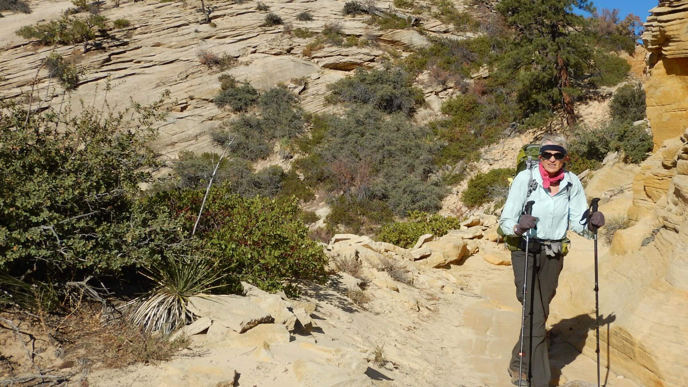
Hiking in solitude while viewing vehicles
On our first Trans-Zion trek, we hiked the Kolob Terrace Road. Happily, the Park Service has built a connector trail within the wilderness which parallels the road all the way to Wildcat Trailhead, where we took Wildcat Canyon Trail to Lava Point and West Rim trails. We saw no one on this trail but from certain points could view vehicles on the road above us. Also, an ostentatious “mega-mansion” just above the road dominated the skyline. (Later in the trip, I even saw its lights from our last camp across Zion Canyon on East Rim!).
The Wildcat Trail is the access for a trail leading to the head of the famous Subway. So although there were dozens of footprints joining us at the Wildcat Trail junction, almost all turned off on North Fork Peak trail to head of Subway. So after that turnoff we had a beautiful ponderosa forest on the canyon edge all to ourselves. Probably our timing was good; most of the hordes headed for Subway came through in the morning
We contoured on around head of Wildcat Canyon (side canyon of Left Fork North Fork) and found Wildcat Spring flowing just enough water to filter for camp; around the other side of canyon we camped on first flat in ponderosa below Lava Point.
Day Trippers down to West Rim
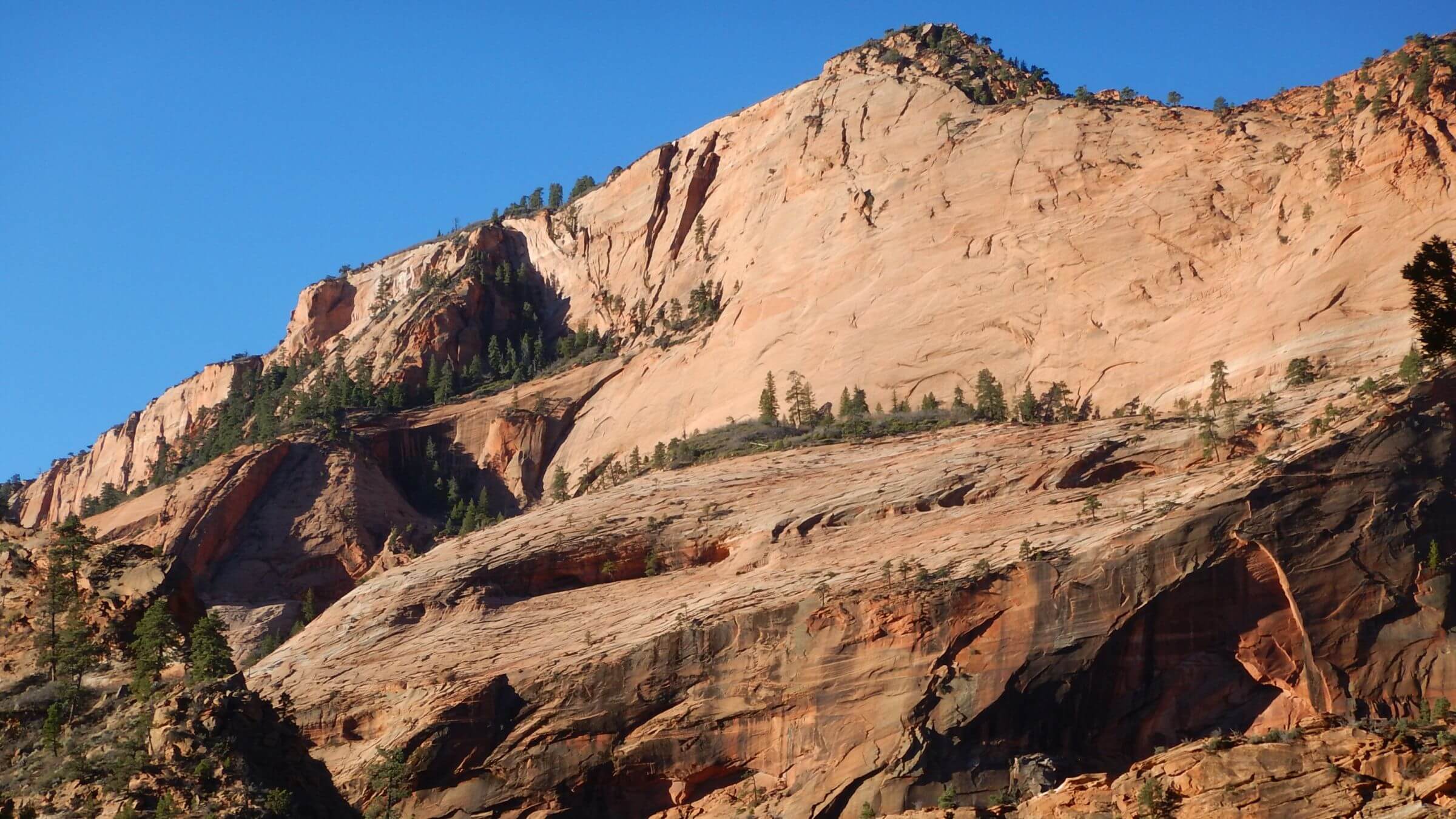
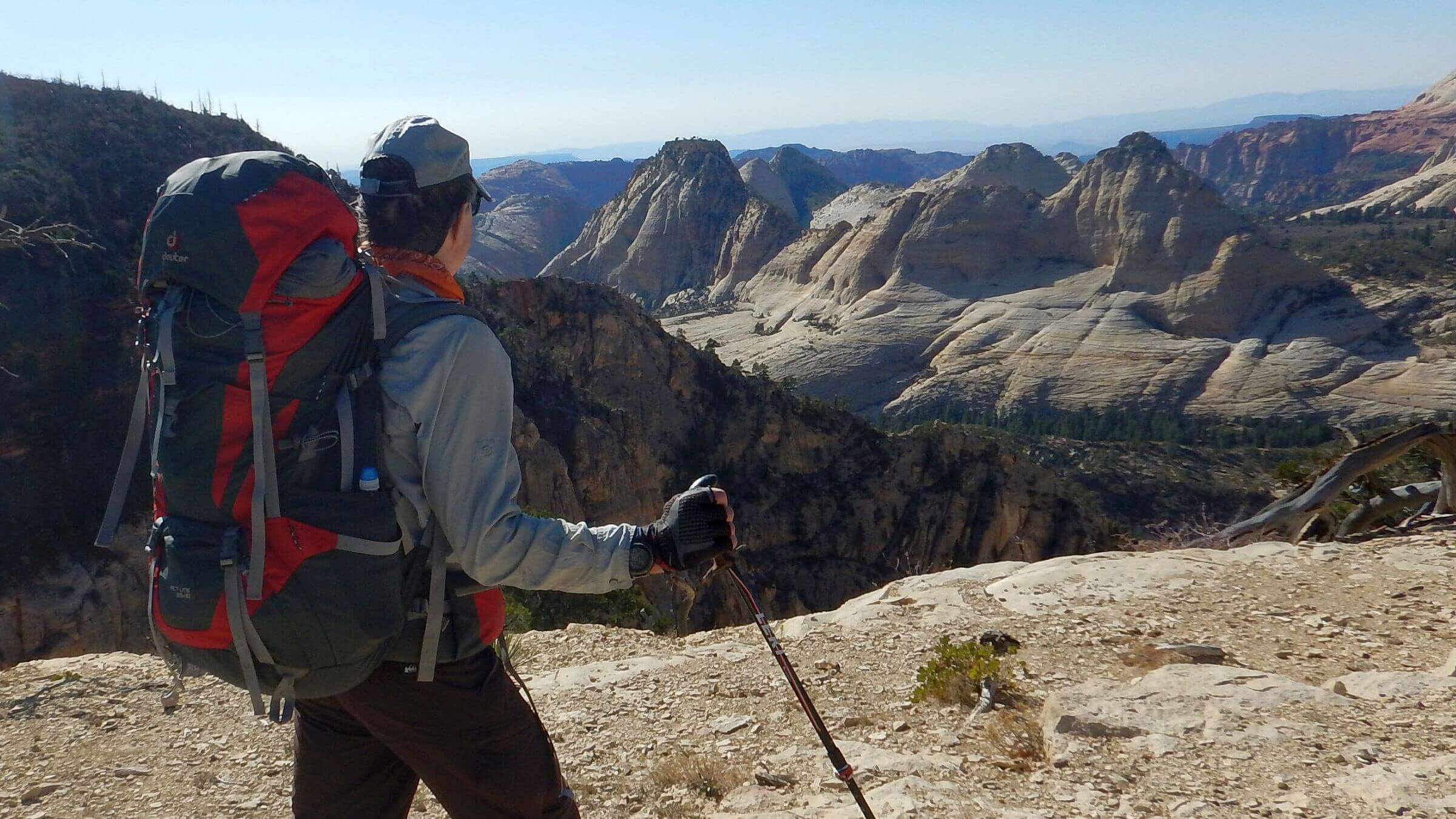
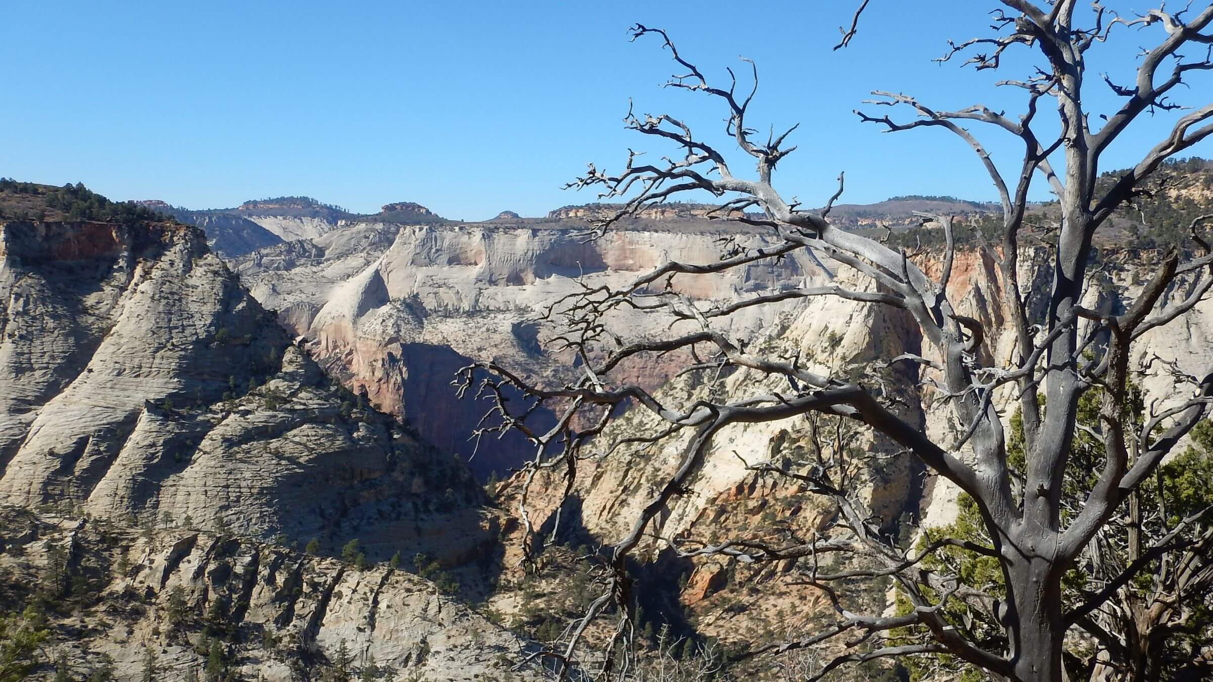
Hiking down Lava Point Trail, we were passed by a jogger and a dozen day hikers headed for West Rim and the main canyon. We had surmised that many day-trippers use the outfitter services to facilitate canyoneering or a one-way 12-mile hike into the main canyon. We did part of West Rim loop in evening solitude, watching sunset pink creep across stunning white sandstone into the depths of Right Fork North Canyon. Across the gulf we saw towers and figurines with fanciful names such as Church Mesa, Bishophoric West, Inclined Temple, and South Guardian Angel. We passed several heavily used campsites; none occupied.
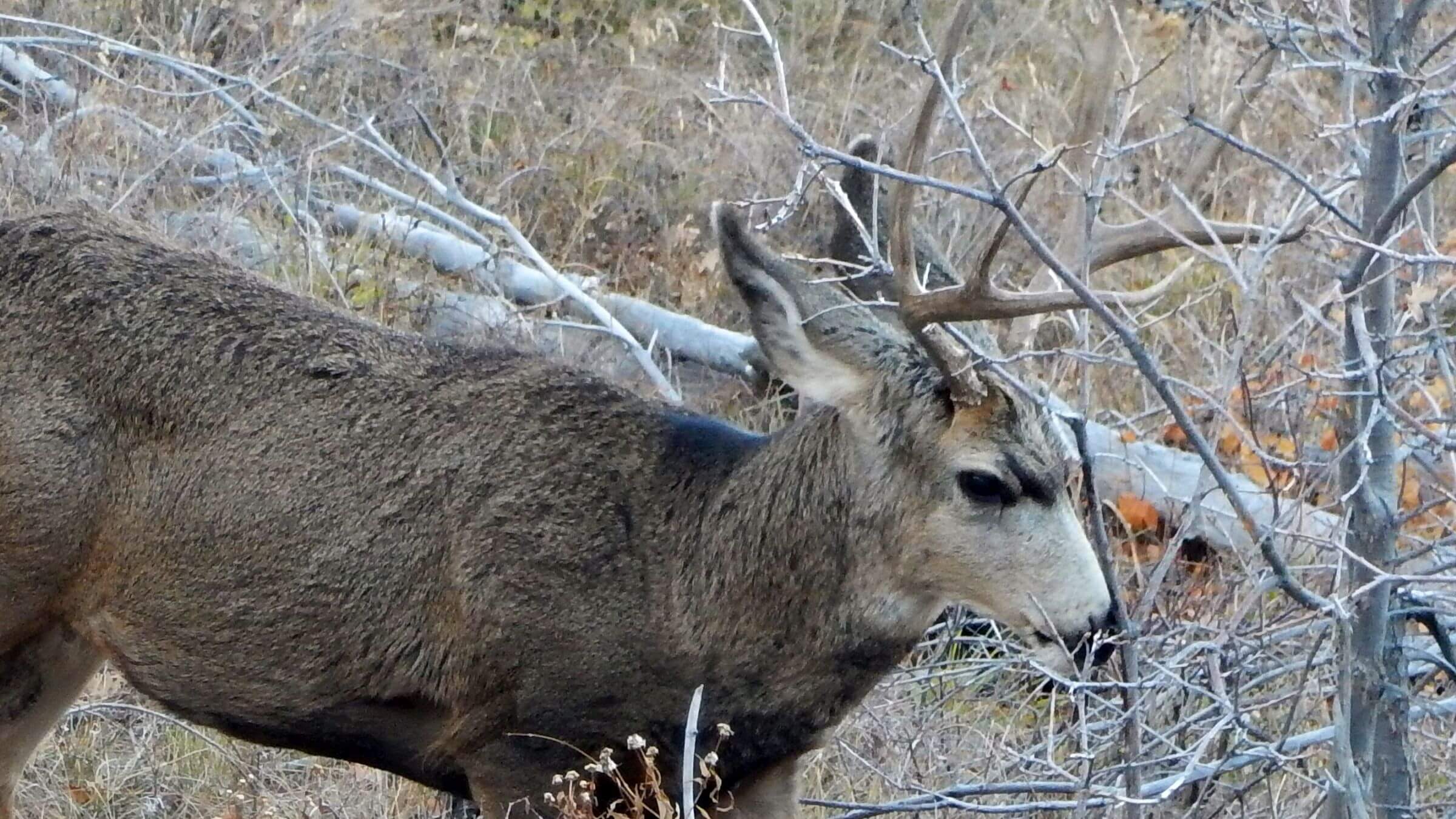
Our own reserved site was only tent wide on a steep side slope; we instead chose the unoccupied beautiful group site in the pines right above nicely-flowing Cabin Spring. I am pretty sure I stayed in this site on a winter visit in the 1970s as well as our last “trans” trek in the 1980s. We had only deer for company.
Next morning, we descended on switchbacks blasted into a cliff (West Rim trail was built in 1925-26—84 years before most of Zion was designated wilderness in 2009). A very early hiker met us at end of switchbacks and a few more as we made our way down an orange and white rock stair step ridge. At the turnoff to Angel’s Landing, we met the masses. Since I find the Landing with its precipitous drop-offs rather scary, it bothered me to see families with small children and hikers in flimsy sandals literally lined up on this steep ridgeline trail. I did it in once in December snow and David had no interest, so we dropped down the paved trail seeking to make breakfast in the canyon and figure out the shuttle schedule.
Zion Canyon to East Rim: Hikers, Horses and No One at Night
At the West Rim/ Grotto trailhead, we made breakfast in a picnic nook near the shuttle stop, then took one stop to the East Rim trailhead. Most visitors turned off on the short trail to Weeping Rock; we followed the hardier day hikers up to Echo Canyon where David hid water for the next night’s camp on the dry mesa above (hoping no critter would try to bite through bladder bottles for a nice drink). Continuing up switchbacks, we contoured out to Observation Point shared with at least a dozen others. Another mile up East Mesa Trail, we lost crowds and made a quiet camp on the rim in the juniper. Next morning, two happy canyoneers came through camp enroute to Mystery Canyon rim (where we had unknowingly pitched our tent); they would make 15 rappels into The Narrows. They had ropes and climbing gear and were outfitted for a cold wade. We headed back down to Echo Canyon, picked up our (unbitten) water and hiked on up the lightly-used slickrock East Rim route. We met a group of young backpackers hiking out. On the rim, we saw horseback riders apparently coming in from private land off the North Rim Road as well as hikers from the East Rim trailhead.
Stave Spring was dry as Park Service had warned and all the nice flat area in the pines bore signs with a slash through camps (but no areas with signs welcoming campers) so we took our packs on out the gently climbing trail towards Cable and Deertrap mountains, dropping them temporarily in the trees to make an out-and-back trip to Cable Mountain. East Rim has no designated campsites, but at-large, dispersed camping is allowed on the mesas.
We met families returning from jaw-dropping views at Cable (where early pioneers clear cut ponderosa pine stands and sent logs by cable into the canyon) Mountain. Taking our packs on towards Deertrap Mountain, we met an ambitious young European hiker who had summited Angels Landing, Observation Point and both viewpoints, finishing his 25-mile jaunt at sundown.
Deertrap was a large windy ridge. We made camp out of the howling wind in pine and juniper. Next morning a cold front hustled me out wearing three layers of clothes and a windbreaker!
We dropped plans for a finale hike down The Narrows, chilled by prospect of slipping on icy river rocks, cancelling our outfitter and Lodge reservations. Maybe some summer with 80-degree temperatures and a few thousand hikers!
The Park Service issues 60,000 wilderness permits. Given what we observed in Zion Wilderness, most of these must be for The Narrows or the Subway. (A wilderness permit is required to hike the Narrows from the top even without camping).
The Kolob Canyons Road reopened February 7, 2019. So, you can now trek the entire Trans-Zion in November and probably camp in solitude. But check on trail conditions; another trail segment might be closed.
show less
Google Map
(Click upper-right box above map to “view larger map” and see legend including NAVIGATION INSTRUCTIONS; expand/contract legend by clicking right arrow down/up.)
Downloads
Links
(If link has expired, “Google” subject covered.)