


Humbling First Visit
It seemed like an easy start.
To launch our project to visit all Virginia wilderness, we chose a loop through the Priest and Three Ridges, mostly on the Appalachian Trail (AT) and not too far from home in Falls Church. We figured we’d pick off this 30-mile loop in a couple of days.
So I was surprised at first day’s end to be clambering long switchbacks up The Priest Mountain by headlamp, only 11 miles hiked and 2 miles left to reach a campsite on the ridge. With many hikers, humidity, staggering elevation changes (almost 700 feet per mile), bugs and a cloudburst—our first official Virginia wilderness visit was humbling.
This post includes visits to five wilderness areas in the central Blue Ridge region: the semi-disastrous (but successful) Three Ridges-Priest loop and a nicer visit to three more areas in 2014.
show more
Three Ridges & Priest
It was a hot August day. Three Ridges provided views of the Blue Ridge Mountains and The Priest soaring out of Tye River drainage below—plus a bee attack (appropriately) on Bee Mountain, encounters with many hikers and joggers, and lots of ups and downs. Dog-tired after the long drop to the river, I abandoned my fantasy of camping at Priest Shelter and was ready for the first flat spot. At Tye River, we passed a group packing up to hit the trail. As we climbed, we saw lights below, gaining on us. David rejected one sketchy campsite on a drainage just off the trail. Perhaps the competition stopped here as the lights stopped.
At 10 p.m. we found a camp spot on a ridge near a rock outcrop. We ate a snack and crawled into the tent. Still hot: the warm clothes I packed were extra weight. Above us a ghostly light—someone on top. Rain started in the wee hours, providing steamy fog for our morning slog up a rocky ridge. On top was a nice flat and used campsite—maybe last night’s light. Gentle descent to Priest Shelter by verdant meadow and creek. Register full of southbound hikers’ “confessions” to “the Priest” of cursing the steep ascent. After a gentle mile on the AT, we left wilderness and encountered a camp with a truck, a jeep, two big tents, lawn chair sitters and loud country music. We continued outside wilderness on Crabtree Falls Trail alongside the creek glissading over a 2,500-foot descent in five separate falls. A huge viewing platform over the topmost falls was choked with people—maybe 150 hikers on the way down. At the bottom we started hiking a road down river to the AT but a kindly couple with grandkids gave us a ride for four miles.
Mau-Har Trail return loop climbed the ridge, then plummeted 1500 feet into Campbell Creek. On descent we were hit by a sudden downpour. David’s camera in a top pack-pocket was not in plastic and ruined. Hard rain persisted as we scrambled along slippery rock outcrops above the falls and pools of the creek. It diminished for our hike in open forest to deserted Maupin Field Shelter. We were so wet we abandoned plans of camping there, donned dry clothes and soon began the rocky descent to Reeds Gap in the dark.
Despite a beautiful sunset, I accumulated curses for my next confession to The Priest.
Saint Mary’s
Our first visit was an overnight hike in early April 2004 on a gentle road along the Saint Mary’s River. After a short hike up Sugartree Branch, we camped on a beautiful green flat strewn with old mining machinery. We took a brief out-and-back hike to Blue Ridge Parkway. Trails were good, air chilly and we were the only visitors.
Quite a change in June 2014. The river road had washed out—according to the Forest Service sign, it was a victim of Hurricane Isabel in 2003. (The washouts must have occurred after our 2004 visit.) Several day hikers joined us negotiating extra crossings and a brushy social trail to the falls.
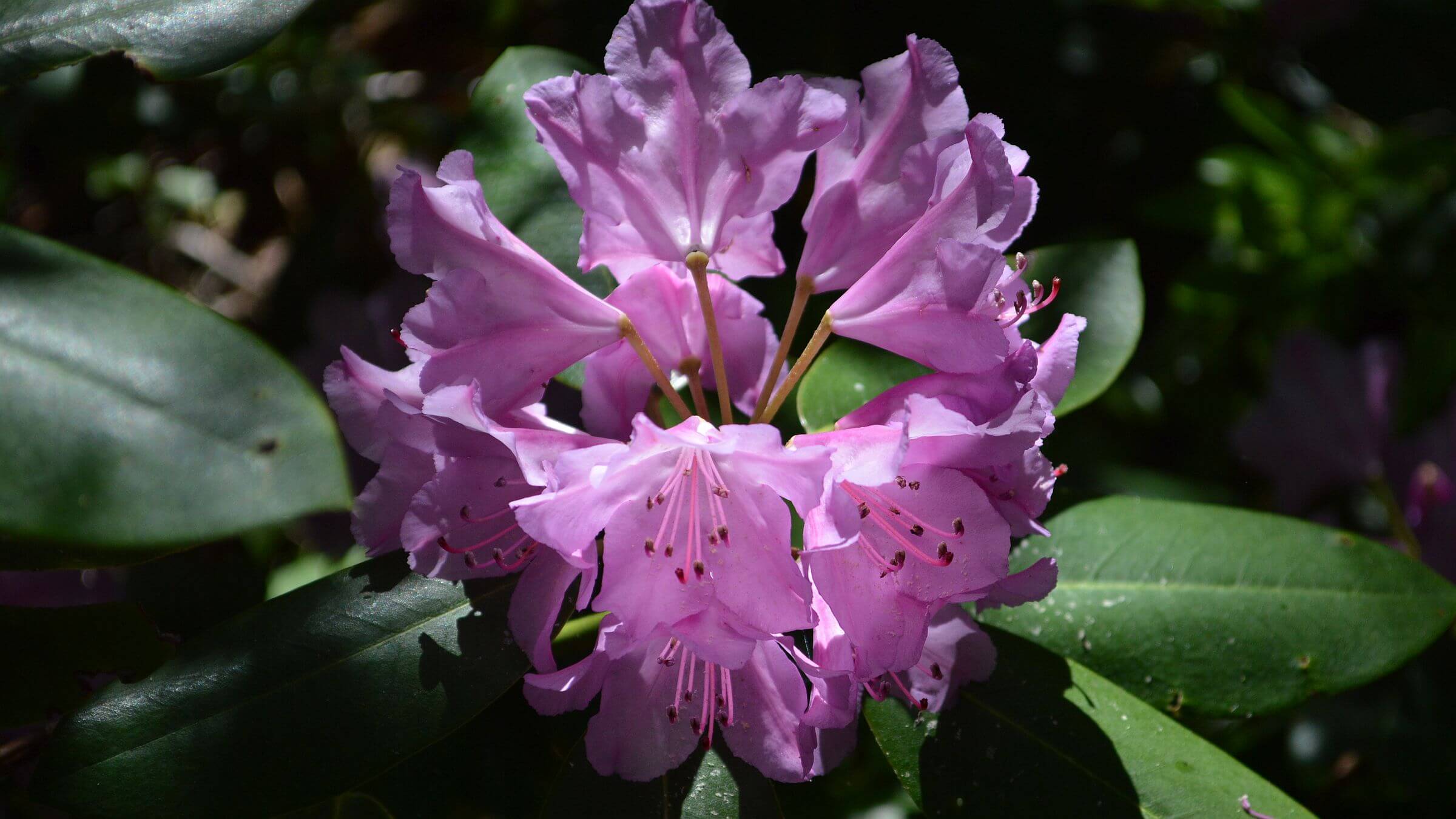
Sugartree Branch Trail required clambering over logs and pushing through heavy boughs of blooming Mountain laurel and rhododendrons. Along the creek were 30-foot towering rhododendron “trees” in full blossom and fringe trees with white flowers. Up trail from the mine site, we dropped packs on a pine-needle carpeted flat created by old roadbed and hiked to the east boundary, past the junction for Mine Branch Trail where we saw several people hiking out. With the river trail washed out, this apparently is now the favorite access route. On the ridge we saw a sign for Big Levels / Bald Mountain jeep road which follows the ridge outside wilderness, and a nice campsite on Green Pond—a marshy bog. We bounced down to packs for camp and a serenade by a whip-poor-will with echo from another bird down on Saint Mary’s River.
The next day we checked out the only other trail in the wilderness: Cellar Mountain with a nice kiosk at the trailhead. Our 1990 Forest Service wilderness map showed a loop trip possibility with a Cold Spring Branch Trail departing near the trailhead but we only found an old roadbed obliterated by downed logs and brush. A decent trail climbed steeply to the ridge but was hard to follow as it contoured through oak and mountain laurel blooms. A nice campsite on a saddle just east of Cellar Mountain provided a good spot for a rest break. We skipped the heavily wooded Cellar climb and slowly covered 1.5 miles of brushy trail up and down a little ridge to the open parking lot, terminus of Bald Mountain road and sign for Green Pond. We found the unmarked Cold Spring Branch trail in brush.
Cold Spring Branch trail crosses two sections of private land so it is not signed nor maintained, a Forest Service official said. He also said Saint Mary’s River trail will not be restored, to discourage the “party crowd” from using the area.
James River Face & Thunder Ridge
Confusion, crowds and sometimes solitude marked our June 2014 visit to two adjacent wilderness areas south of James River. Our 3-day loop began at Balcony Falls Trail (named for falls on James River, not viewable from the trail) near the hamlet of Natural Bridge. After driving by chaotic Jellystone Park Camp Resort, we were glad to head for public land and wilderness. Our trip started at a beautiful grassy trailhead with a confusing trail kiosk. After camping near the trailhead, we wound our way up an old road to meet the Appalachian Trail (AT)—no other hikers but many ticks. At a saddle with a spur trail to Marble Spring we found and extinguished a smoldering fire. Once on the AT, we started meeting hikers. Where the AT crossed the road at Petit Gap, we made a brief “out and back” hike into Thunder Ridge Wilderness for rocky outcrop views. Then we went down Petit Road to a trail sign with a horse drawing, and camped in Thunder Ridge Wilderness just off the washed out, brushy, log-jammed trail.
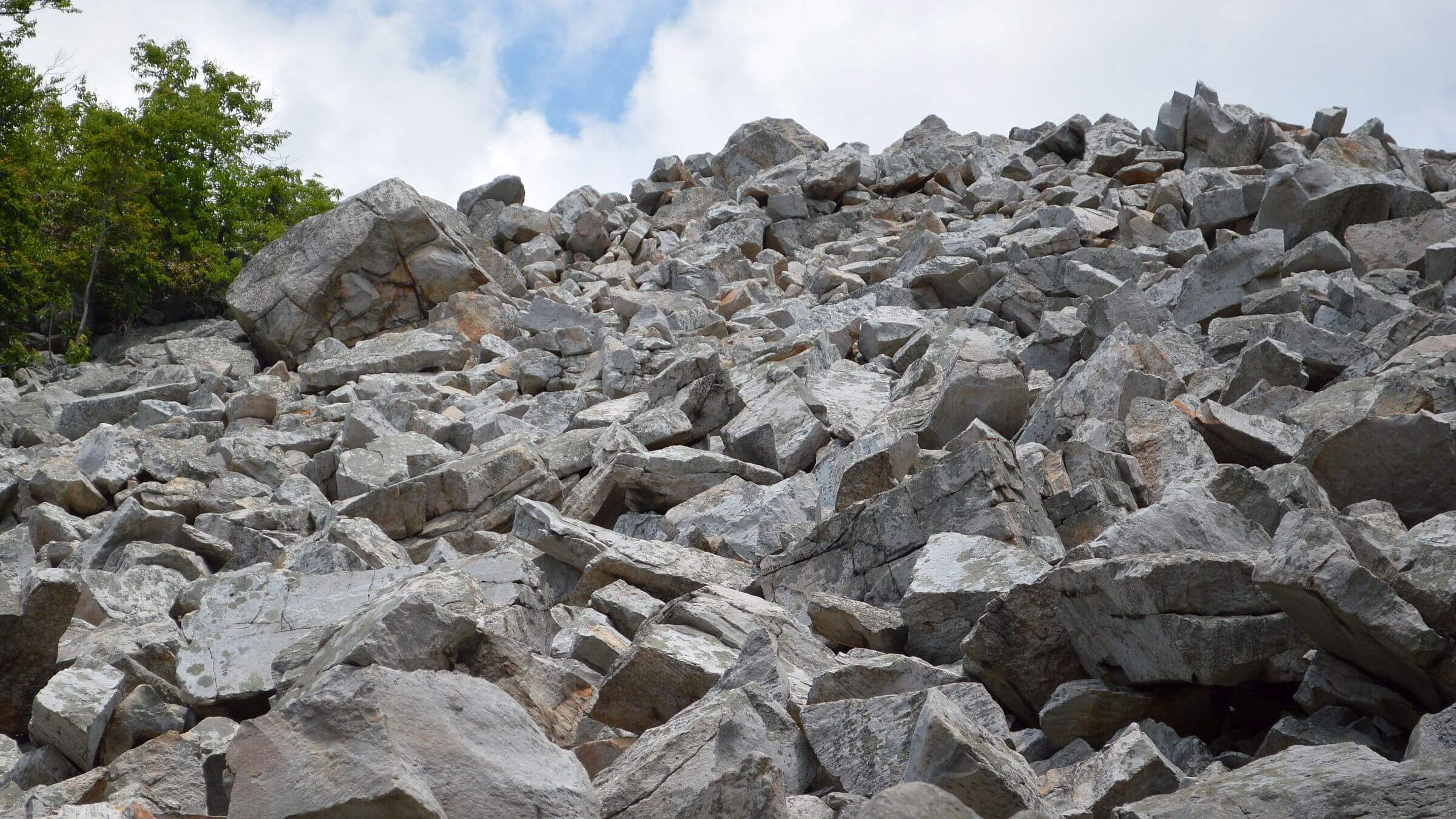
The next day we followed roaring Elk Creek down to the road out of wilderness using a network of “social trails” (people-made). We took a day hike up Belfast Trail, climbing steeply to meet many people, some with Jellystone t-shirts and sandals or thongs. The attraction? Devil’s Marbleyard, a big white scree (boulder field of sandstone) slope with people perched on boulders. Above it, a gentle creek trail wound its way to Gunter Ridge. I now wished I had brought my backpack up the grade to hike over the ridge in wilderness and down gentle switchbacks closer to the trailhead.
Instead we wound our way on a non-wilderness road above subdivisions to a confusing horse trailhead. With no signs, we dropped down to the main road which we followed to the trailhead. Almost back, we saw a connecting trail and realized we could have taken the old road/trail back.
The Forest Service said Internet blogs have popularized Devils Marbleyard. With a small trailhead parking lot, cars line the narrow forest road or park illegally on private property. But the Forest Service doesn’t want to build a larger lot because this area of wilderness is already overused.
show less
Google Map
(Click upper-right box above map to “view larger map” and see legend including NAVIGATION INSTRUCTIONS; expand/contract legend by clicking right arrow down/up.)
Downloads
- Google Earth map (kmz)
- No GPS track-data collected