Popular loop and unused legacy trails on burned ridges
The first time we visited Strawberry Wilderness, we were turned back by deep snow drifts—late May was too early to visit this alpine wilderness with elevations up to 8000 feet.
The next time we came—40 years later—was the right time of year (July) with snow melted off, but we were too late to see most of the wilderness. Particularly the west side which formerly offered a nice system of ridge and creek trails. Between our first and second visits, three fires burned most of the 70,000 acre-wilderness and trashed most trails except for a popular loop through two unburned basins.
We first visited this area on a Memorial Day weekend in late 1970s while living in Corvallis. We thought perhaps we came in from Canyon Mountain Trail near John Day into west side of wilderness. We followed a ridge several miles but had to turn back with deep snowdrifts; even too much for snowshoes.
On this revisit in 2018 we hoped to see what upper end of the west side was like. So, after evening camp at Little Strawberry Lake and climbing Strawberry Mountain, we dropped off the main route down Pine Creek Trail into west end of wilderness (called Road’s End Trail at a trailhead on south end of wilderness at end of Forest Road 1640).
However, after a few hours trekking damaged trails through blackened trees and following traces of a ridge trail, we had to give up the venture in a bare flat. Our map showed junction of several trails, but no trails were evident.
By default, we had to join the masses for a popular loop that links Strawberry and Slide Creek basins—the only areas left unburned in the Strawberry Wilderness.
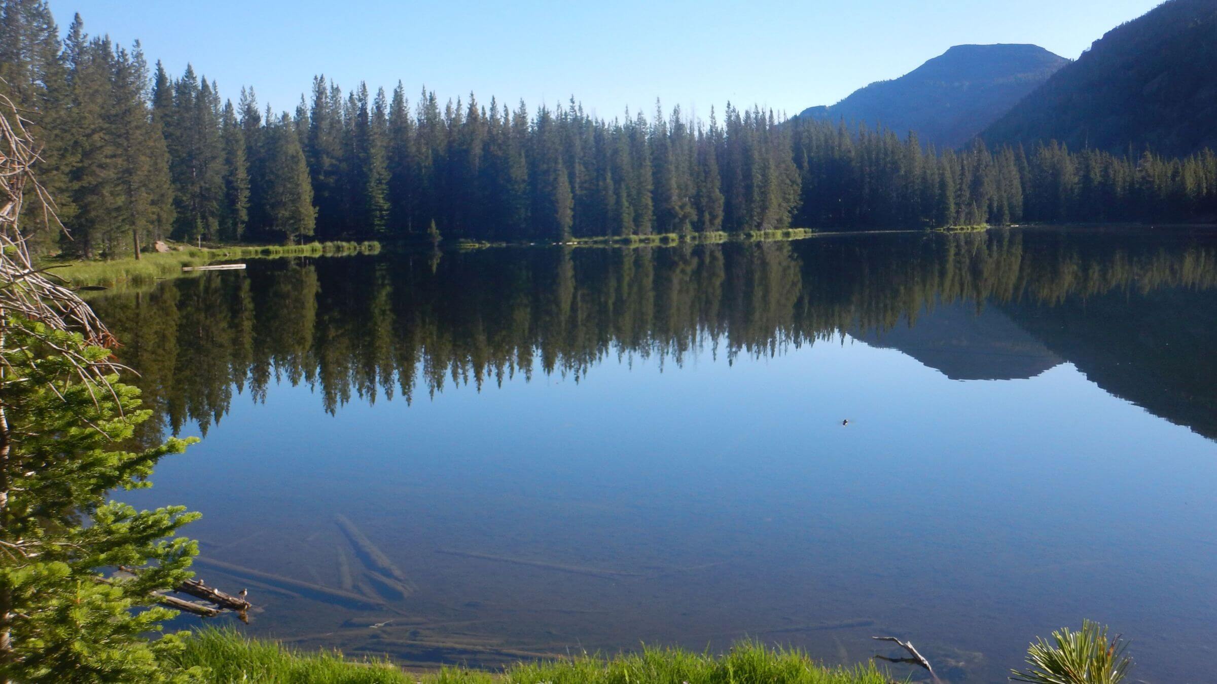
Strawberry Mountain Wilderness designated in 1964, now includes about 70,000 acres in eastern Oregon’s Blue Range Mountains. It was named by early settlers who found abundant strawberries in nearby valleys. The elevation ranging from 4000 to 9000 feet supports very diverse vegetation. Glaciers created the U-shaped valleys and left a few lakes.
We first visited because the area was the closest semi-arid alpine mountains to Corvallis, our rainy western Oregon home. A late May 1978 hike was turned back by deep snow, even with snowshoes.
We returned 40 years later to an area scorched by fire. The 1996 Wildcat Complex fire—11,000 acres—burned Strawberry Peak and two basins on either side. The 2015 110,000-acre Canyon Creek Complex Fire reburned most of the Wildcat and the entire west side including non-wilderness. The 14,000-acre Roberts Creek Fire burned everything east of Canyon Creek burn except Strawberry and Slide Creek Basins.
The 34 miles of trail that we hiked was about all that remained of the 125-mile trail system. We looped through Strawberry and Slide Creek Basins, the only two unburned wilderness basins.
Visit statistics: for 4-day backpack included 34 miles, at 2.0 mph, and 425 feet per mile average elevation change.
Go to map below for more information on trailheads, GPS routes, mileages, elevation changes, and photos. (Click on white box in upper right corner to expand map and show legend with NAVIGATION INSTRUCTIONS.)
show more
Old wilderness, diverse ecology
One of the original areas designated in the 1964 Wilderness Act, the nearly 70,000-acre Strawberry Mountain Wilderness encompasses five of seven ecological life zones in North America. It boasts stands of larch, spruce, pine and fir and a native herd of Rocky Mountain elk as well as mountain goats, bighorn sheep, deer, black bears, and mountain lions.
The 1996 Wildcat Complex Fire—10,000 acres—burned Strawberry Peak and Onion Creek and Indian Creek and Wildcat basins on either side of the peak. The 2015 Canyon Creek Complex Fire reburned most of this area, the entire western side of the wilderness and non-wilderness for 110,000 acres burned. On the eastside of the wilderness, 14,000-acre Roberts Creek Fire burned everything east of the Canyon Creek burn scar except for Strawberry and Slide Creek basins.
Most hikers do a 17-mile loop which only skirts the burned areas. It begins and ends at Strawberry Campground, climbs to the top of Strawberry Lake basin, circles part of Strawberry Mountain and follows road before descending to High Lake, climbing a small pass and dropping into Slide Lake Basin, finishing with a contour trail that eventually descends to the trailhead.
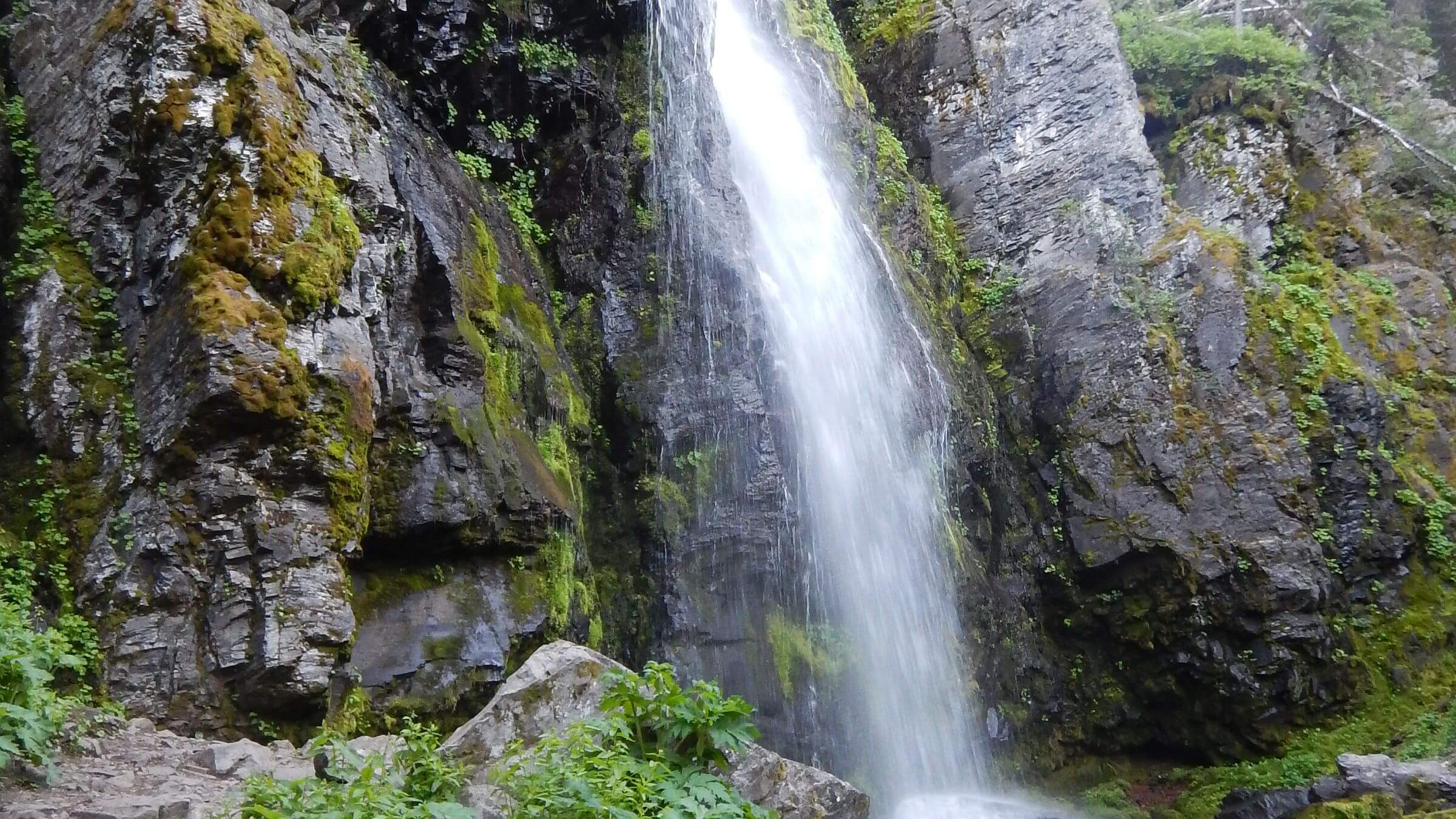
After driving over from our home in Hailey, Idaho, we got to the campground in late afternoon. We hiked past Strawberry Lake and Strawberry Falls and took a spur trail to camp at Little Strawberry Lake. One other couple had a camp nearby. When we unpacked, I realized my cookset was empty: I forgot to bring a stove!
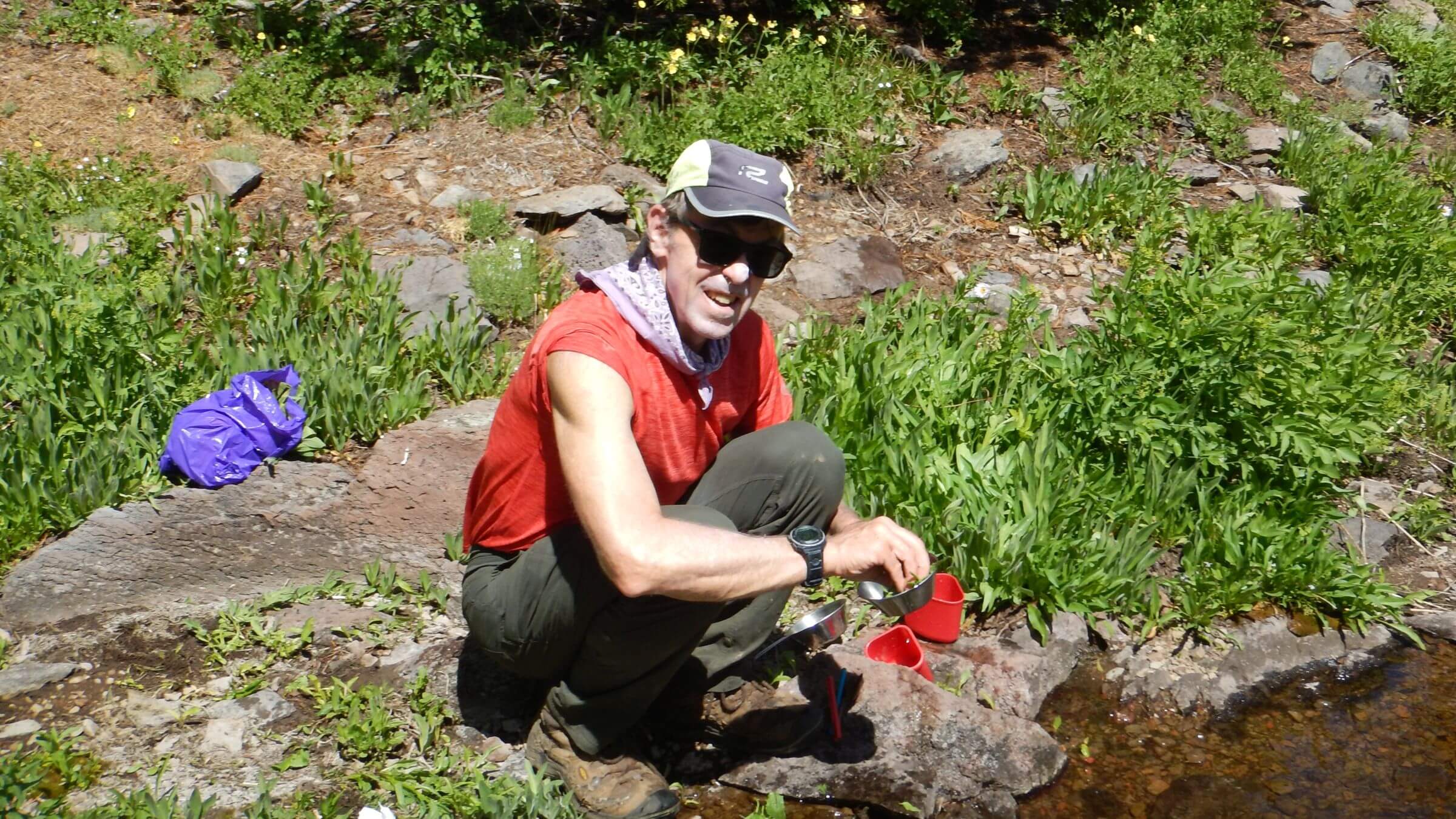
That night, and for one breakfast and two dinners that followed, we built a fire, wrapped the cook kettle in foil, and took a long time boiling water for the meal.
Next morning, we wound our way out of the big basin, and dropped down to Onion Creek for a breakfast-making venture. We took a side trail to climb Strawberry Mountain where we were bombarded by thousands of migrating butterflies!
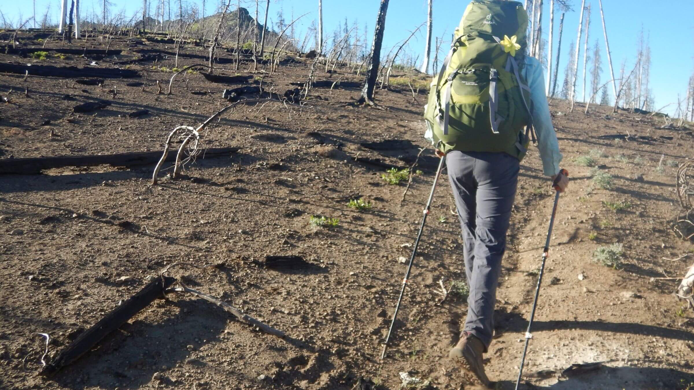
At the next trail junction, we left the loop to explore the western end of the wilderness. The fire-damaged connector trail to Indian Creek was steep and eroded. Floral finery eased the discomfort: fields of white phlox, Indian paintbrush, red/yellow columbine, blue penstemon, lupine, yellow buckwheat, purple elephant’s head, and a great meadow of purple swamp onion around the spring at head of East Fork Indian Creek. The trail shot down to a burned-out basin where Indian Creek Trail was supposed to depart, although no trail was evident.
We climbed the only discernible trail to a signed junction at a saddle and hiked through blackened and remnant trees over ridge and down to a basin, leaving our backpacks in a stand of lodgepole pine. After clambering up the ridge, we found trail again near Indian Creek Butte. The main trail on the northside was gone but a faint contour headed south for about a mile.
Here we found a barren flat and a knocked down sign for Pine Creek Trail but no more signs of any trail. However our map indicated at least three trails, one descending into East Fork Canyon Creek (start of 2015 fire) and two following either side of the ridge line to eventually descend into Pine Creek.
We saw little indication of hikers but did notice two sets of cat tracks—one large and one small—perhaps indicating a cougar and cub on this trail just over the ridge from (appropriately) Wildcat Basin.
We turned back and made camp where we had stashed the packs.
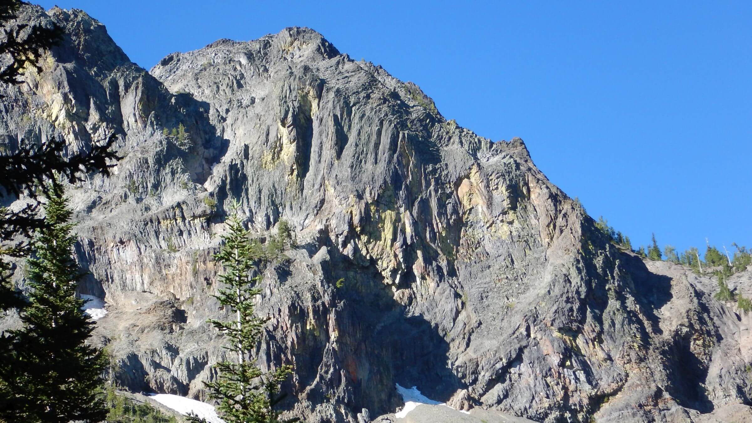
Next morning, we returned to the saddle and completed a loop through Wildcat Basin; only lightly touched by fire and boasting beautiful Douglas-fir stands, verdant meadows, a spring and campsite. The trail screamed up out of the basin past a white limestone outcrop below black volcanic cliffs, then gently contoured to the junction with Pine Creek Trail.
Finishing the basin loop with the masses
Rejoining the road, we saw our second couple of the trip—ahead of us on the loop. We saw several cars parked at Road’s End Trailhead. A big kiosk map showed fire-damaged Pine Creek Trail as “Road’s End Trail” heading 12 miles west to a trailhead. Since this trail is burned and parts have disappeared, the Forest Service should either restore it or remove the sign advertising a mostly nonexistent route.
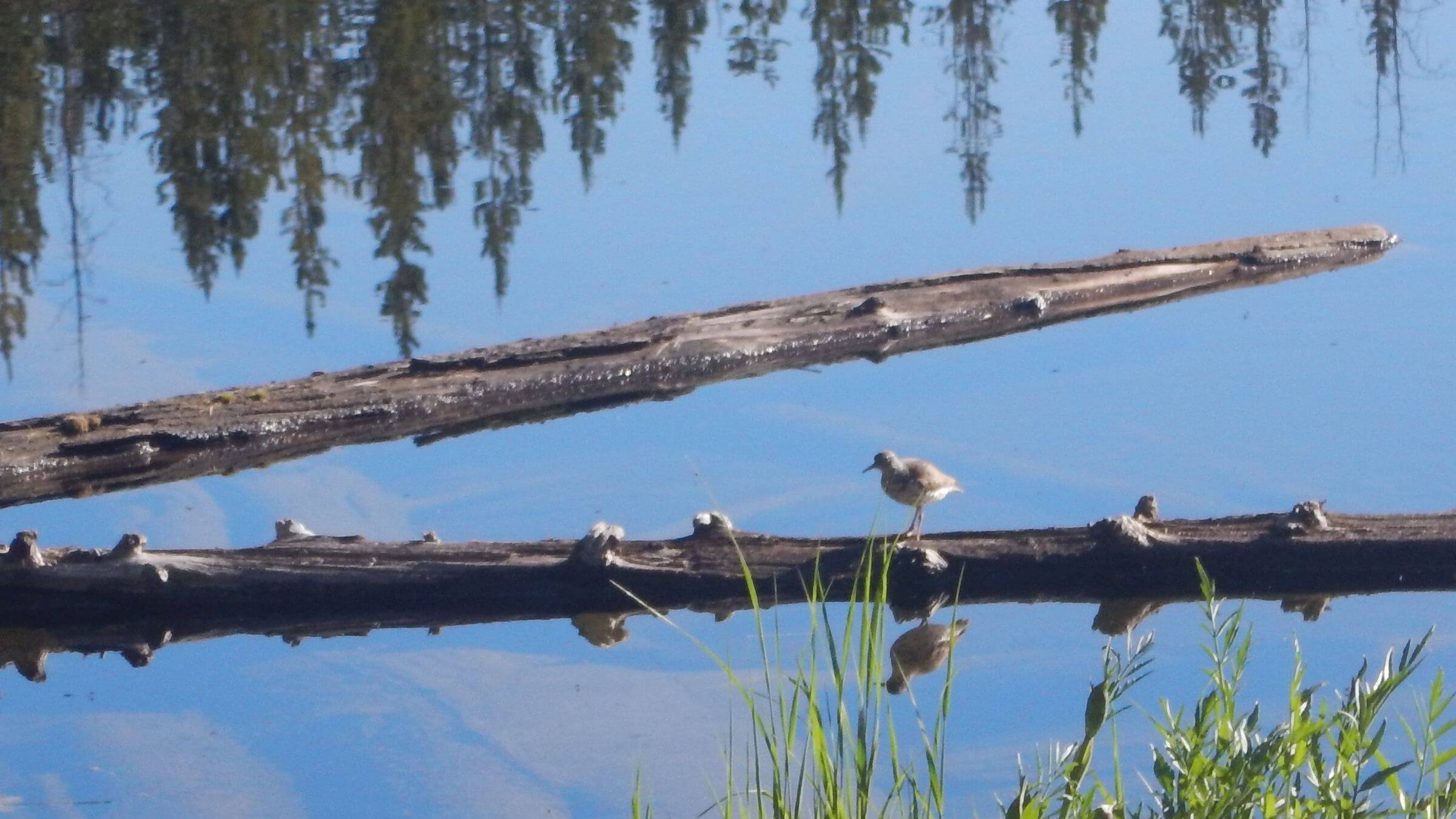
We saw many people on our return leg: large groups trekking down to High Lake for fishing; a day-hiking couple who raced us to the pass between lakes; two delighted Portland guys with a neurotic city dog camping at Slide Lake (and spotting mountain goats on scree slope with binoculars). The couple ahead of us made a camp right on the lake but broke camp and left after an hour of mosquito harassment. David fished awhile while I rounded the lake and also found a trail at its far end climbing gently to Little Slide Lake.
We left our packs and took a brief hike down main trail past view of Slide Falls and via eroded horse trail to a junction with Skyline Trail which crosses Slide Creek and climbs through Big Rhiner and Deadhorse basins to a trailhead on the east side of wilderness. We hiked only a mile up this excellent switch-backing legacy trail before turning back for evening camp. From horse tracks, a few local hunters probably use it in the fall. Our map showed we would enter the Roberts Creek burn at the pass which we did not get to.
We took our packs to Little Slide Lake and a secluded campsite at the far end. David caught a nice cutthroat to augment our freeze-dried dinner, using our fire both for boiling water and fish broiling in foil.
The trail out of Slide Lake was split between old horse trail and a newer “foot trail,” a level contour along top of basin needing major repair. The big snows of 2017 and spring melt created washouts dangerous for hikers.
On switchbacks down to the campground we saw day-hikers headed to Strawberry Lake and a few young runners who turned towards Slide Lake but returned shortly and passed us—presumably turned back by the washed out contour trail.
Our brief foray into Strawberry Mountain Wilderness left me intrigued to try the longer trail system hiking from west to east and back—however the disrepair of trails in the burned areas might explain why only 17 miles of the 125-mile trail system are used by many.
show less
Google Map
(Click upper-right box above map to “view larger map” and see legend including NAVIGATION INSTRUCTIONS; expand/contract legend by clicking right arrow down/up.)
Downloads
Links
- Slide Basin-Strawberry Mountain loop: color article and practical guide
- Canyon Creek Complex Fire of 2015
- Oregonian criticizes Canyon Creek Fire management