Wilderness for Wildlife, not Visitors
In August 2000, we made our first visit to the only wilderness in New Jersey—inadvertently.
Our teenage daughter had insisted on a “real” beach vacation with no camping or backpacking, so we took the Cape May-Lewes Ferry from Maryland to New Jersey and spent a couple nights in the beach resort of New Haven.
On our last day in town, while our daughter and her friend hung out in town, we walked down the beach and found a long undeveloped stretch on south end of town marked “Holgate Unit.” We didn’t hike much further. Area was closed until March and we were out of time; had to drive to Cape May for last ferry of the day. In 2016 we learned that trailless beach was on the edge of wilderness.
We had returned to visit 7,000-acre Brigantine Wilderness, one of the few managed by the U.S. Fish and Wildlife Service in the Eastern states. It covers three parcels (note three yellow sections in map below) within a larger wildlife refuge: one is tidal wetland accessible only by boat, another a marsh blocked by private land, and the one area open for hiking, the beach we had visited previously.
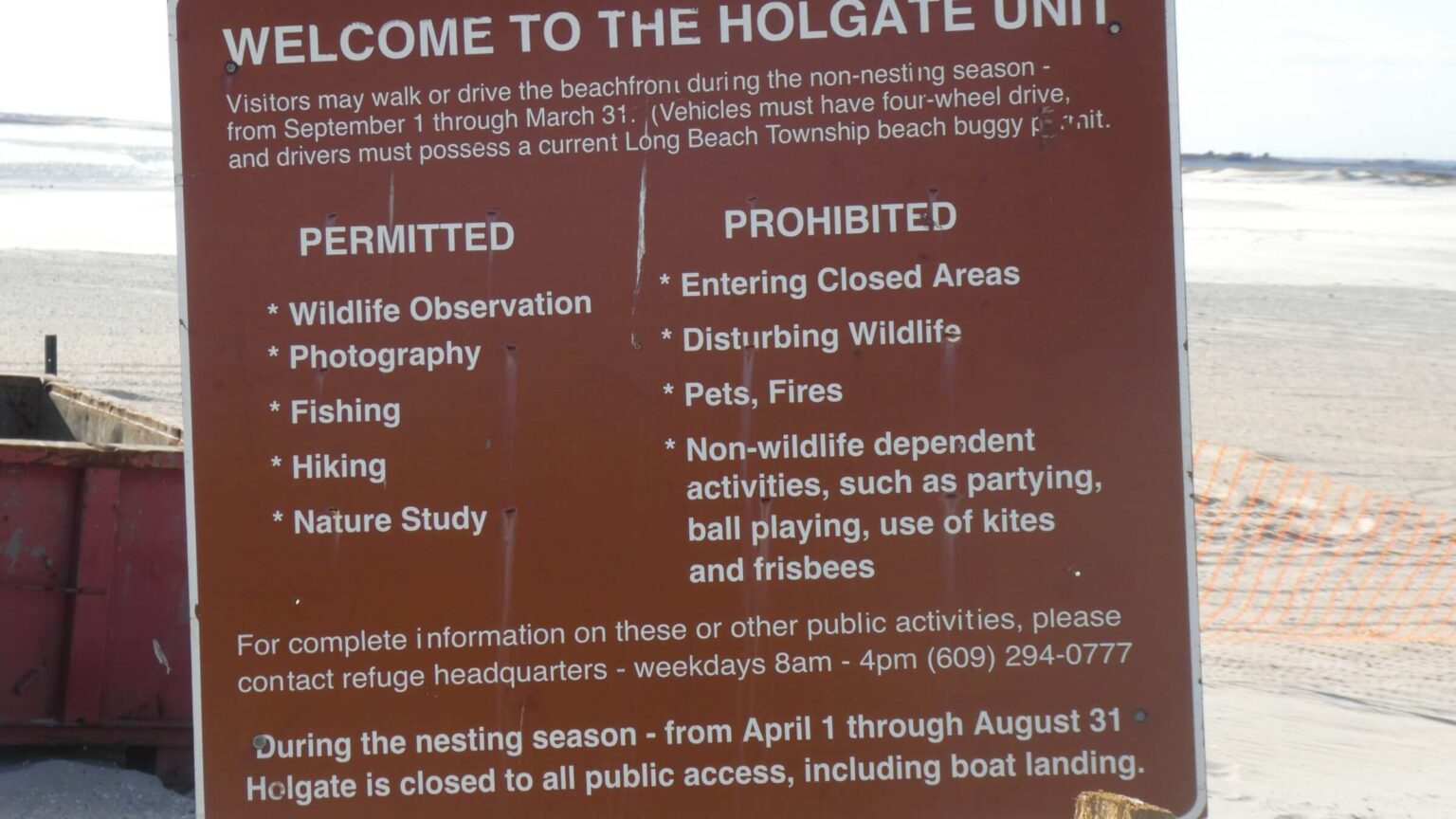
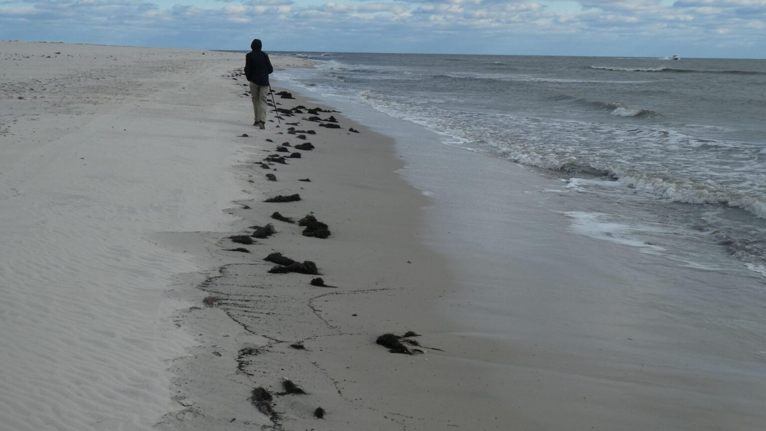
Holgate Beach, reached by circuitous drive along Highway 9 and backroads to New Haven at tip of barrier island, was open for hiking during daylight hours September 1 to March 31.
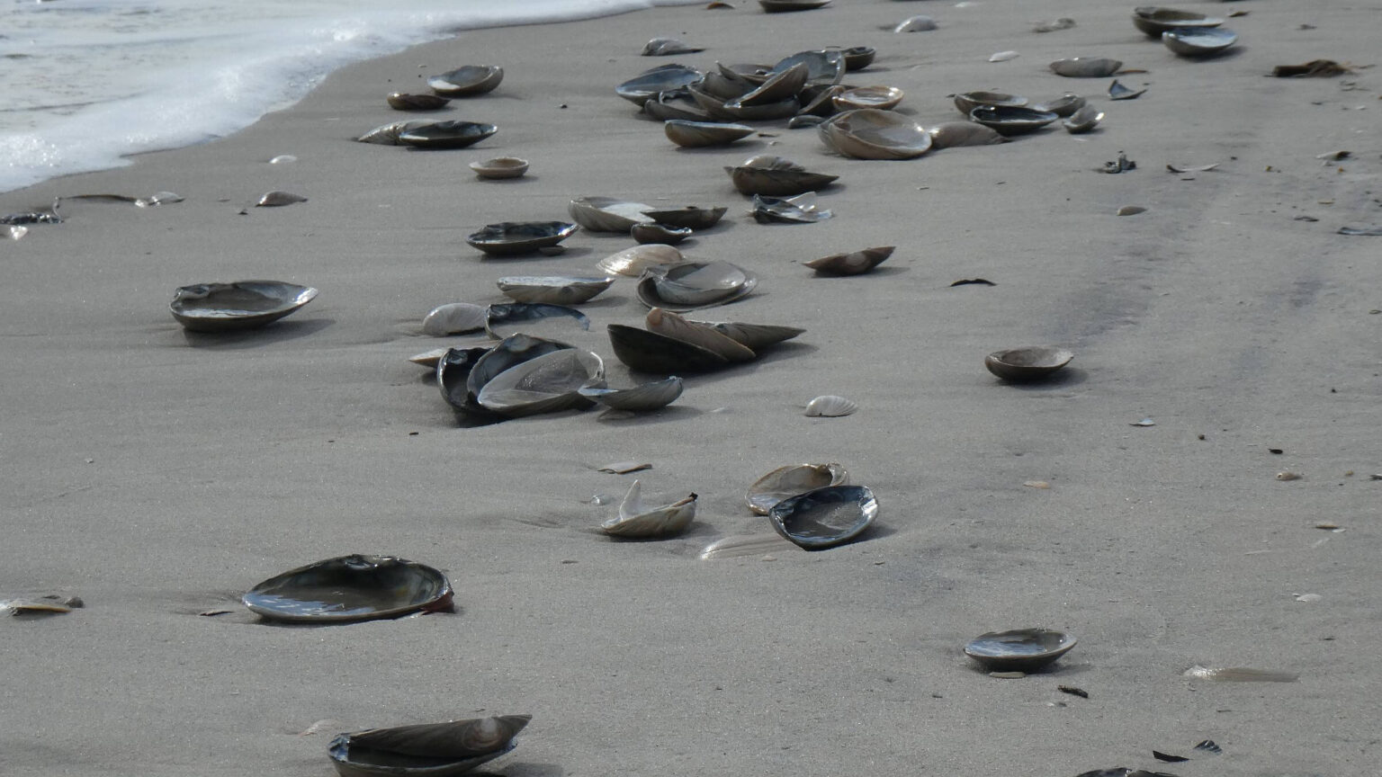
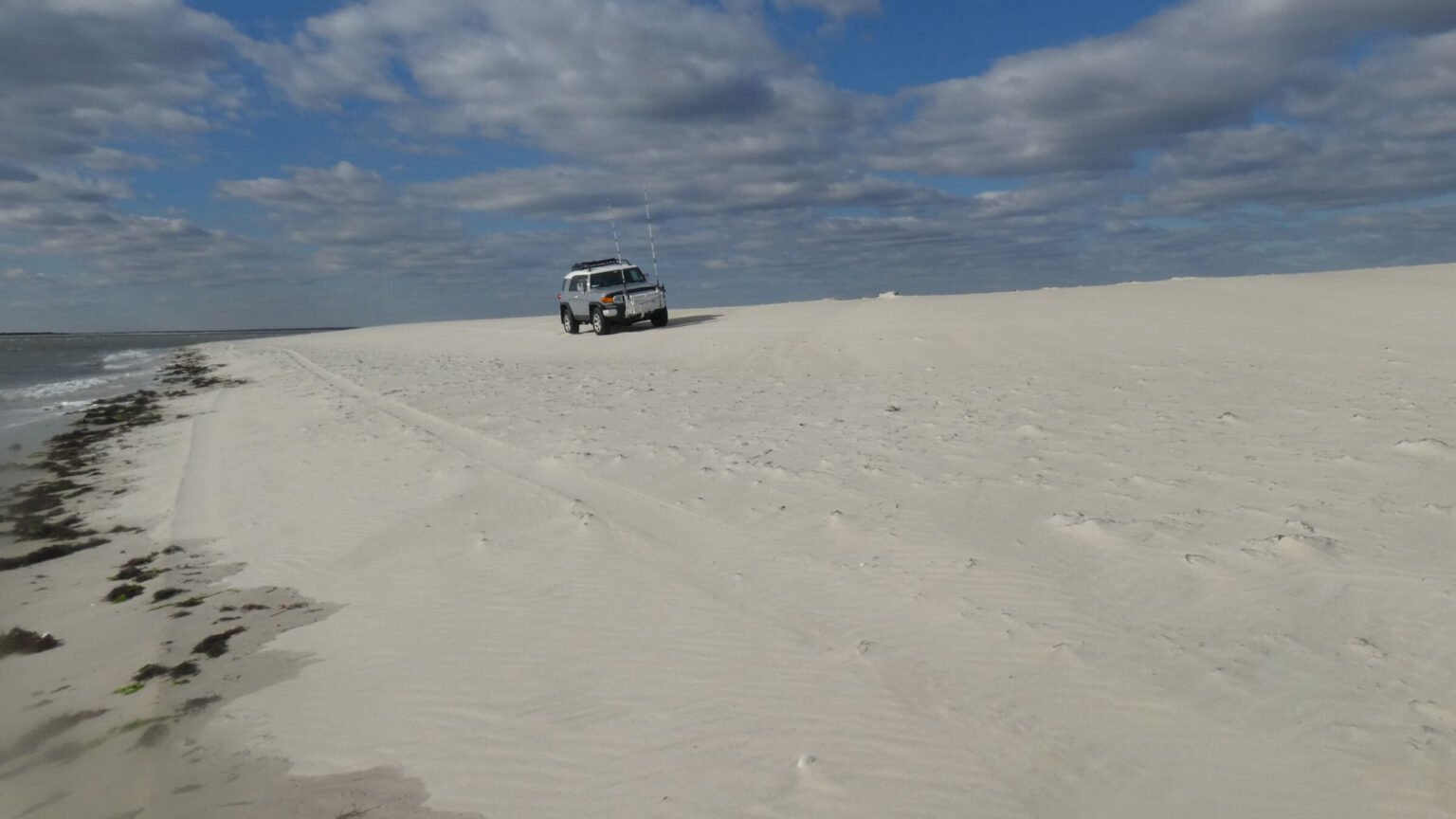
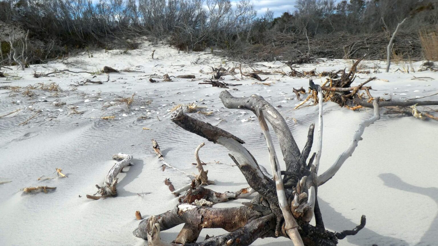
But we were limited to about a 3-mile strip of beach, with dunes marked by closure signs. Our three-hour walk on wild windy beach was shared with vehicles—surf fishermen with a permit are allowed to drive this wilderness beach. Most of the 2,000 miles of Atlantic coastline is private and closed to the public; this scrap of public land offers minimal “wilderness experience.”
After edge of wilderness visit, we stopped at nice visitor center for Edwin B. Forsyth National Wildlife Refuge with nature trails (outside wilderness) and friendly volunteers. We found the wilderness within the refuge not so visitor-friendly. Maybe a better experience with a boat!
Brigantine Wilderness encompasses about 7,000 acres of tidal wetland and shallow bay habitat with a small strip of beach just south of New Haven, New Jersey. Managed by the U.S. Fish and Wildlife Service (FWS) as part of the 39,000-acre Edwin B. Forsyth National Wildlife Refuge, it was designated wilderness in 1975.
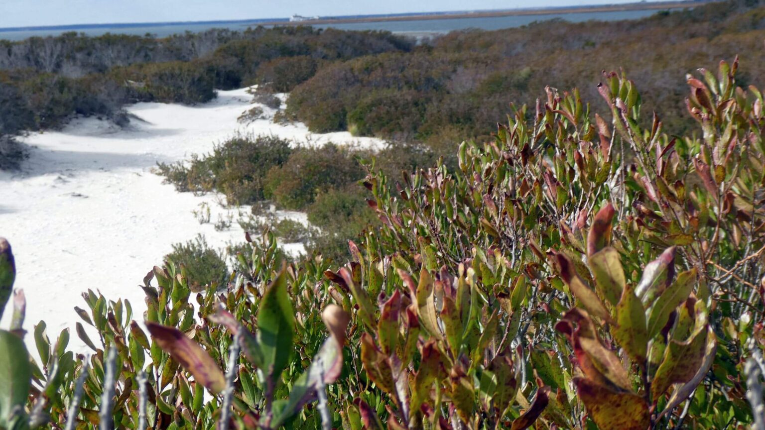
Wilderness/refuge includes one of the most active flyways for migratory waterbirds and protects Holgate and Little beaches, two of the remaining barrier beaches in the state. Grasses stabilize fragile dunes and safeguard rare piping plover, black skimmer, and least tern.
Only hiking terrain is Holgate Beach, a narrow strip 3.5 miles long south of Beach Haven, New Jersey on wilderness boundary—only open September 1-March 31 and closed to all activities during “nesting season” April-August. Only beach is open to visitors; signs along wilderness boundary ban access to an intriguing set of sand dunes.
Vehicles also use beach: Surf anglers with a dune buggy permit may enter during the open season. Daytime use only. No camping, fires, horses, kite flying, or swimming at any time.
Refuge headquarters near Oceanville, New Jersey has a visitor center with nature trails, conservation education resources and enthusiastic volunteer staff—yet wilderness itself is not managed for “visitor use and enjoyment”: the purpose for wilderness stated in Wilderness Act of 1964.
Visit statistics: 3-hour out-and-back hike on beach along wilderness boundary covered about 4 to 6 miles (depending on map source); GPS track lost.
Map below shows day hike route and wilderness parcels. (Click on white box in upper-right corner to expand map and show legend.)
Google Map
(Click upper-right box above map to “view larger map” and see legend including NAVIGATION INSTRUCTIONS; expand/contract legend by clicking right arrow down/up.)
Downloads
Links
- History and background (from wilderness proposal)
- Edwin B. Forsythe National Wildlife Refuge