Climate change ‘dries up’ Sawtooth memories
Sawtooth Wilderness is best known and best used for its high country lake basins just west of Highway 75—but Idaho native David has a special spot for the lesser-used river country on southern end of the wilderness: Middle Fork Boise, Queens, and Little Queens rivers.
In 1976 David had a summer job with the Forest Service at Dutch Creek Guard Station a few miles from Atlanta, a remote former mining town/resort about 100 miles from Boise (half of the trip on winding dirt road) near river trailheads in the Sawtooth Wilderness.
While other Forest Service employees drove to Boise or Atlanta on days off, David hiked back into Sawtooths to climb a peak or visit a lake basin, writing me letters, sometimes huddled in a raincoat under small trees while thunder boomed throughout a basin. In July David hosted my first visit to Sawtooth Wilderness: up Little Queens River into lake basins, then back on the Queens River.
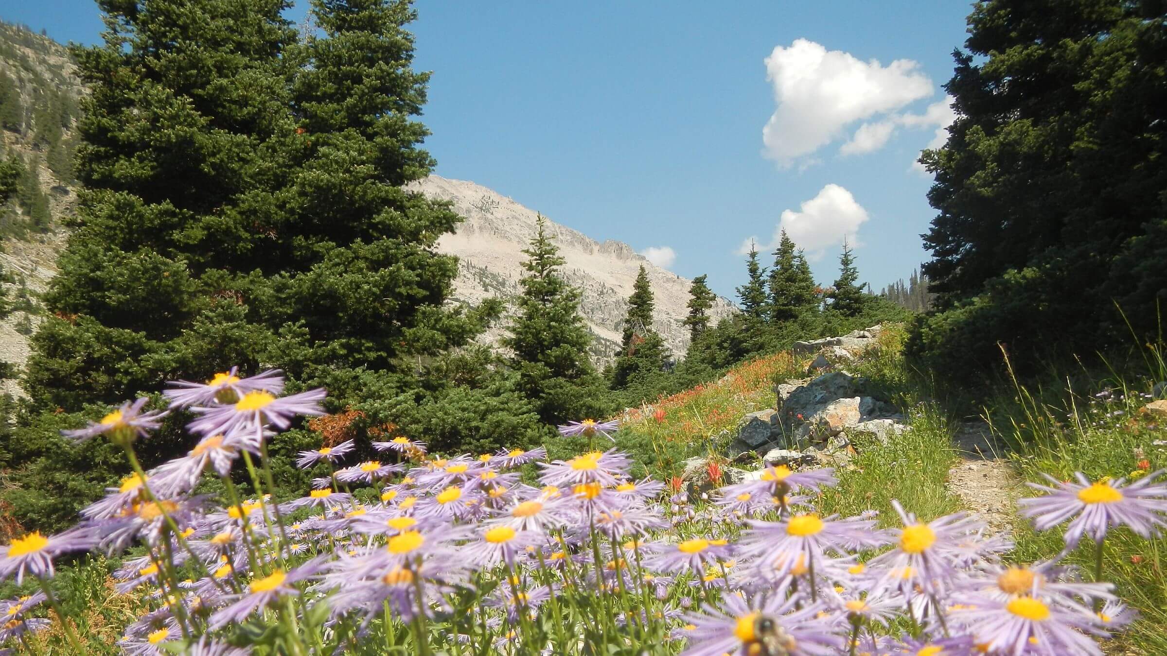
We sauntered on river trails through ponderosa pine up and back from alpine lakes, snowy basins, and small groves of spruce, subalpine fir, and whitebark pine. Trails built for horses gave easy access. Sunny mornings and afternoon thunderstorms prevailed. No other hikers.
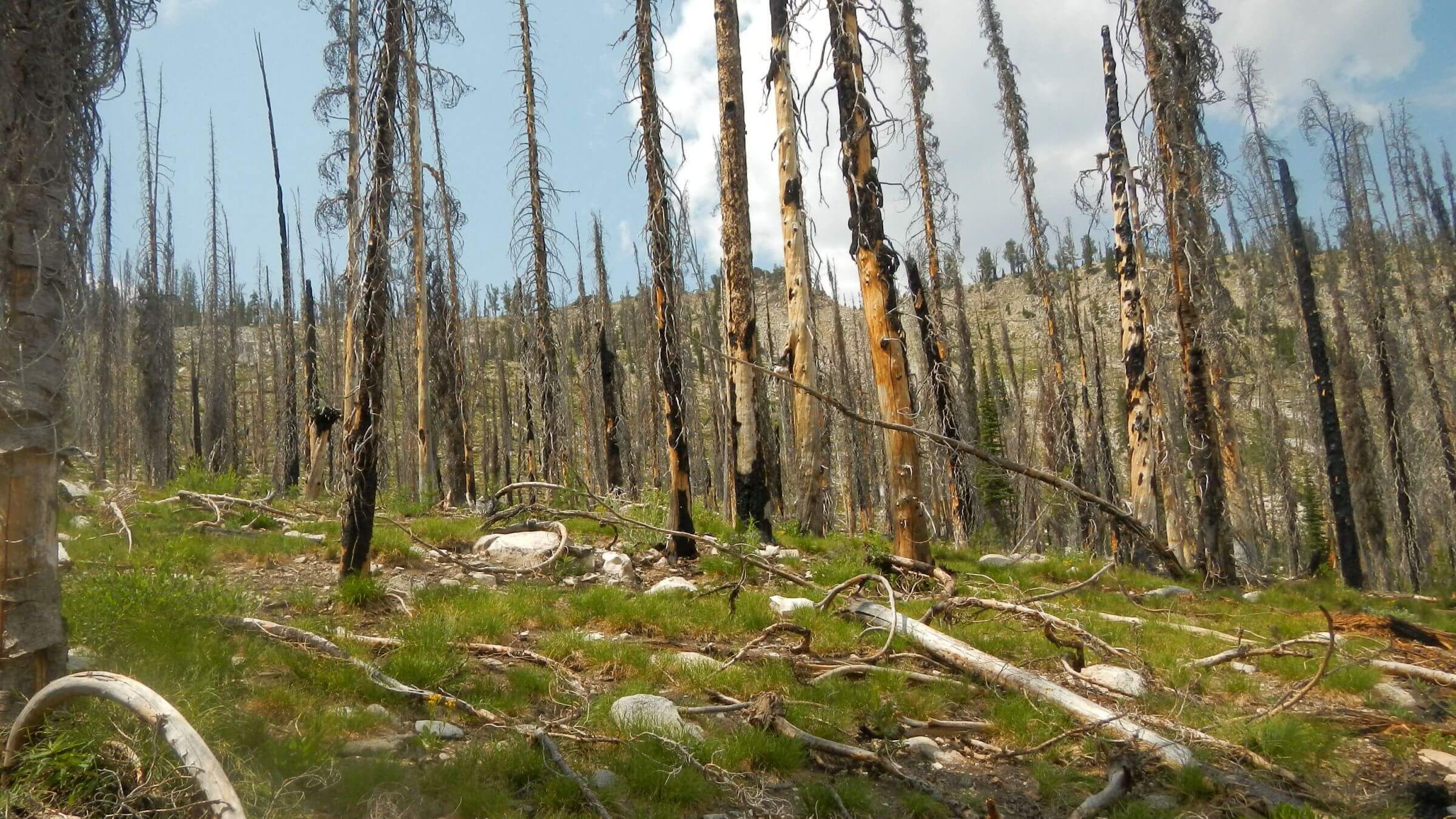
Returning 46 years later we found the same rocky peaks, rivers, lakes, and alpine meadows—but more people, bone-dry soils, many basins, and ridges dotted with burned trees and trails clothed in post-fire vegetation.
Like hikes in other Western mountains, our trip was indirectly impacted by effects of climate change: uncertain weather patterns and more than 30 years of large fires which severely damaged trails in some areas.
Our 2022 river country hike took us through results of at least seven fires—including a twice-burned lake basin and a jungle on Johnson Creek where a well-built stock trail was obscured in chest-high ceanothus.
During layover in the (former) mining town of Atlanta, we learned residents were evacuated in 2013 for Little Queens Fire although the town was spared.
We also learned that Trinity Ridge Fire of 2012 had demolished David’s summer workplace—Dutch Creek Guard Station. It was not rebuilt and no longer shows on maps!
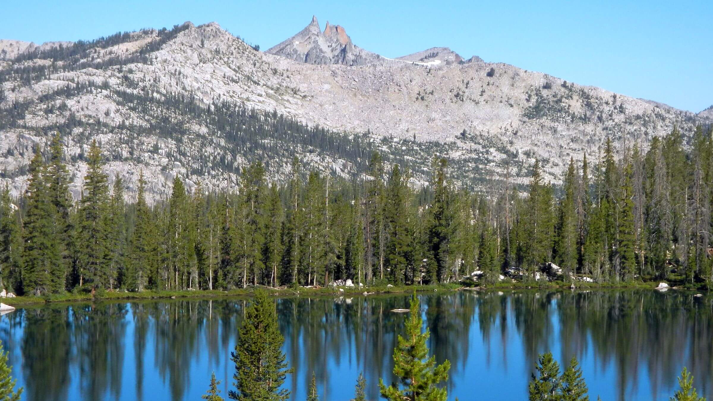
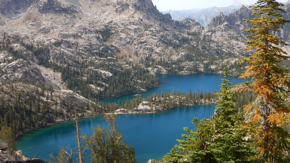
Sawtooth Wilderness—forming the headwaters of the Salmon, Payette, and Boise rivers—has dozens of jagged peaks, many over 10,000 feet in elevation, hundreds of alpine lakes, and serene basins with crystal-clear springs. Naturally, this dazzling landscape is a popular backpacker destination.
We have visited Sawtooths many times, but they are so overused we prefer other places. These backpack trips were about our sixth and seventh dating back to 1975, although David also day-hiked Sawtooth Primitive Area in late 1960s. In 2016, our long trek across Idaho included much of a 1975 White Clouds-Sawtooth trip David took with his dog.
The 2022 trip repeated part of a 1976 loop on Little Queens and Queens rivers to high country from Atlanta area where David had summer Forest Service job. Although this area is still less used, revisit was negatively impacted by fire damage to trails.
The 2018 trip aimed to visit trailless basins in Warbonnet Peak area, but dry soils unsafe on steep climb above Baron Lakes. So, we hiked trails around the first north-south ridge on eastern side of wilderness visible from Sawtooth Valley floor—starting and ending at Redfish Lake.
Solitude was the norm for both trips, even 2018 visit to popular area just after Labor Day weekend. We saw crowds mostly near trailheads or camping at heavily-used lakes; people seem to park at lakes more than hike in Sawtooths. We shared campsites with no one on either trip.
We noticed drier conditions likely from climate change. In 2018, some trails were powder dry, further pulverized by outfitters using stock to ferry camping gear into popular lake basins for hiker clients. Since 1970s trails have degraded and scarce lake campsites trampled.
Forest Service management should refocus on visitor enjoyment—purpose of Wilderness Act—by cleaning up fire effects on trails with power tools and providing more camp options.
Visit statistics (of 2022 & 2018 trips combined): 16 days, 145 miles at an average of 1.9 miles per hour, and 400 feet per mile average elevation change.
Go to map below for more information on trailheads, GPS routes, mileage, elevation changes, and photos. (Click on white box in upper-right corner to expand map and show legend with NAVIGATION INSTRUCTIONS.)
show more
Sawtooth History
Named for their jagged peaks and U-shaped valleys, Sawtooth Mountains encompass 678 square miles across four counties. Sawtooth formation is due to the lifting and erosion of the Idaho Batholith of granite and granodiorite. Hundreds of lakes in Sawtooth Wilderness were formed as glaciers eroded the earth then melted away as the Little Ice Age ended. Some perennial snowfields remain.Sawtooths were utilized by people as early as 8000 BC. A band of Shoshone Indians known as Sheepeaters for their bighorn sheep dining preference were the last to roam freely in central Idaho. In 1878 Levi Smiley found gold, spurring the first white settlers from eastern U.S.; sheep and cattle ranchers came after the miners left.
Forest Service established a Sawtooth Primitive Area in 1937. Idaho Senator Frank Church introduced a bill in 1963 to create Sawtooth Wilderness National Park encompassing the primitive area although it was not enacted.
Primary political push to protect the entire Sawtooth Valley came after molybdenum was discovered near base of Castle Peak in the White Cloud Mountains in 1968 and an ambitious mining venture was proposed. Sawtooth National Recreation Area, created in 1972, encompassed Sawtooths and White Clouds, banned mining, and the primitive area became Sawtooth Wilderness, now 218,000 acres.
2022 return: Alturas to Atlanta
Our 1976 trip started near Atlanta on south end of wilderness; our 2022 trip began on eastside at Alturas Lake (site of David’s first camping trip as middle schooler) and eventually circled around and down to Atlanta. We climbed over Mattingly pass and looped the first north-south ridge on eastern side of wilderness visible from Sawtooth Valley floor—starting and ending on Middle Fork Boise River with side trip to Leggit Lake.We had to choose between Little Queens and Queens rivers for our loop; we chose Little Queens for more convenient lake visits.
Wrong choice! Fire-damaged trails in Little Queens area—some not cleared since Idaho City Complex Fire of 1992—were the biggest change and disappointment.
After being dusted out by passing “dirt bikes” on first few miles of motorcycle trail from Alturas, we were pleased the machines had to turn off toward North Fork Ross Fork and Johnson Creek; only a few mountain bikes attempted super-steep route to wilderness boundary, where we camped, battling mosquitos, on wet broad Mattingly pass. Before the pass, 2021 Jakes Fire had burned trees on the hillside west of trail, but Forest Service used the trail for fire line, so it was in great shape with no fire damage.
Mattingly Creek Trail offered steep drop through fields of flowers and scary creek crossings (I waded) to Middle Fork Boise River where we started meeting people. A group camped near river had been packed in by Backcountry Horsemen for a week of trail clearing. Clouds gathered in high country above, but we only got a sprinkle or two.
Next day I got behind David on river crossings. He met a group hiking a day ahead of us from Alturas; they had camped at Heart Lake off main trail and were headed for Spangle Lake. We did not see their camp but met another Alturas group there. Only one hiker (bound for Sawtooth Lake) had signed register but at least two other groups came that way.
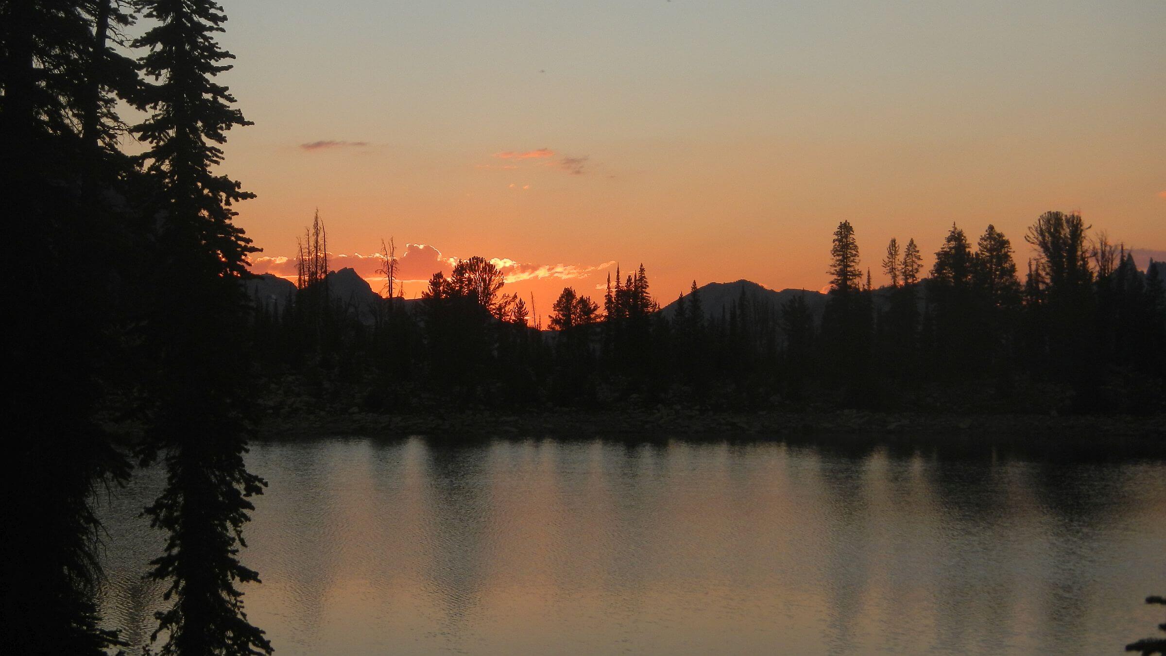
Hail caught us above Spangle; we put on raingear and went on to the pass. We met other backpackers who envied my rain pants. They were looping from Grandjean Trailhead up Payette River to lake country, as were others we met. Rain slowed; we stopped for a break and were passed by a family with dogs. I saw them on Ingeborg Lake while I was checking out campsites and assumed they camped around the bend from us.
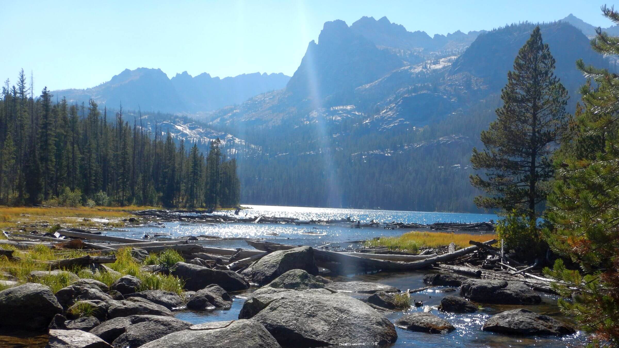
Ingeborg Lake was lower than our last visit in 2016; we saw it had no inlet or outlet—perhaps result of dry conditions and less rain the last few years. David asked me to hike back around lake to look for possible spring while he set up camp. Rain returned and I took refuge in a spruce grove. Rain continued off and on for an hour. I soaked my Gore-Tex boots and socks hiking through basin; water was running a few inches over the ground! I found no spring.
On a clear cold morning, we switchbacked down good trail past several lakes to Benedict Creek where “Grandjean Lake Loop” traffic departed. From muddy tracks the family that passed us did not stop but hiked on in the rain; we never figured out where they camped.
On steep climb toward pass above Queens River, we met Pat and Roxanne and their spooky dog. They came up Queens and camped at Pats Lake, our destination for the night. Roxanne’s parents and grandparents worked on trails here; Pats Lake is named for her grandmother Pat who cooked for the trail crew! They did a loop last summer on Little Queens and Queens; the trail from Pats to Little Queen’s was “very brushy,” he warned. They weren’t doing it this year.
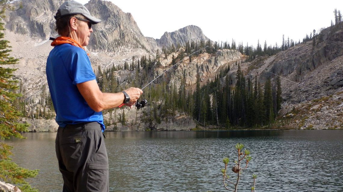
Great fishing at beautiful Pats Lake; it was quite burned on the far end. Very few mosquitoes that night or rest of the trip—we figured the big rainstorm harmed current brood.
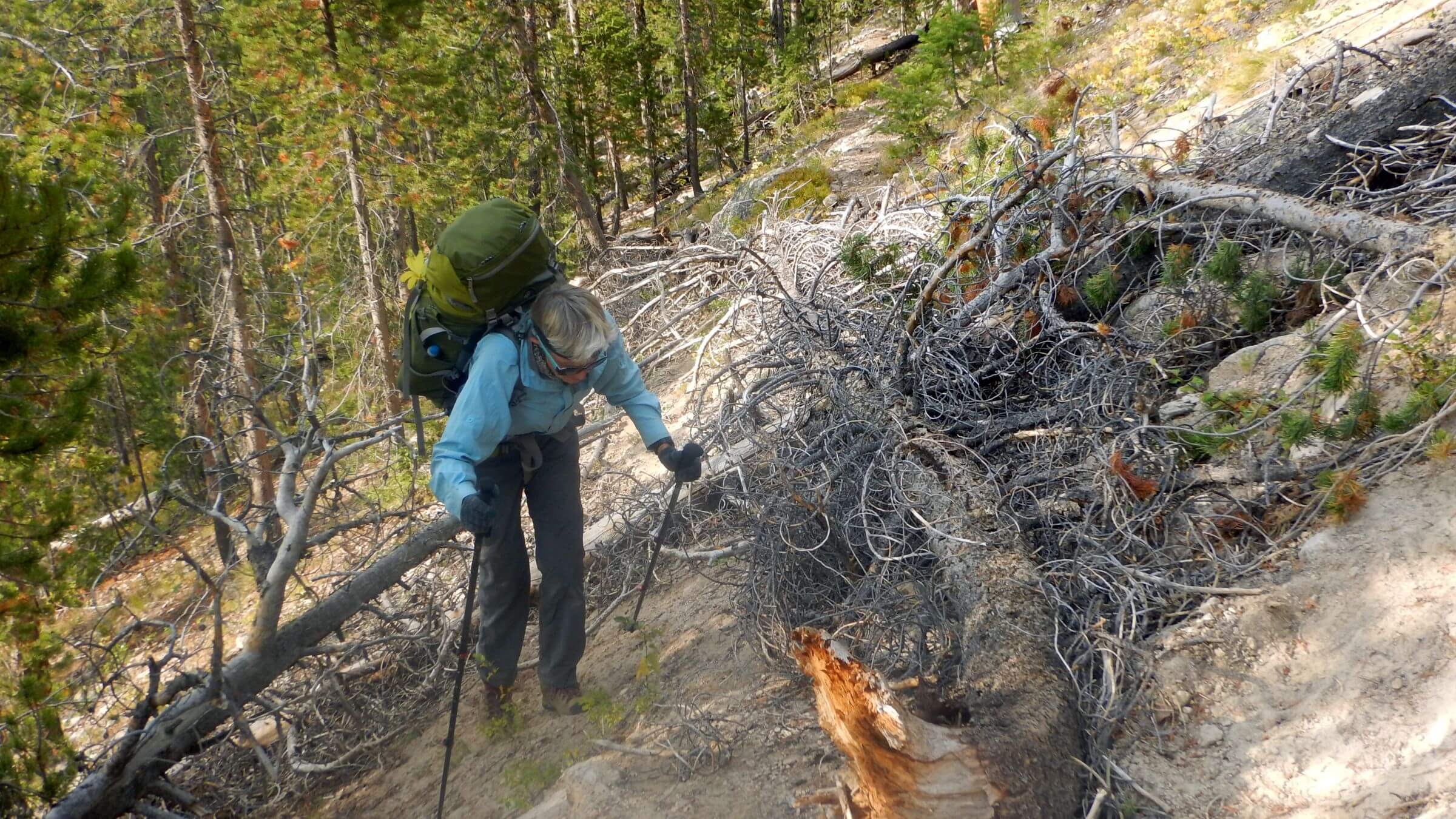
Next morning, we found our way through basin below—heavily burned in Idaho City Complex Fire of 1992—using GPS route as trail was mostly nonexistent. It started as fairly good contour trail on far side of the basin, slowly descending into Johnson Creek.
Near the bottom trail was cloaked in ceanothus—a fire-stimulated plant that had never been cleared from the trail. Unlikely to be cleared now with hand tools which the Forest Service insists on using in wilderness (strict interpretation of Wilderness Act prohibitions not shared by Park Service which uses mechanized tools where it deems necessary).
Near the bottom before crossing Johnson Creek, ceanothus jungle was higher than our heads. The springy plants literally knocked me backward onto my pack. We crawled through brush over a big log across the creek (David, ferrying our packs, slipped and had a painful fall) and found our way to a clearing.
Climbing straight up we found trail burned by more recent Little Queens Fire of 2013 contouring along a side slope; ceanothus hadn’t taken over yet. Just a few downed logs on trail to the pass into Little Queens River. The five-mile hike from Pats Lake took seven hours!
Other side, severely burned by Little Queens Fire, was open hillside with a few logs to cross. After turnoff to Browns Lake, once a popular destination, it was brushier closer to river. We stopped for a break and saw a group overtaking us—a young woman striding ahead, others lagging. They soon caught up: three women, one guy, and one quiet border collie.
This was the group David met at Heart Lake junction! They camped at a lake above Pats and were behind us all day. Their short-clad legs were blackened and scratched; they seemed surprised at brushy trail. They had a ride at Queens Trailhead the next day. We learned we all lived in Hailey! They forged ahead; more showers came, and I briefly donned raingear.
We camped in tall grass surrounded by a few young trees near Little Queens River. The whole canyon was open burned landscape with some blackened poles but much brilliant pink-blooming fireweed. Next morning, we found a nice campsite to cook breakfast in unburned Douglas fir, waded Little Queens, and happily found a big bridge over Queens River just before trailhead and picnic area. We clambered up old jeep road to camp on burned ridge above Atlanta. A rainstorm met us; we huddled under remnant trees until wind and rain calmed down.
Sprinkles next morning tapered off as we wound down into town. I was hoping it would pour while we had a cabin but only scattered clouds during our two-day layover in Atlanta.
2022: Atlanta interlude
Atlanta was settled by miners. Gold was discovered in 1863; gold and silver mining started slowly because of the area’s remoteness; only way to town was circuitous route through the mountains. We found a gravestone for two mail carriers who apparently died in a mountain blizzard. Mining took off after a road was built up the Boise River in the 1930s, making it easier to transport equipment, food, and ore.Atlanta was a “party town” when David worked nearby in 1976, with many people driving dusty road up from Boise. Our waitress at Beaver Lodge mentioned several bars and restaurants in the 1980s when there was still active mining and larger population. Now Beaver Lodge was the only place for lodging and food—the restaurant was open noon to 7 p.m., serving burgers, sides, and sandwiches. During our layover we had late “breakfast” and dinner around those hours.
Restaurant was busy—mostly Universal Terrain Vehicle (UTV) groups probably from various area campgrounds. We had Cabin #1 of six—a large rustic wood frame—and seemed to be the only guests. We were told it would fill up for Atlanta Days the coming weekend.
In a cluttered antique shop, we met the town’s amateur (but a bit reticent) historian who sent us to find the cemetery. We wandered by a three-story wood frame building, Atlanta Christian Chapel, and were invited in for a tour and cookies (baked for youth expected back from a backpack trip). Churches from Caldwell built the chapel and offer Sunday services. We checked out mostly closed Atlanta Guard station. A friendly couple sitting on porch of a house rented from the Forest Service offered hospitality and Diet Dr. Pepper.
2022 Atlanta-Alturas: mellow Middle Fork, twice-burned Leggit
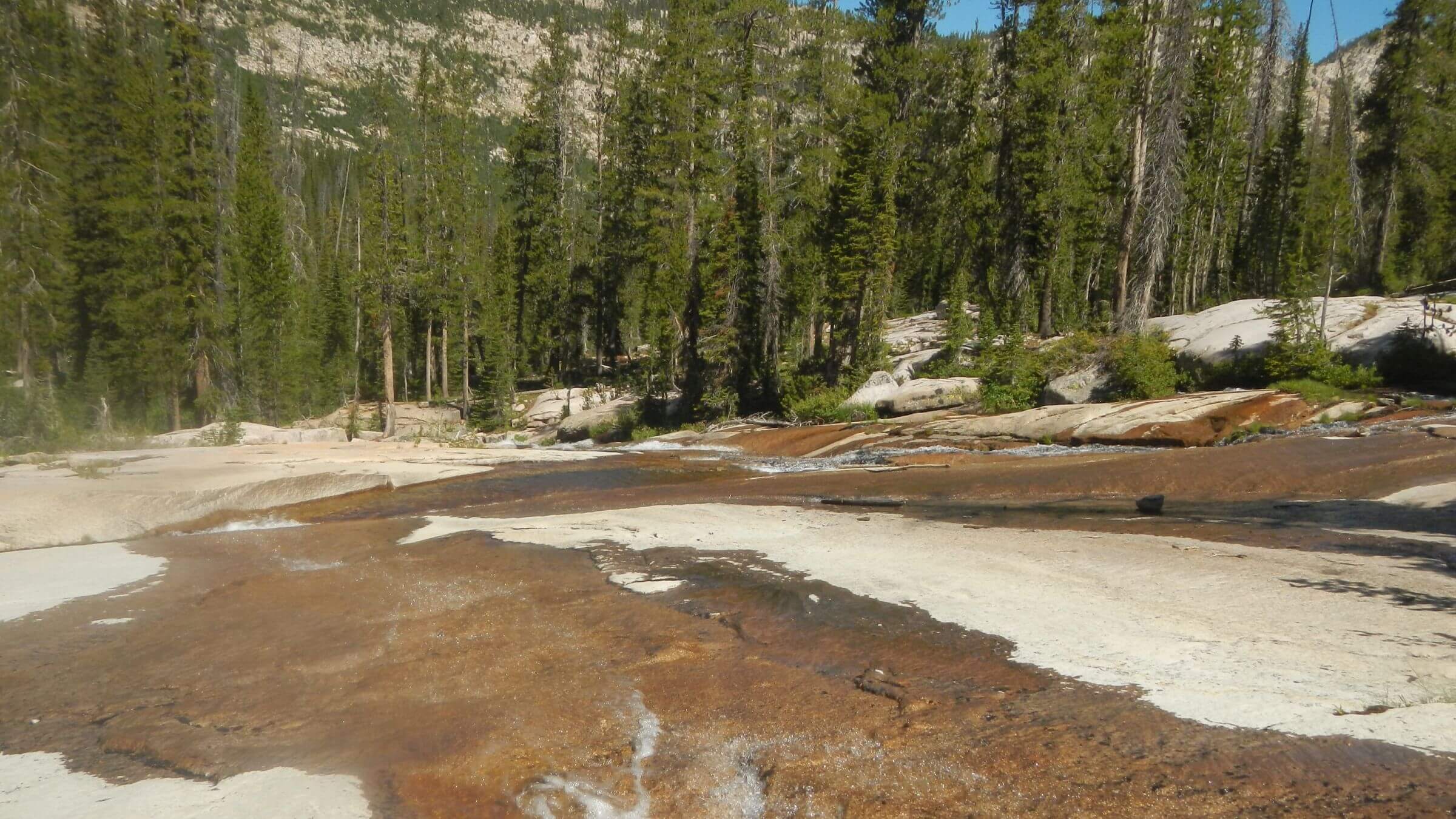
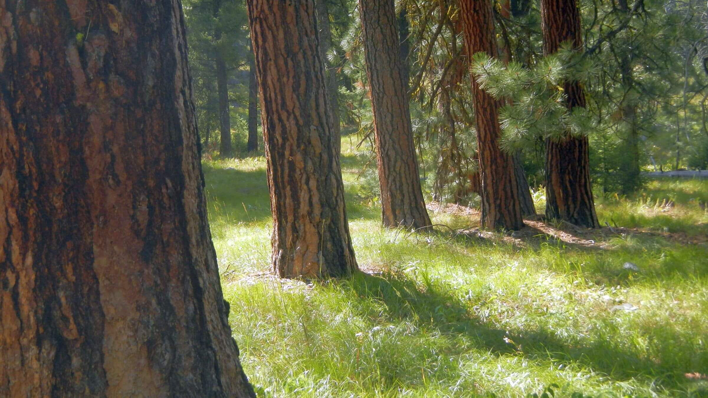
Road out of town took us past ramshackle houses to Atlanta’s famous Hot Springs, two large ponds with nearby picnic tables. We looked in vain for a dam on the river at Power Plant Recreation Area (we later found it on Google Earth imagery two miles west of Atlanta, built in 1906-1907 by miners). We saw vehicles and big horse trailers at trailhead. Power Plant Trail skirted around edge of a very large campground with only a few sites occupied.Trail contoured along Boise Middle Fork a few miles through orange-bark ponderosa pine above vivid green pine grass carpet, then climbed to junction with unmarked trail to Leggit Lake. A tired-looking hiker had spent three nights at the lake; saw fish but caught none. He said trail was poor but discernible. It started as steep jeep trail; we lost it crossing a boulder field from a recent fire. We wandered along dry creek bed and found trail winding up through burned trees. Higher up we hiked over logs and through abundant floral growth from 2013 Leggit Fire and recent avalanche. Cairns marked the obscure trail.
We could see a rocky basin above cliffs. Trail switchbacked through small fir downed by avalanche then shot steeply up hillside and cleverly edged along the side of what our hiker friend had called “The Wall.” We soon were gazing at a beautiful alpine lake in a rocky basin. Six hours to hike five miles up Leggit basin. David caught one giant trout for dinner; tried for another but was fine with no more hits, as one was more than enough for dinner.
We did better finding trail down, noticing our errors were from following creek instead of side slope. One couple with dog carrying its own pack were backpacking for their third annual visit. Back on the jeep road I met another couple day hiking who wanted to know how far to the lake. Four rough miles. I suggested they aim for beautiful flower basin two miles ahead.
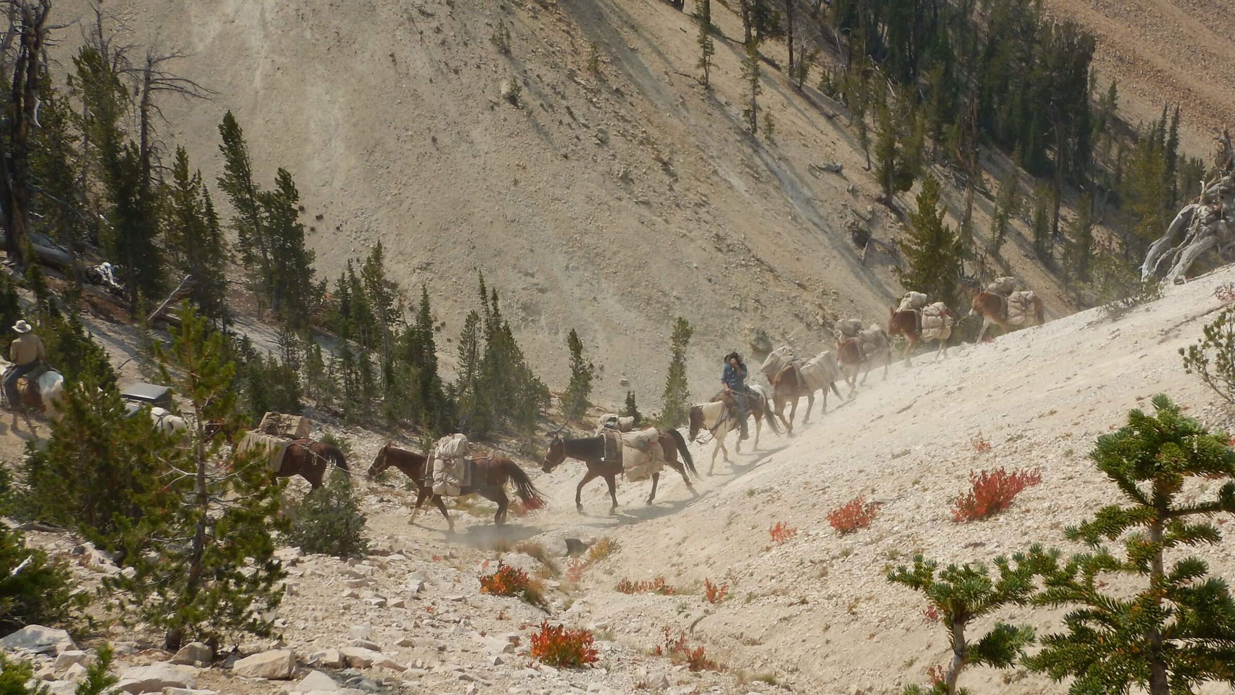
Back on Middle Fork we met a large pack train with horses and mules, returning from the lake country; they seemed to be locals. This explained trailers at the trailhead. We camped in trees near Mattingly Creek and a beautiful field of flowers.
Early next morning we made steep hike up and steeper drop down. Two horses had come up from the river and over the divide; I noticed they took soil around slippery parts of the trail. I was relieved that the highly-compacted motorcycle trail was fairly gentle and not too slick.
We met group of 10 dirt bikers (the leader warned of more coming), then many mountain bikers, plus a day hiker and kids on bikes being pulled on leash by a rowdy Wirehaired Pointing Griffon. I got to our vehicle, glad for end to Saturday chaos and sore feet from compacted trail.
2018 Revisit: Slidy Slopes, Powdered Trails & More People
Drought thwarted fall 2018 plan to visit trailless lakes and avoid crowds in a popular part of Sawtooth Wilderness south of Redfish Lake.Three days after Labor Day weekend, campgrounds and trailheads at Redfish Lake were still packed with people—but we had a plan to elude the crowds. Like many others, we’d take shuttle boat across Redfish Lake and hike up Redfish Lake Creek, but we’d soon leave the beaten path for trailless lake basins behind Warbonnet Peak.
Or so we thought.
That plan fell apart on dry scree slopes above Baron Lakes. The goat route and/or social trail along a knife-edge ridge seemed to end in cliffs. We slid our way down to Upper Baron Lake and camped at the far end. Very dry year had rendered soils slippery and hard to hike.
Next morning (without packs) we checked out a route to the saddle, clawing half a mile up slippery glacial till behind the lake. Looked like steeper ascent to saddle above. David’s preplanning with Google Earth imagery indicated a more precipitous drop to the lake. He nixed returning for the packs, voted to bag cross-country and loop trails around Sawtooths.
Turns out we missed a “social trail” (hiker-made route) that went right to Warbonnet Basin!
I found out about this after our trip. While checking for links to trailless Sawtooth hiking, I discovered that a long-distance hiker took our same route to the pass above Baron in August 2017 after a very snowy winter with much wetter non-slippery soil conditions.
Unlike us, he made it to the pass, and discovered a fairly good social trail from Alpine Lake (a heavily-used lake we passed on way to Baron) to the pass descending to Warbonnet Lake. David’s fears of a steep cross-country drop were unfounded. The hiker successfully visited Warbonnet, Bead, Packrat and Upper Redfish lakes plus other trailless lakes. Fishing was great.
2018: Cramer Lakes Loop with the Masses
Thwarted from cross-country plans, we hiked back over Baron Pass, descended to Redfish Creek, crossed, and hiked up to Cramer Lakes. We passed many campers at Lower and Middle Cramer lakes, but at far end of Upper Cramer found a nice sandy spot all to ourselves. We cooked fish David caught at Middle Cramer (as it turned out, only lake where he caught fish).Next day we crossed pass above Cramer Lakes, descended past Hidden Lake, and crossed South Fork of Payette River. Just past junction to Edna Lake, we saw a pack-string pursuing us to Sand Mountain Pass—perhaps an outfitter packing out his base camp at Edna Lake with about 18 stock (mules and horses). Trails were powder soft from stock use.
Descending Sand Pass we saw many people on switchbacks below. Imogene Lake, a large popular destination, was occupied in every nook and cranny. At lake’s upper end we noticed a social trail climbing to basin above Imogene. We passed Mushroom Lake, ringed by day hikers, and climbed on to a smaller, unnamed lake. As we scoped out campsites, a couple carrying large fly rods trooped by. “You have to fish the upper lake,” they enthused.
We hiked up to check out the third unnamed lake. It was much larger and windy with choppy waves. David made a few casts but found no interest from fish. Perhaps he needed a fly rod.
2018: Solitude on Redfish Ridge
We left the masses after Hell Roaring Lake. The lightly-used trail climbed and dropped sharply between basins. It had not been cleared for several years, so we had downed logs to scramble over. Using GPS, we ventured off trail to Decker Lake. It had a bathtub ring, seemed dammed, with no fish, but offered nice camping in solitude.After nearly constant people from Baron to Hell Roaring lakes, we saw no one on the trail except for two women we met near the end starting their backpacking trip from Redfish Shuttle.
At Redfish Inlet junction (heading northeast), the trail left wilderness. Immediately the trail work got better; logs were freshly cut with chainsaws. This trail, which followed a ridge above Redfish Lake, was open to mountain bikes. We encountered only two: a father and daughter cycling switchbacks near trailhead at Sockeye Campground.
Our last leg was a loop back to our vehicle on road through still-busy campgrounds. Campers were awed seeing backpackers and wanted to know if we had gone “up there?” pointing to iconic Sawtooths visible from Redfish. We had. Wow.
Sawtooth Reflections: Managing For People
The famous Sawtooths draw crowds, but limited loop trail system concentrates most use in northeastern third of the wilderness. As in previous trips, we saw minimal campsites, all overused and mostly right near the lake shores—because slopes offer very little flat area.Building a few more campsites on slopes and/or timbered areas away from popular lakes would be much more fruitful than vigilante removal of fire circle rocks and elaborate trailhead signs about “fire pans.” Further, some management (for example, rotating camping from year-to-year among most popular lake basins) or restriction of commercial outfitters packing into wilderness from popular trailheads seems appropriate for this wilderness gem.
Also, Forest Service could spread out use by building more connector trails over ridges and reduce multiple social trails into popular trailless areas by putting cairns on the best route. Finally, noticing the immediately improved trail management (downed log cutting) in adjoining non-wilderness where chainsaws are allowed, (and abysmal lack of trail work on many fire-damaged and/or eroded trails in the wilderness), makes us question the Forest Service “minimal tool” policy which interprets the Wilderness Act to disallow mechanical tools in wilderness. Park Service policy allows chainsaw use in wilderness where expedient.
Both agencies base policy on Wilderness Act: Section 4. (c) Prohibition of Certain Uses, which states no motorized equipment in wilderness. However, this list of restrictions starts with a disclaimer: “except as necessary to meet minimum requirements for the administration of the area for the purpose of this Act.” According to Section 2. (a), the purpose of wilderness is the use and enjoyment of the American people. We think it is necessary to keep trails open for public “use and enjoyment,” and so does the Park Service.
It is unconscionable that Johnson Creek Trail connecting to Little Queens River and part of a Queens-Little Queens River Loop is such a ceanothus jungle 30 years after the fire! A trail crew with power brushcutters could clean up that trail in a few days.
show less
Google Map
(Click upper-right box above map to “view larger map” and see legend including NAVIGATION INSTRUCTIONS; expand/contract legend by clicking right arrow down/up.)