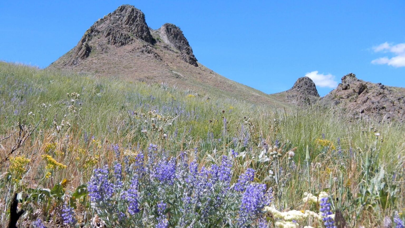
 Lupine and grass recovery 2 years after 2018 Sharps Fire (Day1)
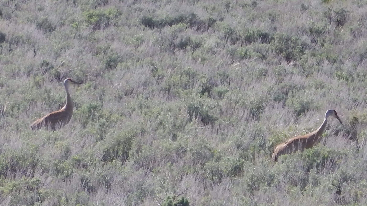 Sandhill cranes: near Baugh Creek (Day1 route) from May 2017
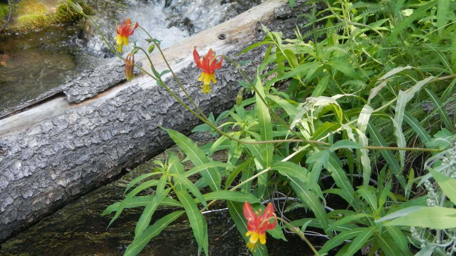 Crimson columbine on Porcupine Creek (Day2)
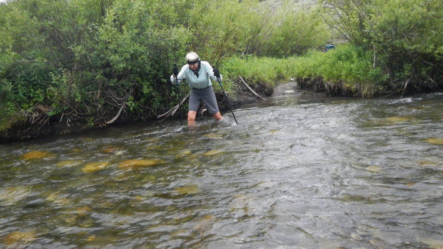 Crossing Little Wood River (Day3)
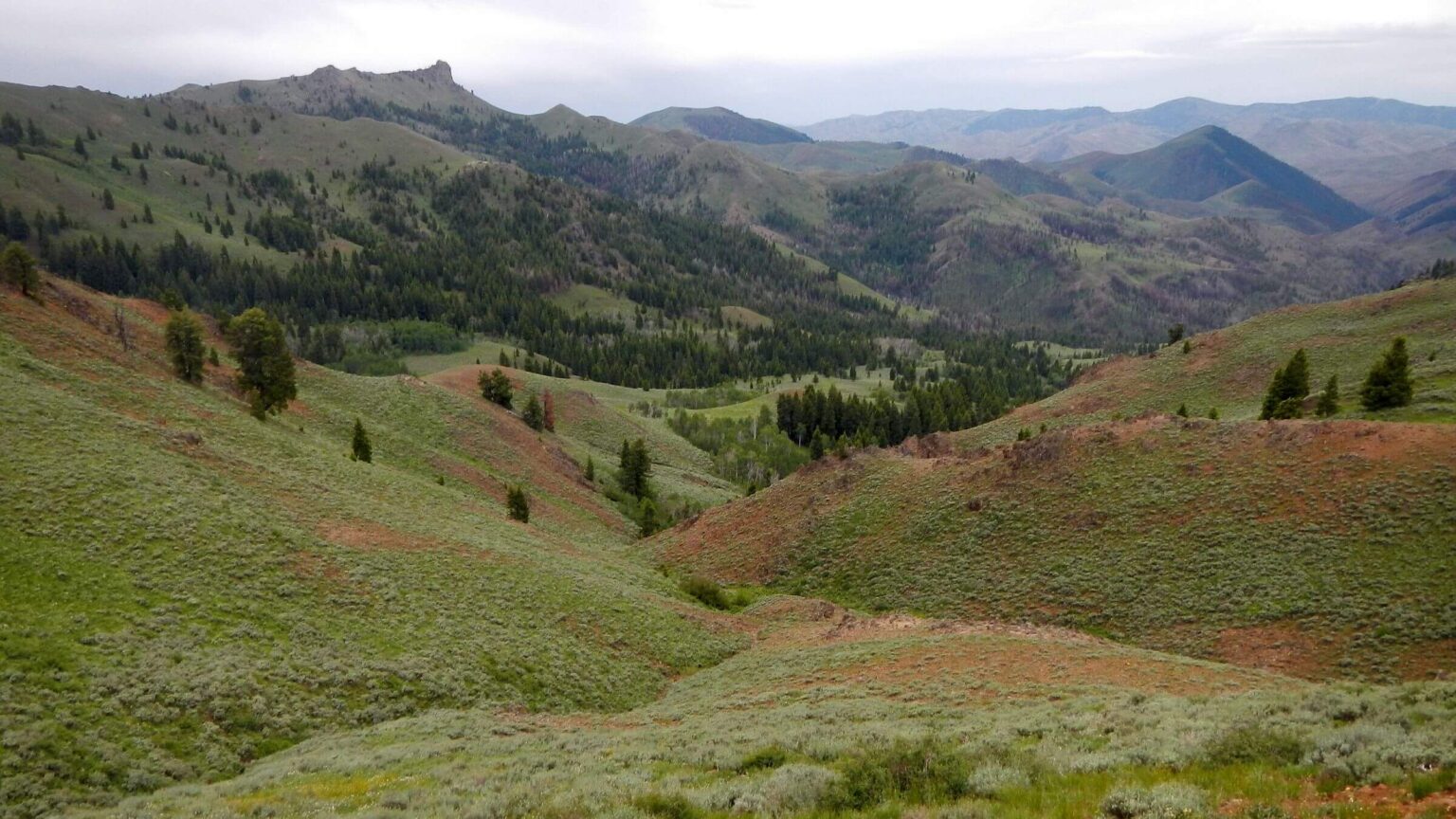 Copper Creek from Swede Peak Trail (Day3)
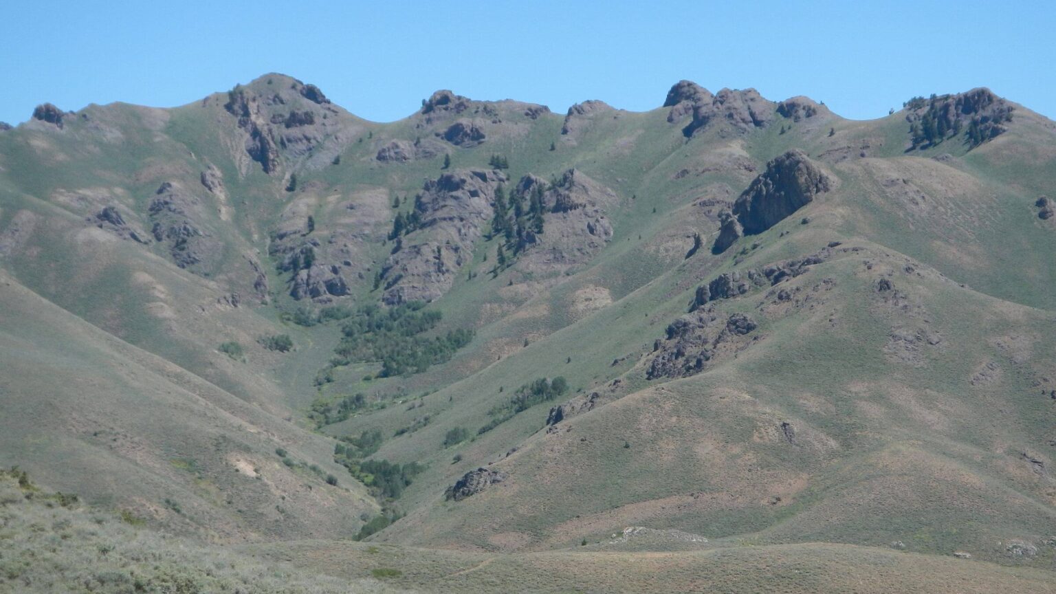 Friedman Wilderness Study Area: later photo from rerouting Day4 track around non-accessible private property
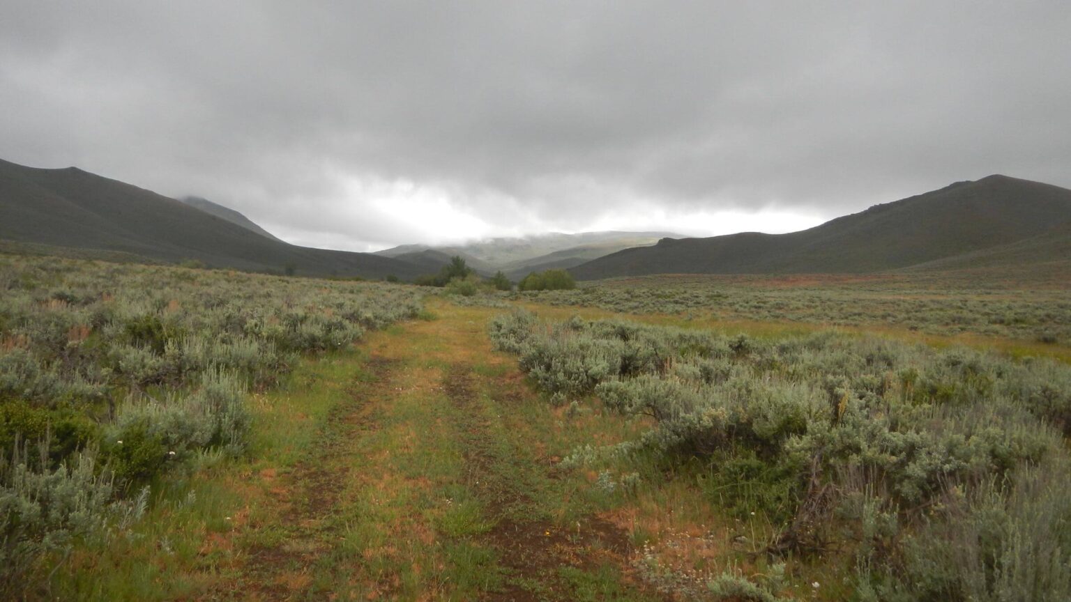 Flat Top Sheep Company “Access Yes!” property (Day4)
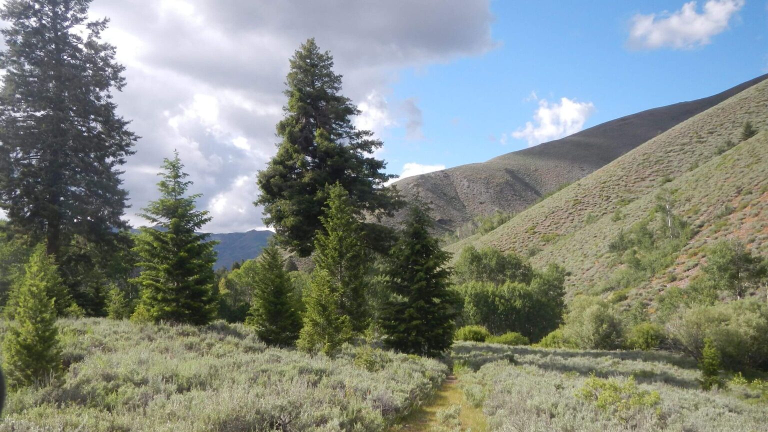 Iron Mine Creek on Lava Lake Land & Livestock “Access Yes!” property (Day5)
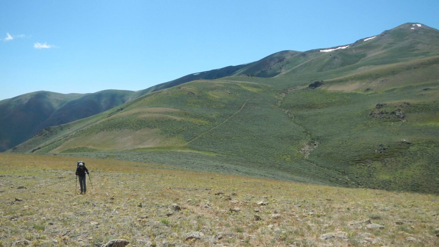 Descending Blizzard Mountain into Craters on the Moon (Day6)
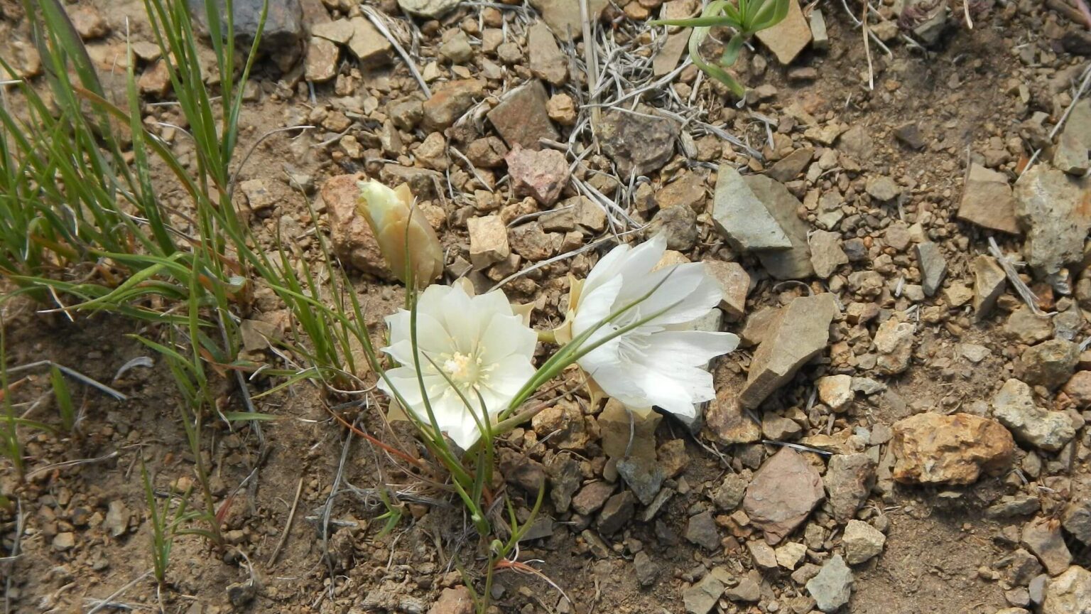 Bitterroot (Day6)
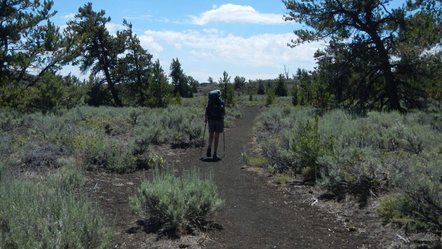 Wilderness Trail through limber pine (Day7)
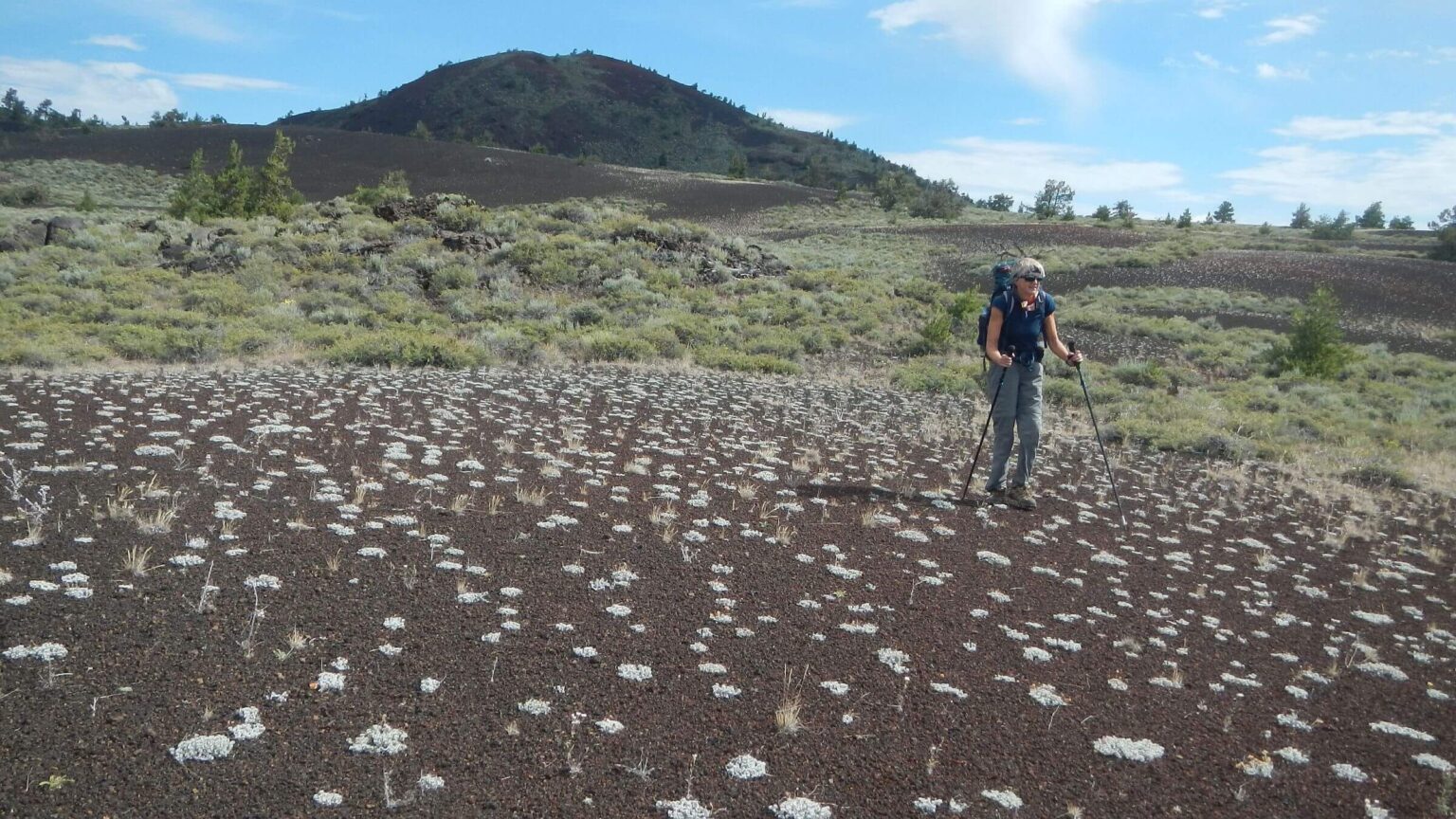 Cross-country route around Big Cinder Butte (Day8)
Third Time’s a Charm on trek try
It took three tries over three years, but we finally made it.
Our weeklong journey across public and private land in the Pioneer Mountain area (Pioneers) provided nearly exclusive access to vast fields of flowers, high grasses and sagebrush, lofty peak views, idyllic creeks, beaver-built wetlands, and forest. We saw no hikers until we reached our destination in the popular Craters of the Moon National Monument and Preserve (Craters).
Others inspired this journey.
On a 2016 hike, we met an Idaho couple testing llamas for their Central Idaho wilderness circuit from Hailey planned to end at Craters.
This motivated us to try a hike from our house in Hailey across the lower Pioneers to Craters. We failed twice! But third try in summer 2020 was a charm despite unpredicted cold, wet, and windy weather, and a regrettable encounter with a surly rancher.
Completing this complicated puzzle of federal, state, and private lands—some open to the public and some adamantly closed (!)—took many hours of planning and some adjustment on the fly.
We even took two more day trips after the trek to (1) forge a reroute around closed private land and (2) hike/map a route directly into Craters, since we camped on private land behind a locked gate toward the end of our trek and drove to Craters Wilderness for the last segment.
Photos on the map below depict the matchless beauty of the lower Pioneers, seen by few people other than fall hunters. But given land management complexity and uncertain access, this country is tough for a continuous backpacking trip.
show more
Encounter Inspired First Two Tries
We met well-known Ketchum couple Bob Jonas and Sarah Michaels near the start of our Central Idaho Trek—from Hailey to near Salmon—in June 2016, while crossing a trailless pass in the Pioneers from Summit Creek. They were testing routes with llamas for their Central Idaho “walkabout” the following summer (2017). Bob wanted to start in the desert, loop through central Idaho mountains and end at Craters.Bob and Sarah’s trek starting west of Hailey was hampered by high temperatures, injuries, and later by high water and snowy passes. Deadfall trees and summer fires forced reroutes. Wet fall weather stopped the trek short of Craters; Bob finished on his own a few days later without llamas (see end of Bob’s blog).
Meanwhile we were trying to forge a direct route to Craters. We made two attempts hiking east from our house in May 2017 and September 2019. Both times we left a vehicle at the Robert Limbert Visitors Center and got a Park Service permit to conclude our hike through a small gated northwest section of Craters (North End) on the northwest side of U.S. Highway 20.
High water after record-breaking snowfall thwarted the first attempt. We hiked from our Hailey house up foothills over Patterson Peak, down washed out Fisher Creek Road, up flooded Porcupine Creek, over the ridge near Grays Peak and on to Little Wood River—where we turned back at brown, swirling high waters. We crossed basin above Upper Porcupine Creek on a steep scary snowpack, followed elk tracks on the trail (identified by GPS) under the icy hillside snowpack and then skidded down to Federal Gulch for a 20-mile road hike home. In July we tried to cross Little Wood higher in the basin; still too high.
Technical problems—not water—thwarted our 2nd attempt in September 2019. During our first day on steep cross-country drop off Patterson Peak, David, carrying Cindy’s pack on his hip, dislodged his GPS from a cargo pocket and we weren’t able to find it in the brush.
Third Time
For the latest attempt, David spent about 50 hours planning, including study of ownership maps and Google Earth imagery. We also consulted with government officials and the owner of Lava Lake Land and Livestock LLC (Lava Lake), the majority landowner for our trek.Lava Lake and other private lands hiked were in the Idaho Department of Fish and Game’s Access Yes! program, which compensates landowners who allow nonmotorized public access on their land. (Compensation varies depending on value of land to the public; e.g., a small parcel with river access might be paid more. Signs may be erected by the landowner or the agency depending on the contract.) This program was invaluable to our hike.
We could not park a vehicle at Craters visitor center because of a National Park Service (NPS) construction project, but the Lava Lake landowner offered an alternative. Instead of hiking the ridge beyond Blizzard Mountain into Craters, we hiked down Cottonwood Canyon to our vehicle on Lava Lake land by the Craters boundary (for public land route see Craters North End below). The landowner lent us a key to a locked gate and permitted us to camp. (Access Yes! is set up for hunters day use but not camping. This trip would be difficult without camping on private land, so contact the main landowners, Lava Lake and Flat Top Sheep Company to ask permission.)
We dropped off our vehicle in Cottonwood Canyon at a nice camping spot, returned to Hailey and started from our house the next morning. This time we hiked up Quigley Canyon instead of the scenic Patterson route used on previous treks. Cindy refused to repeat the steep drop off the peak that cost us the GPS last time. Dog walkers, bicyclists, and motorcyclists seemed surprised to see backpackers. Beyond Quigley, effects of the Sharps Fire of 2018 were reflected in a few burned trees, recovered range, and abundant flowers; on Town and Baugh Creeks, new beaver ponds had appeared. Near a big slough we heard a rolling-squawking cry, and soon saw a sandhill crane pacing the hillside above. The cry was answered by another crane in an unseen location, perhaps a hen nesting on the hillside. (On our May 2017 trip, we also saw a pair of cranes strolling near this area.)
On the second day, a big cold storm moved in and dominated our trip for 3 days—contradicting the forecast for mostly clear weather with “a few showers” predicted for only the fourth day. We had some rain the second night for our camp on Gray’s Creek. The following morning brought gray gloom and a chilly crossing of Little Wood River, harsh wind near Swede Peak, and rain for the road hike down from Mormon Flat, where we met sightseers in pickup trucks or SUVs. Roads were the only place we saw people (in/on vehicles).
Our trip could have ended the fourth day. We were hiking a jeep track across public land but had to cross a private ranch on Muldoon Creek to reach BLM-managed public land on the opposite ridge. We had tried but failed to get contact information for this ranch. On our fall 2019 trek we had passed through without seeing anyone, so wrongly assumed we would be okay in 2020. It was summer and cattle were out in pastures below the jeep road we were hiking. They spooked and began herding themselves back to the ranch. Yikes. We passed historical charcoal kilns and the ranch property quietly on the Muldoon county road. But when we turned off on an old route to the creek, I heard the roar of an engine. Uh oh.
The young rancher was furious and ordered us off his land. Where to cross? He wasn’t awfully specific: up or down the county road but off his land. We went on up the county road, rounded a bend, and quickly crossed the creek near BLM land about a quarter mile beyond. We would have needed a full computer screen and Internet to do better for rerouting on the fly with only GPS. (We did this later to record a GPS track for the alternate route shown on the map below.)
The rest of our trip was on BLM-managed, state, or private Access Yes! land. Despite periodic drizzle, we enjoyed grassy pastures, flowers, and willow-lined creeks; but were frequently annoyed by cattle “herding” ahead of us on the roads. Rain cleared on the fifth day as we entered beautiful Iron Mine Creek Canyon on Lava Lake land: a lovely hike except for down logs from avalanches near the head of the canyon not cut out by hunters. Interestingly, aspen were dying from high water due to overambitious beaver—perhaps responding to more habitat from better managed grazing.
The last weather misadventure occurred in Blizzard Basin where post-storm cold high winds nixed an ascent of Blizzard Mountain. After being knocked around by near 50-mph gusts on the ridge, I was happy to skip our originally planned route along Craters boundary on a high ridge and instead head down Cottonwood Creek. After an initial steep drop on an old power-line road, our route mellowed along the creek through high grassy meadows, shaded with willows and cottonwoods against sagebrush hills. No cattle grazed in the vast basin above our vehicle. We camped in an aspen grove right by the Craters boundary where we had left our vehicle.
Craters Wilderness
To finish the trek we drove road and highway to Craters on the seventh day, got a wilderness permit, and spent a night in designated wilderness. We hiked the Wilderness Trail (longest trail into wilderness) to its terminus at The Sentinel.We went a bit beyond Sentinel to loop around the crater through sagebrush and grass (from an old burn) and decided against venturing further towards Fissure Butte on a rough route through lava and sagebrush. We returned to Echo Crater, the most popular camp area in the wilderness and a shelter from persistent winds after the storm. I was annoyed by stinging bees (first I had seen) and sagebrush encroachment on the trail, and saddened to see some dead limber pine, perhaps drought-stressed.
Despite the hordes at the visitor center and at the Tree Molds Trailhead (where Wilderness and other day-hiking trails depart), we saw only two day-hikers and one backpacking camp just below Echo Crater Rim. Perhaps this first flat spot looked good after the brief unmarked cross-country slog through sagebrush to the crater from the trail. However, much nicer camping was available from winding further into the crater. The bottom inner crater is fabulous with fine pumice-soil flat spots nestled within limber pine; we had it all to ourselves. We noted more evidence of use since our last visit in 2017; hiker-made “social trails” dropping right into the crater’s loose pumice were particularly disturbing.
The NPS wilderness philosophy may be indirectly contributing to more social trails and wilderness “trammeling.” For example, a signed and brushed route to Echo Crater, and extension of Wilderness and Tree Molds Trails would reduce multiple trails created by visitors. We once suggested more wilderness trails to a Craters employee who replied that leaving the area in an unimpaired natural state without improvements preserved “wilderness character.” Ironically, NOT building or signing trails to channel use is creating a spaghetti system of “social trails” (as we saw at Echo, Sentinel, and after terminus of Tree Molds Trail).
For our last day, we looped cross-country around the backside of Big Cinder Cone to Tree Molds Trail (day-use trail to grove of trunk molds left when ancient trees were caught in lava flow and subsequently decayed). The trail rejoined us with civilization; we met 25–30 hikers in large family groups. No one was masked (required by NPS at visitor center because of pandemic). We pulled up our bandanas like bandits and stepped off the trail.
Trailhead parking was close to full and a line of vehicles was pulling in. With pavement and marked trails, you get crowds. With difficult land navigating, you get solitude.
Addendum: Craters North End
Since our successful Pioneers-Crater trek finished on private land behind a locked gate (we got permission and a key from Lava Lake Lamb, one of the landowners) we later did a day hike from Craters of the Moon National Monument to ensure that hikers could continue the trek on public land along the ridge to north end of Craters. We found the area’s roads and routes to the ridge hikable but offering logistics problems. First, camping is limited. Public land on the ridge has no good flat spots with water or shelter from wind beyond Iron Mine Creek. Upper Little Cottonwood Creek in the North End of Craters would be great camping, but NPS forbids it because the creek is the water source for Craters facilities. Camping is only allowed in a group campsite—about 14 miles from our camp5—that must be reserved in advance. The North End has no trails, but a number of old roads closed to vehicles are available for hiking and mountain biking. (NPS drives only on the main road.) It is worth a visit in its own right; Little Cottonwood Creek is a lush riparian area heavily used by wildlife and includes some old-growth Douglas-fir groves. We have never seen anyone during a couple of visits except NPS employees.show less
Google Map
(Click upper-right box above map to “view larger map” and see legend including NAVIGATION INSTRUCTIONS; expand/contract legend by clicking right arrow down/up.)
Downloads
Links
- Land ownership map (must create account but “free trial” access for 1 month)
- Little Wood River gauging station
- Craters of the Moon Wilderness
- Thwarted by Little Wood
- Backpacking Craters Wilderness
- Lava Lake conservation projects