Hiking Graded Roads In Nation’s Largest Wilderness
Parched throats. Harsh beating sun. Alkaline flats. Waterless wastelands. Unbearable soaring temperatures. One expects such hardships when backpacking in Death Valley.
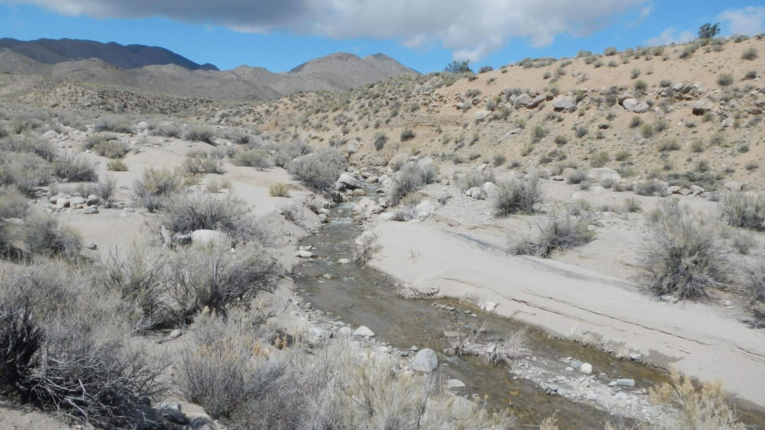
Not for us. Our 54-mile March backpacking trek in a small portion of the nation’s largest and lowest elevation wilderness offered none of these hardships—rather, cold wind and snow flurries, and, in the canyons, often water and sometimes overabundant vegetation. The most unpleasant ordeal was slogging deep, sandy, well-graded roads within the wilderness.
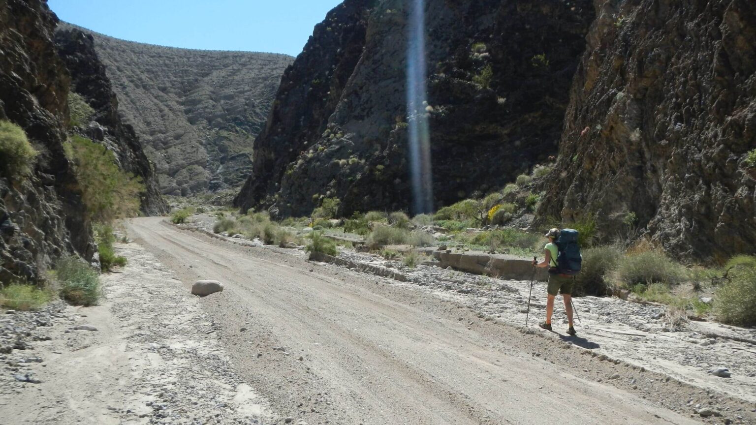
Park Service energy and budget seemed focused on over-grading these “wilderness” roads, particularly in washes, transforming roads into ditches with high berms (to return from photo, click on page outside photo) that channeled canyon waters.
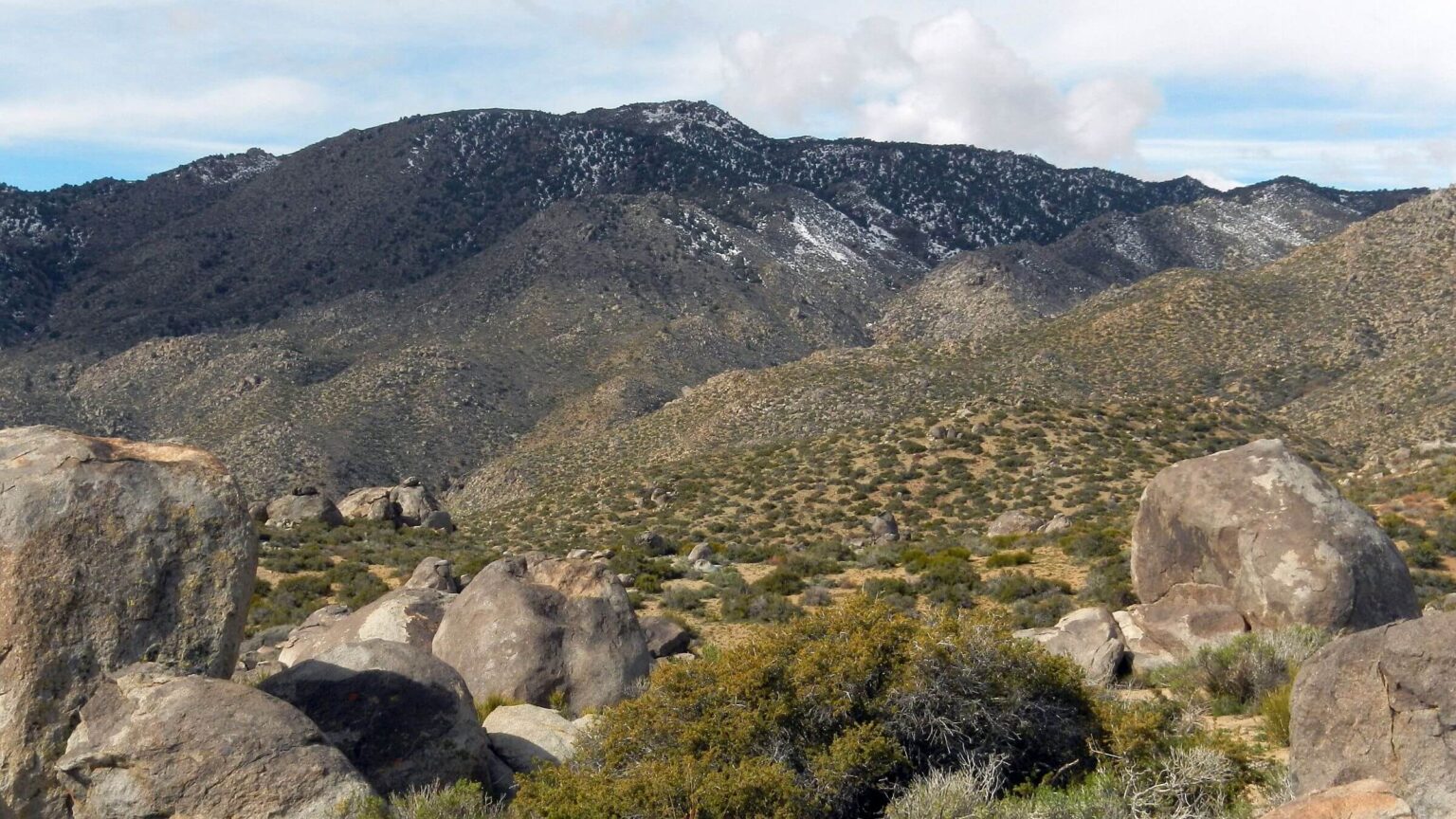
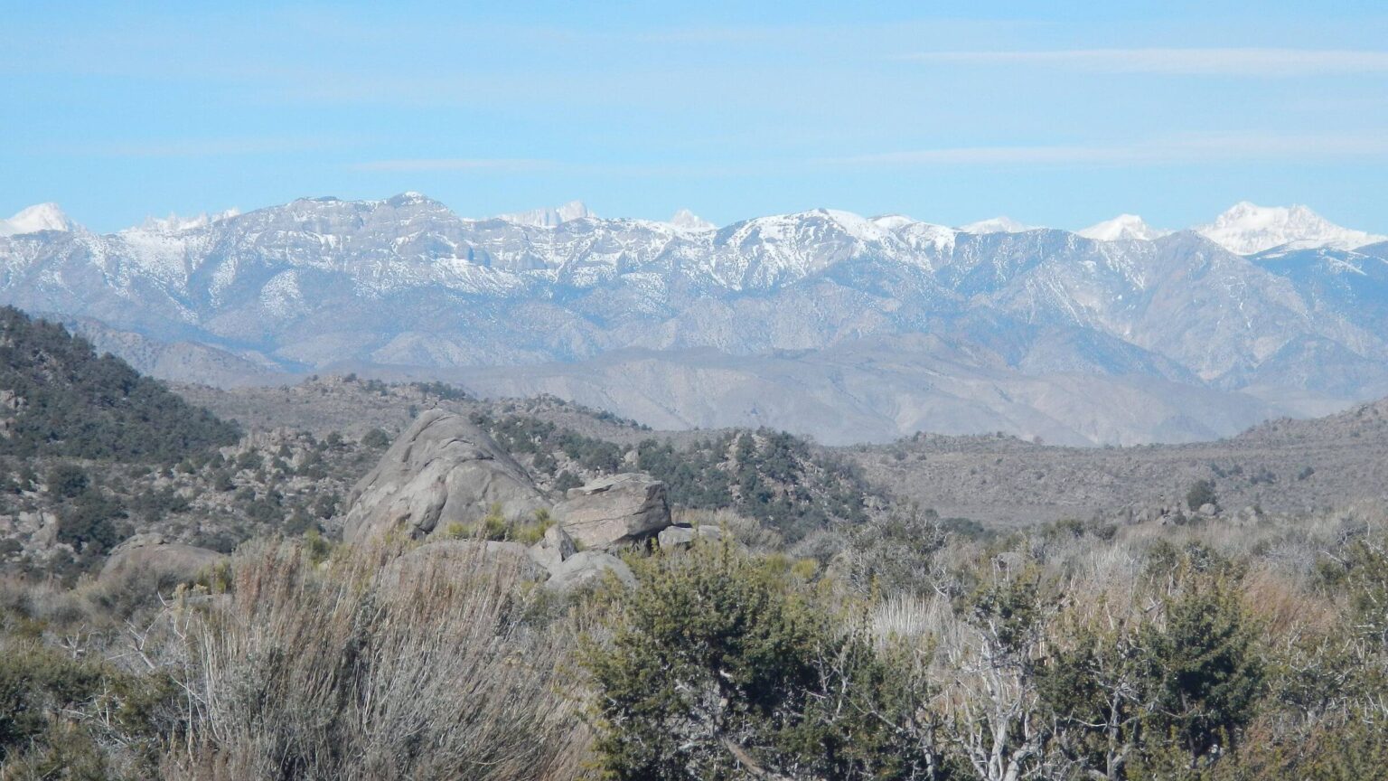
We were too early in the year to experience super-hot summer temperatures that gave Death Valley its name and fame. Late March was still cool with highs in 70s F at sea level at Stovepipe Wells, with 50s on the higher mesas and freezing nights on Hunter Mountain. A mid-trip storm offered chilly winds and ice but dazzling fresh-snow views of Mt. Whitney in distant Sierras.
Monsoon 2023 and winter 2024 were unseasonably wet in California and many Death Valley roads were flooded, damaged, and closed fall through winter. But this benefited our trip as most springs were viable and many intermittent stream drainages were running or offered water pools.
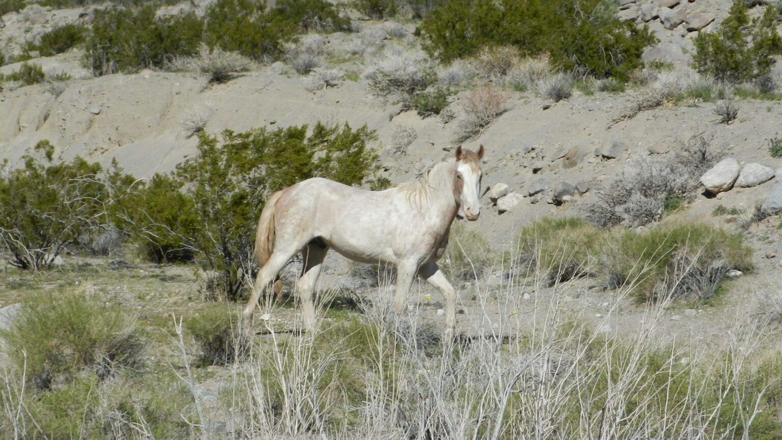
Besides washes with hiker routes and roads, we also found old trail. We saw no trailwork but feral horses kept some trails open.
Although Park Service literature said roads into Cottonwood and Marble canyons require a 4WD high-axle vehicle, we saw a 2WD pickup on Cottonwood and a big popup camper van near the road end/trailhead at Marble. We saw many unused primitive sites for vehicles use.
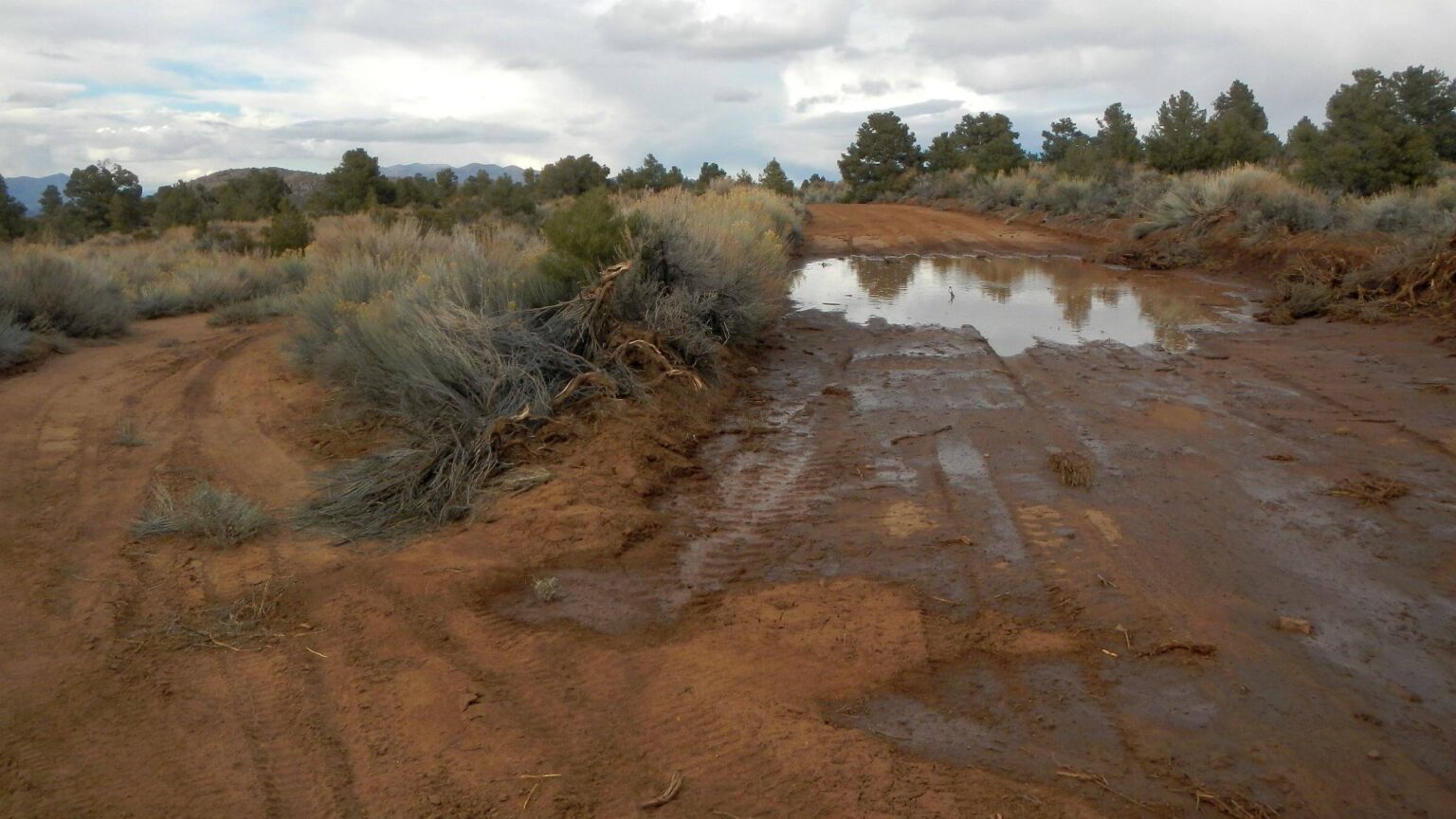
Hunter Mountain Road, classified as primitive, was wide, well-graded, and could be navigated by any two-wheel drive vehicle with clearance. We saw no vehicles, but tracks showed many drove this road over past weekend. Only hazards were deep muddy waterholes from recent snowmelt.
Hunter, Marble, and Cottonwood—part of the 1000 miles of paved and dirt roads within Death Valley Wilderness—are “cherry-stem,” exempted from the wilderness prohibitions so the agency can maintain them and the public can drive on them unhampered by inconvenient Wilderness Act prohibitions on “mechanized or motorized vehicles.”
From hiking just a small portion of this sprawling wilderness, we inferred that Death Valley National Park officials tend to ignore the backcountry and backpacking, and instead focus support on “scenic driving” and “primitive car camping” in wilderness.
Death Valley is largest U.S. wilderness (outside Alaska) at 3.2 million acres. It was designated Monument in 1933. The 1994 California Desert Protection Act made it a National Park with 93% wilderness. But this “wilderness” contains 1000 miles of “cherry-stemmed” roads; we hiked some of the 600 miles considered “4WD” and found them suitable for passenger cars.
Indigenous peoples lived in Death Valley at least 1000 years, migrating seasonally between elevations. The Timbisha Shoshone are remnant population—gained tribal status in 1983 and reservation in Furnace Creek area in Timbisha Homeland Act of 2000.
Mining for borax, talc, and gold when people passed through on way to California Gold Rush. In 1880s a borax company settled Furnace Creek. Monument managers later swapped land with mine operators. Restrictions in the Parks Act of 1976 ended new exploration.
Ranching began in 1870s. Hunter Mountain, Cabin, and Spring were named for cattle ranching family. Some cattle were removed when area became monument but some grazing is still allowed in the park. Historic fences, buildings, and spring developments remain.
Our trip extended popular Cottonwood-Marble Canyon loop near Stovepipe Wells with side loop to Hunter Mountain; our plan to circle mountain was nixed by lingering snowpack and nonexistent trail.
Abundant water despite website claims of “no reliable” springs or creeks. Very wet weather preceded our trip, but reliable generalization not likely with climate disruption. Check precipitation data from remote weather stations. For example, Hunter Mountain Station “Monthly Time Series” data [on left side] showed 15 inches of precipitation 8 months before our trip, enough to recharge most springs and streams.
Backpacking permit was easy to obtain for our trip but in April 2024, Park switched to cumbersome Recreation.gov website. Call NPS backcountry office: (760) 786-3200 for long voice message; select “3” for camping and then “0” to speak with a backcountry person. We found staff generally knowledgeable, if not encouraging.
Trails are few but ridge corridors and washes are fairly easy to navigate. Feral horses keep some old trails and routes open. Abundant roads help in connecting routes and stashing water.
Stovepipe Wells, rustic facility within Park managed by concessionaire, is nice stay before or after trip. Built by entrepreneur in 1925—8 years before monument created.
Visit statistics: 5 days, 54 miles at 2.1 mph, and 325 feet per mile of average elevation change.
Go to map below for more information on daily routes, mileages, elevation changes, and photos. (Click on white box in upper-right corner to expand map and show legend with NAVIGATION INSTRUCTIONS.)
show more
Closed Road Opens Just In Time
In planning a Death Valley visit, David chose the 26-mile Marble-Cottonwood loop with added traverse of Hunter Mountain for contrasting pinyon pine forest environment. But Park Service website said Cottonwood access road from Stovepipe was closed.David’s solution was to hike cross-country to mouth of Cottonwood. He had an 8-mile GPS “beeline” route suggested by a previous hiker. On the phone wilderness ranger tried to dissuade him, claiming the route was hazardous. David was not deterred: our initial plan included overnight stay at Stovepipe Wells with early start to hike “hazardous” beeline route.
When we got to the park, Cottonwood Road had just been reopened. After check-in at Stovepipe, we hiked about a mile along our planned route, mostly through flat desert with minimal vegetation and a few small wash crossings. No problems. We also drove a couple miles up Cottonwood—sandy but passable for any vehicle. Road was like a ditch with high berms—very hard to turn around. This became a slight issue on the drive out.
We would later conclude that the Cottonwood Road closure had more to do with Park Service grading equipment schedule than public safety.
After hearty buffet breakfast at Stovepipe concession (recommended) we drove up the curvy, mostly flat, sandy road to the mouth of the canyon. Cautious because of Park Service warnings, we parked at a flat area reserved for camping. (We were advised by Park Service to park only at pullouts for hikers but never found any.) I left note for Park Service on windshield, apologizing for possible infraction of parking in large vacant primitive campground, not hiker pullout.
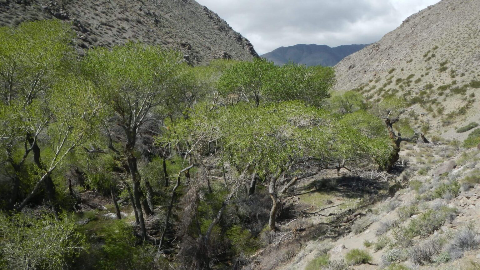
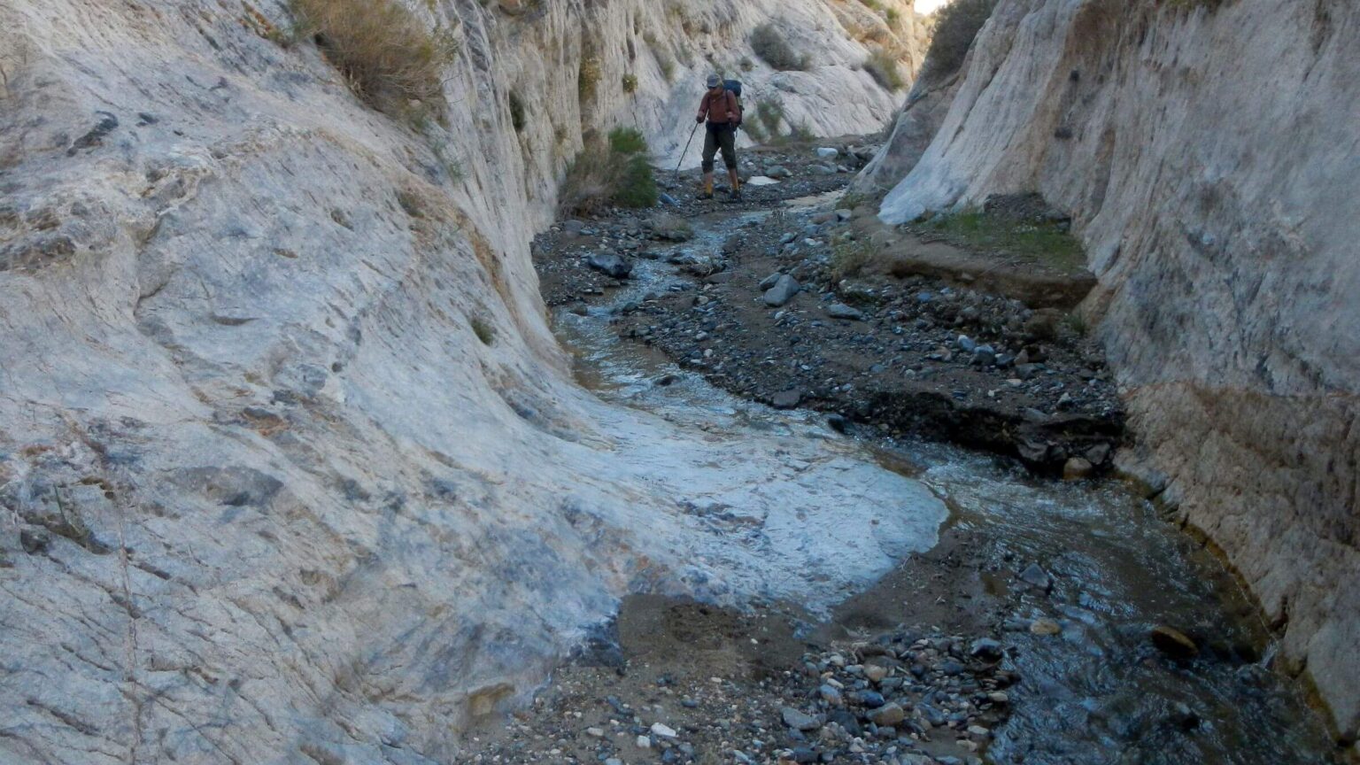
A decent road hike until junction of Cottonwood and Marble Canyons—the only “trail sign” we saw in area. After that we hiked wash mostly outside road to avoid sand slog. Further up, we saw water running on the road and then a Park Service road closure sign (YAY!). A mile or so later we hiked banks of roaring Cottonwood Creek. Road crossed creek many times and I was glad for KEEN hiking sandals.
At road’s end I found route on creek that disappeared into brush; a better route crossed creek and continued through cottonwood trees. We found site for first camp and David hung “bear bag” in a stately cottonwood. I cut myself on willows trying to get to the creek to wash my legs!
Up & Out of Cottonwood: Pelted By Wind And Snow
Cottonwood Creek ascent included some nice trail through trees or along flats, as well as crappy cliffside scrambles or fighting heavy vegetation on creek. We met backpackers from Marble (only people other than day hikers on way out). Then two friendly feral horses that seemed intent on following me (!) until David yelled at them. After skirting big cottonwoods at Cottonwood Spring, our route crossed well-running creek (later determined to be flowing from Hunter Spring on the mountain) and turned up a dry unnamed drainage.We then left Marble-Cottonwood loop on old route to Hunter Mountain (shown on USGS map) that David had traced and loaded on GPS; we did not see trail that left to follow Dead Horse Canyon into Marble. We followed dry wash, climbed to small saddle, and found a few cairns (stone markers) on narrow side slope route into next canyon. Horrendous high wind had dogged us all day but bitterbush (or some other tall shrub) offered windbreak for camp.
On a cold gray morning we followed hiker tracks up wash which soon was running. Tracks headed up a ridge the wrong way; we followed David’s GPS route up side canyon and met old trail with occasional cairns contouring up ridges to the slope of Hunter Mountain. Below were six horses eyeing us curiously. Our route did not come too close so we were not followed this time! (We saw feral burros near Stovepipe Wells but later learned that yes, there are also feral horses.)
On crest of mountain, we found old sign marked “Water ½ M” but no clear tread in high sagebrush. Wind became snow flurries pelting us as we clambered through sage to a wet bog. I donned rain gear. Spring shown on map (near our GPS route) was in a canyon accessed by route through bog and willows (0.8 mile beyond sign) to roaring flow in drainage below Hunter Spring.
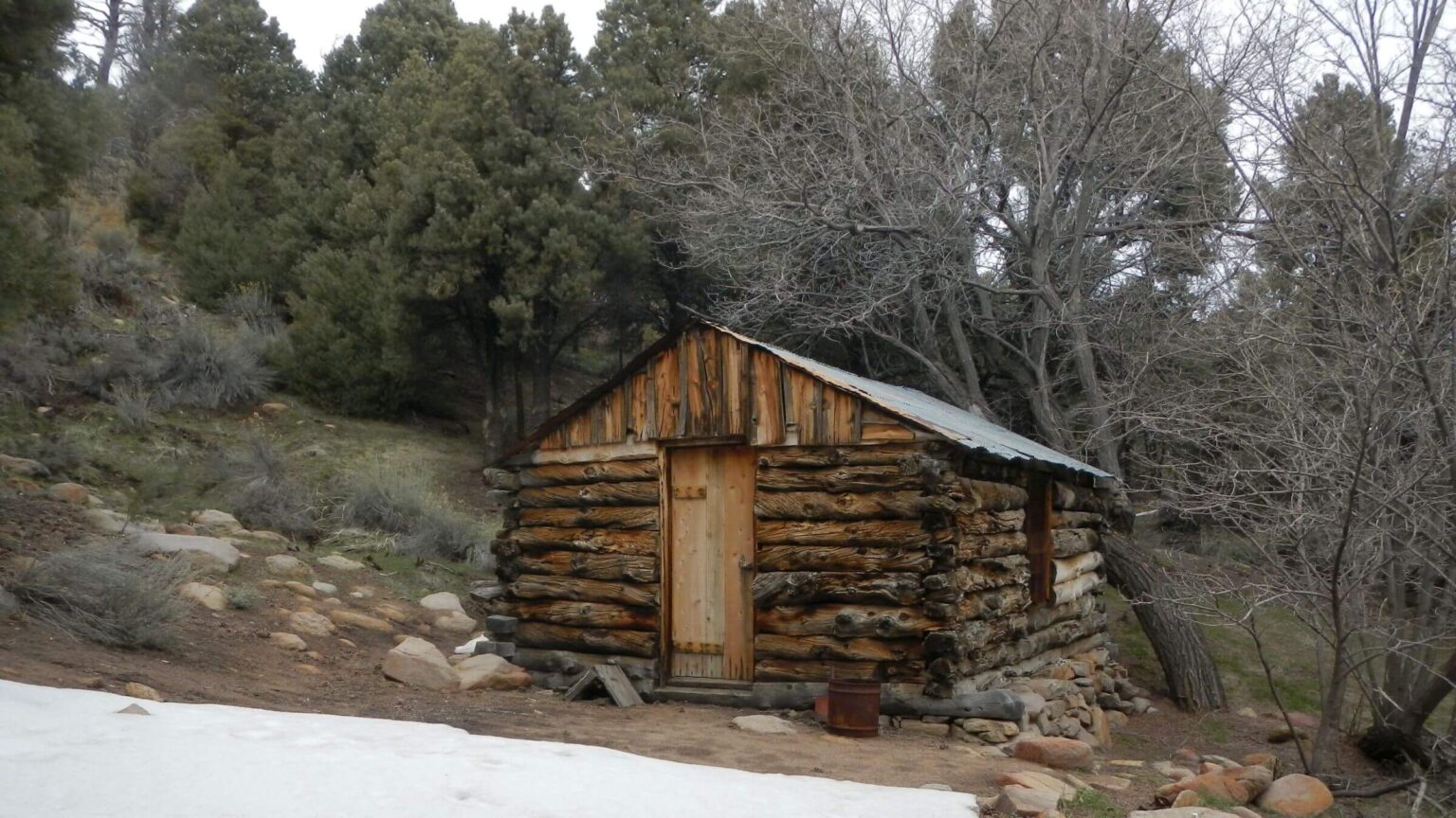
We hiked through pinyon pine to road and dropped packs for brief side trip to historic Hunter Cabin (sign said “Closed Due to Hantavirus,” so photographed from outside). We saw overgrown route David had identified for loop around mountain. Trail looked bad, with at least a foot of snow on mountain crest so we abandoned loop plan. We went on to main Hunter Mountain Road and saw vehicle tracks in mud and deep muddy pools left from snowmelt.
Down the road we found sheltered site in pinyon. By bedtime I wore all my clothes—turtleneck, t-shirt, cotton shirt, and puffy UNDER raingear! Next morning, we found ice in our water bottles in the tent with temperatures likely in the 20s. No hot weather on THIS Death Valley trek!
The undulating road always seemed into the wind! At a crest I saw the source of cold air drainage: snowy Sierras and possibly 14,000-foot Mt. Whitney 45 miles away! We gladly left road for old jeep track into sheltered side canyon toward head of Marble. We met better road that ended near old buildings, wrecked vehicles, and broken pipes from Goldbelt Spring up the drainage. We found a thicket of willow and brambles; if there was water, we could not reach it! We hoped to find water in upper Marble as we were getting low—and we did.
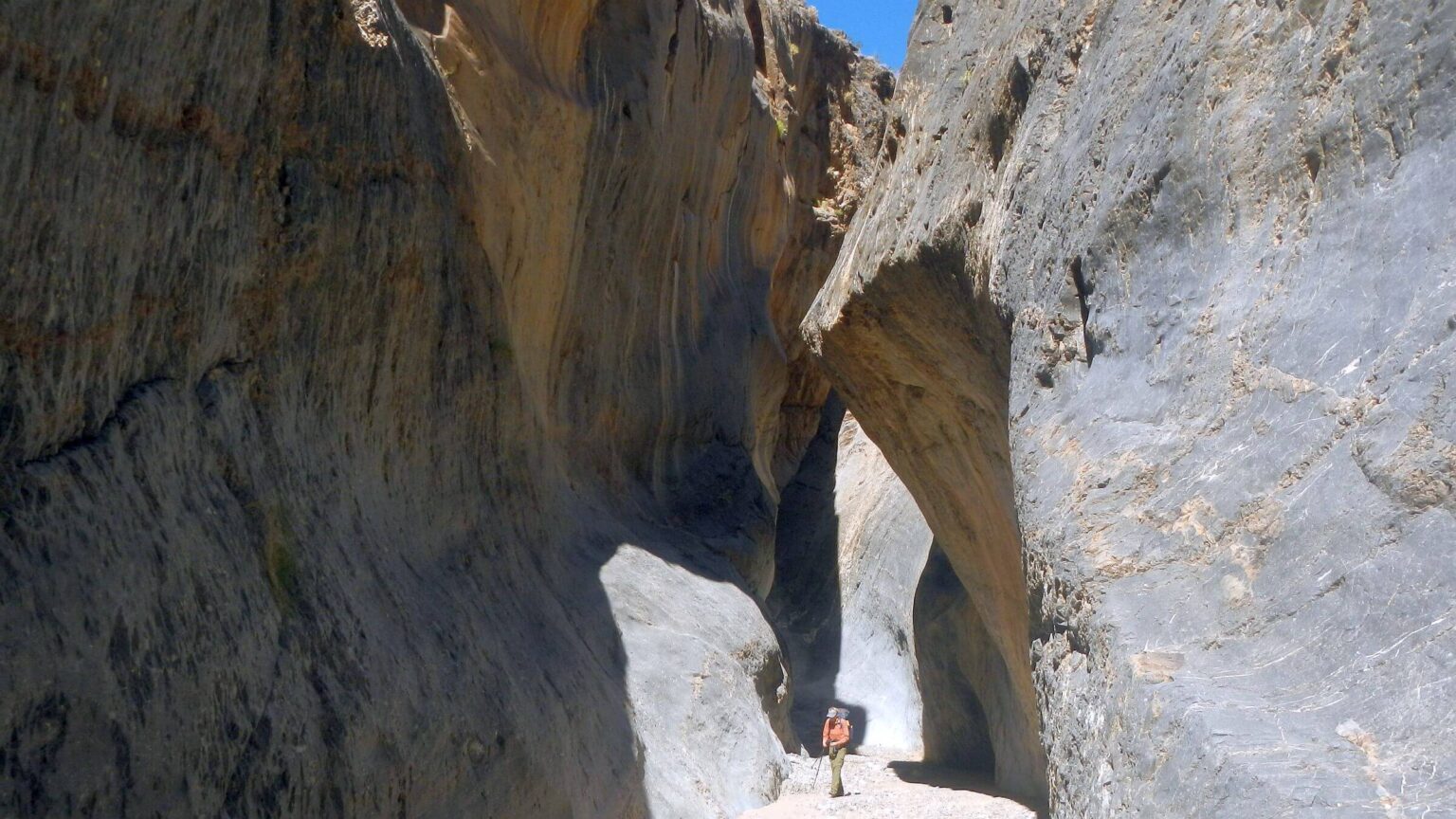
Trail of sorts wound down Marble Canyon with some hillside skitters to avoid heavy creek vegetation; water flow increased with descent. Eventually the canyon dropped into some incredible narrows. We chose route around some rocks at confluence and David noticed a couple (without packs) clambering up the rocks we had avoided. Below a slot descent (where David ferried my pack) we passed day packs and hiking poles. The hikers caught us as we were looking for a campsite. They were from the Northwest and gaga over western canyon country. With 5.4 miles back to the road, they still hoped to visit some nearby dunes, although it was almost sunset.
While David set up camp and filtered water, I hiked about a mile up Dead Horse Canyon and found a waterfall—usually dry, as Marble-Cottonwood loop posts discussed climbing up it to spring a quarter-mile beyond (our planned water source for camp, but water came to us instead).
Dry Canyon, Hikers, Slow Departure
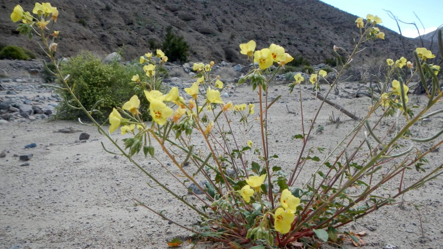
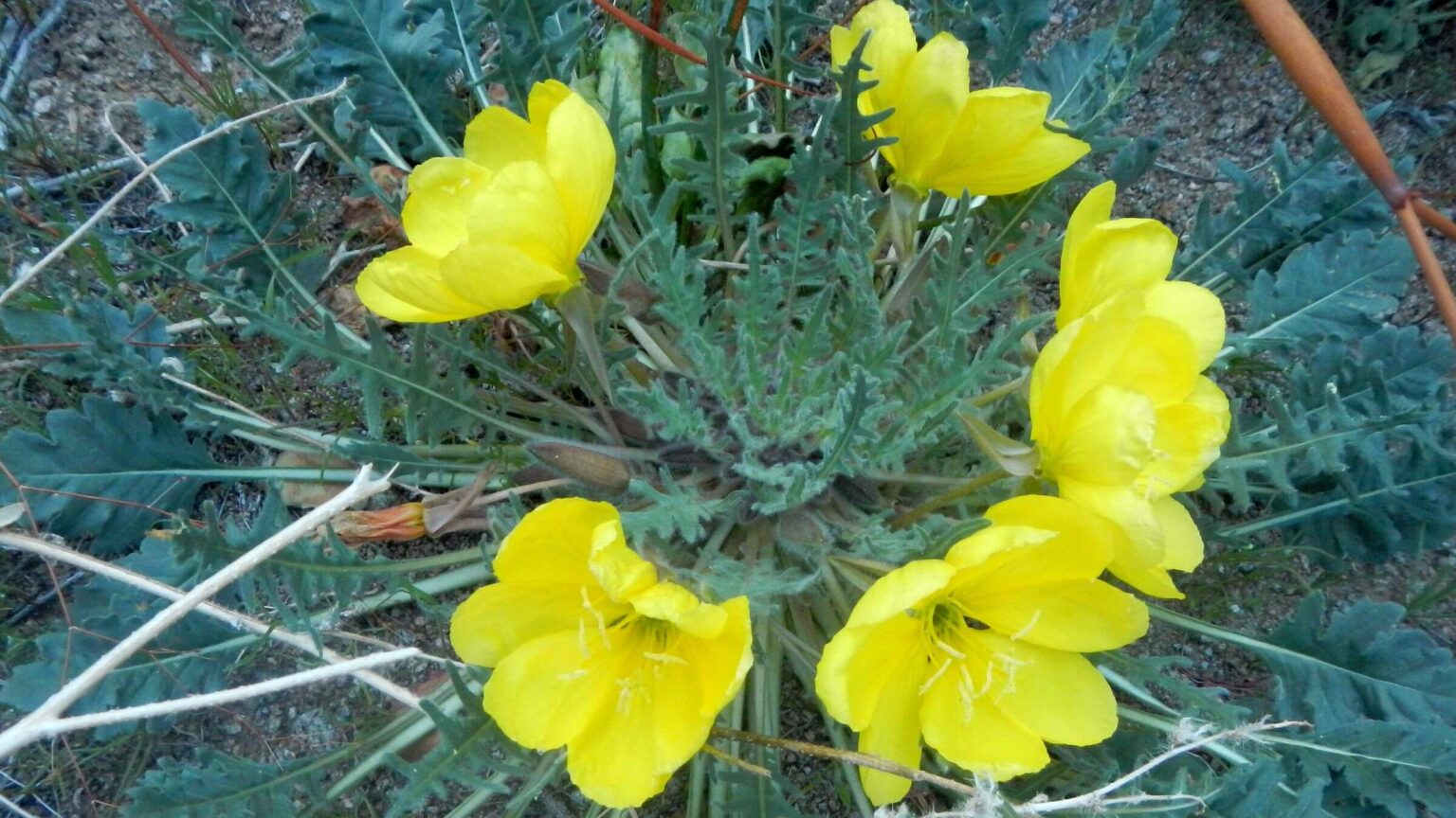
First warm day! We hiked narrows not so spectacular as those above; most people doing only the loop would never see them. Merged flow from Marble and Dead Horse soon disappeared under the sand. The canyon widened with good route on banks amidst beautiful flowers. I tag-teamed with two ravens who would stop, hop a few feet down canyon, then fly farther and hop again. We passed a rocky side canyon which must have flooded; area below this whole canyon was much rockier.I passed a couple camped on a sidebar. They had hiked in the night before and planned a day hike up Dead Horse but not the loop. David noticed camp chairs and heavy gear.
Near trailhead we met hikers: four older folks and a couple with two lagging kids. The lanky, athletic looking dad was curious about our trip; David thought he wanted to ditch his lazy family and do a real hike! We passed the seniors’ sports utility vehicle with Utah plates and a popup camper van with Oregon plates parked in a primitive campsite with camp gear around—likely the family.
We avoided sand and rock slog on Marble road by hiking banks. An old van with Arizona plates was parked by our vehicle at the large, flat campsite. No one around. My note to Park Service undisturbed.
As we packed up, Oregon van passed. We soon caught it creeping along. With high sand berms and no place to pass, we stopped rather than eat dust. Later we passed the stopped van. Dad said they were reinflating the tires, which they had deflated for the sand. He apologized for going slow. “I kept trying to find a spot that was safe to pull over.”
We saw about 10 primitive car campsites between Marble and Cottonwood canyons. Only one was used, by the Oregon family before their day hike.
After Thoughts on Wilderness Management
The National Park Service is one of four agencies that manages the nation’s designated wilderness. Due to popularity of National Parks their wilderness areas are heavily visited but often only in highly regulated portion. Park Service mission is resource preservation and connecting masses of people with outdoors; this has led to rule-driven controlling management practices. This is probably why we found so much emphasis on grading cherry-stemmed roads and car camping, and little attention to wilderness. We often bristle—as we did in this post—having to work around Park Service regulations and management practices in our wilderness visits.Death Valley perfectly illustrates our evolving idea that the National Wilderness Preservation System could use a new entity to direct overall management to achieve the 1964 Act’s stated purpose of wilderness: “…administered for the use and enjoyment of the American people….” Tacking on wilderness management to National Park Service (NPS) or other natural resources management agencies with well-established missions/culture has not worked well in offering these priceless areas to the public. NPS culture—well established years before Wilderness Act—is focused on managing the masses of vehicle visitors, day hikes, campgrounds, ranger talks, and concessionaire facilities. NPS opposed the Wilderness Act and often does not even use the word “wilderness,” instead preferring “backcountry” for all roadless park areas whether wilderness or not.
But backcountry rangers—in parks that have them—are often excellent, knowledgeable people in tune with the land yet distracted by NPS rules; perhaps an outside wilderness visitor group could better direct staff and resources for the purpose of wilderness—just as groups like Appalachian Trail Conservancy or Pacific Crest Trail Association help host agencies prioritize the trails and their users.)
Overall, national park wilderness could use more advocacy / funding to increase trails and campsites and streamline permitting process with hiker needs in mind. But just a simple management attitude change could make huge differences for improvement. For example, Death Valley website could have advertised a backpacking boon for 2024 with all the closed roads and abundant water and park could have opened up key trailhead roads first had wilderness visitors been a priority.
show less
Google Map
(Click upper-right box above map to “view larger map” and see legend including NAVIGATION INSTRUCTIONS; expand/contract legend by clicking left arrow down/up.)