Post-fire return—recovering Crest, failed “checkout hike”
The South Fork Cave Creek Trail has been on my Chiricahua Wilderness bucket list for years. The trail—a mellow 7.2-mile ramble up to the Crest favored by birders—was washed out by a major flood event after 2014 Hurricane Odile. I had heard that volunteer, Conservation Corps, and other trail crew projects had restored the entire length of the trail.
I was anxious to hike it.
We had never entered the Chiricahuas from South Fork of Cave Creek Canyon, probably the most popular and famous entrance point due to spectacular purple volcanic and reddish tuff cliffs and the Southwest Research Station, a biological field station run by the American Museum of Natural History since 1955. Cave Creek, on northeast end of the Chiricahuas Mountains, is entered from small town of Portal either from Interstate 10 to the north or from east on SR-80 from Douglas, Arizona or Rodeo, New Mexico.
We always visited Chiricahuas from the west side closer to Tucson. More recent visits after fire severely damaged trails are noted below.
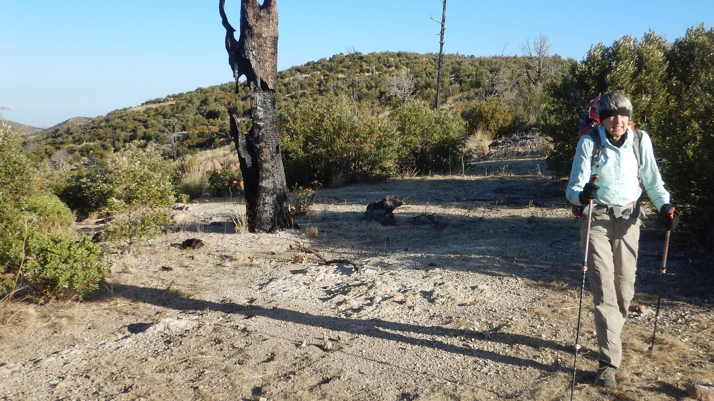
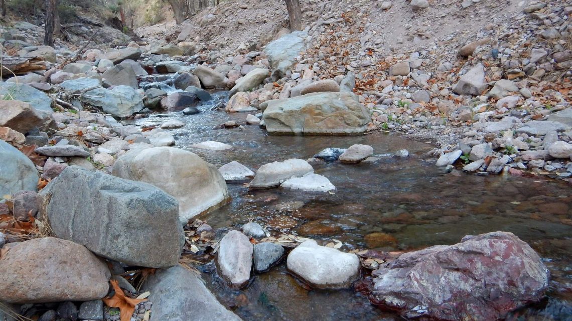
For the May 2024 visit, we parked at Sunnyside Campground and hiked road up South Fork Cave Creek. After an evening camp just off the trickling creek, we followed good trail through old-growth ponderosa and open meadows. We passed the intersection for Burro/Burnt Log Trail to the ridge and continued up canyon through red rock pinnacles on best route.
On up the canyon, we turned on trail climbing up and out. After several switchbacks, trail became a barely discernible rocky, brushy track contouring along a side slope. Whoa, I thought. Those volunteers are doing crappy trail work!
David noted that we were off our GPS track for South Fork Trail but figured it was a false rumor that entire South Fork Trail had been cleared. We did not go back and check where we lost it; big mistake!
We saw what looked like better trail below on other side of a drainage and brushed our way down. The thin side slope trail was a little better but not very good.
After scrabbling on bad trails for several hours, I learned the truth.
Chiricahua Wilderness is among areas designated in Wilderness Act of 1964. We have visited at least 11 times, starting mid-1970s as students in Tucson 3 hours away.
We revisited in May 2024, April 2018, and April 2015 after fires (see map below). Most recent visit to see if reported trail work had improved once excellent trails. It had. Good trail work and young trees beginning to stabilize area, offering good backpacking through post-fire forest regrowth. This post describes recent revisits with past photos from before fire.
The 2018 trip encountered badly burned trails in northern end of wilderness and fair, improved, and poor trails in loop to Crest, down to Cave Creek, and back over Crest to return.
A 2015 attempt to repeat 1992 trip from south end was thwarted by fire-obliterated trails.
Rattlesnake Fire of 1994 may have started new era of megafires. It burned 25,000 acres along crest in heart of wilderness.
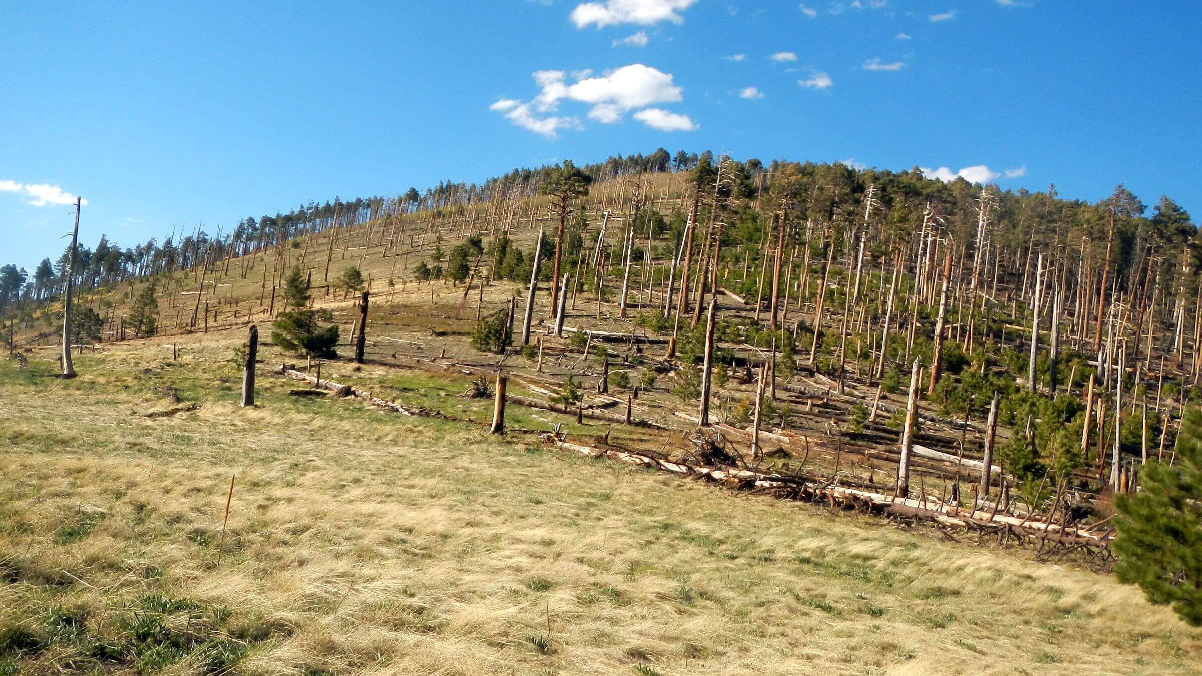
Horseshoe 2 Fire of 2011 started in burn scar of small Horseshoe Fire (35,000 acres in 2010) but burned 223,000 acres including Rattlesnake fire scar. It destroyed most old-growth mixed conifer on 9000-foot Crest Trail. Forest Service spent $50 million on Horseshoe 2 and just under a million for post-fire trail stabilization. Vast legacy trail system now constant repair challenge as burned trees fall, fire-stimulated brush explodes, and slowly revegetating slopes erode. Chiricahua trails website documents evolving trail conditions.
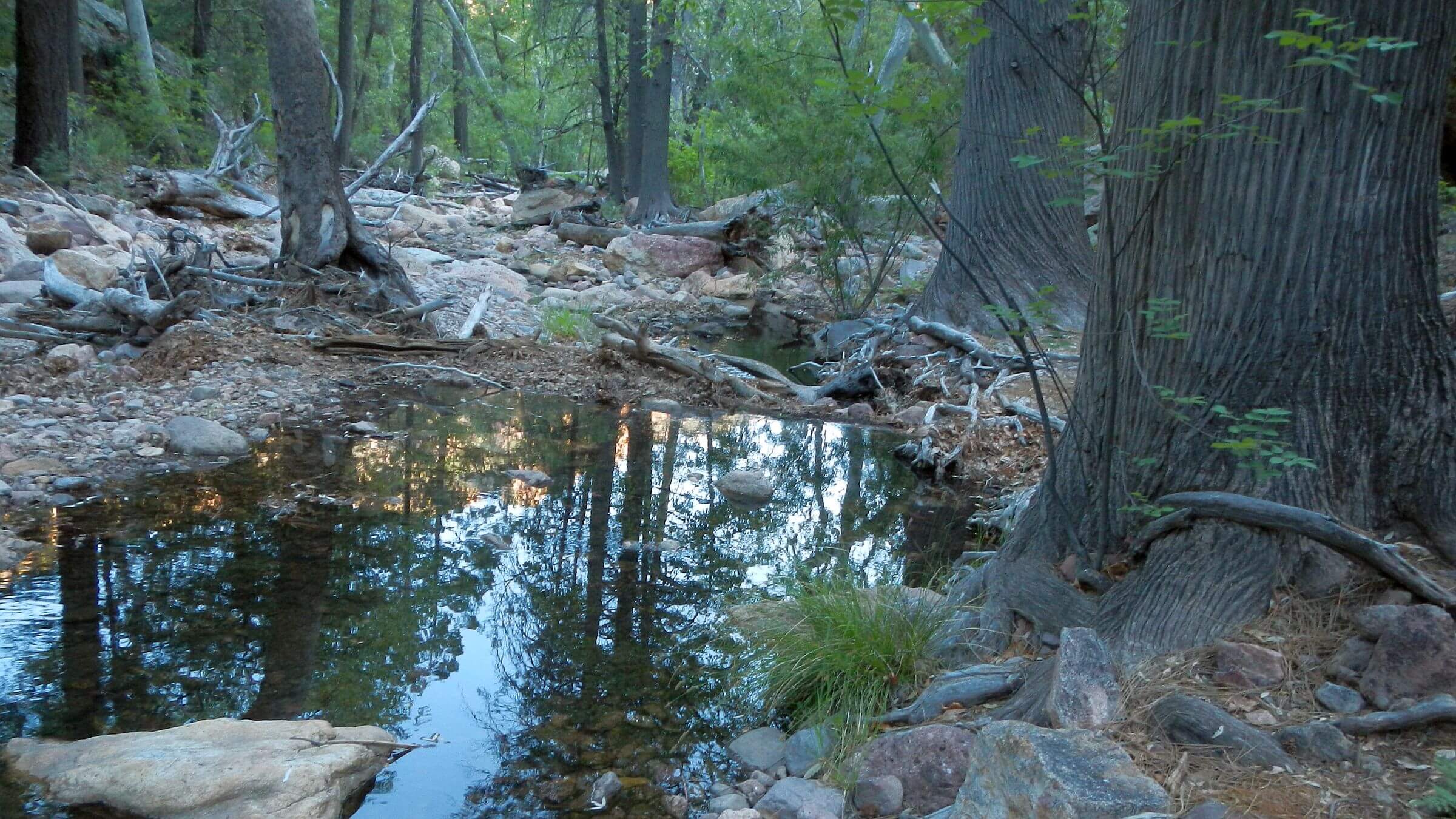
Ample water for our 2024 May visit—such good snowpack we switched planned April visit to May to avoid slogging snow. Also enough water in 2018 and 2015.
Visit statistics for all trips combined: 19 days, 166 miles at 1.8 miles per hour, with 500 feet average elevation change per mile.
Go to map below for more information on trailheads, daily routes, mileages, elevation changes, photos, and fire map (9 fires between 1994 & 2021). (Click on white box in upper-right corner to expand map and show legend with NAVIGATION INSTRUCTIONS.)
show more
Chiricahua Mountains: recent history
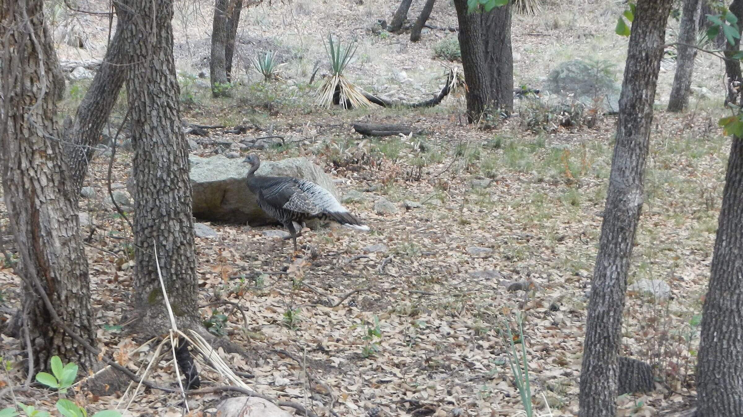
The Chiricahua Wilderness lies astride a mountain massif in southeastern Arizona where two deserts (Sonoran and Chihuahuan) and two ranges (Rocky Mountain and Sierra Madre) meet, providing unique diversity of wildlife and plants.“Chiricahua” is thought to be an Opata (Indigenous people in Mexico) word for “wild turkey.” Turkeys disappeared around mid-1900s, but Gould’s wild turkeys were reintroduced in 2003 (we saw several in each revisit). Various Indian cultures lived here; Chiricahua Apaches were removed by U.S. military in late 1800s.
Spectacular rock pinnacles fostered the Chiricahua National Monument north of the wilderness. In 1930s, Civilian Conservation Corps built many roads and infrastructure in the monument and national forest, including facilities at Portal and Rucker Canyon; Cima Cabin and Fly Peak Lookout Cabin (long deconstructed); and much of the vast trail system.
Many visits to soaring Chiricahuas
I often visited the Chiricahuas in late 1970s as a University of Arizona student. Rustler Park, at 8800 feet, offered a short mellow hike to pretty Anita Park, base camp for an easy 7-mile round trip to Monte Vista Lookout. Forest cover allowed only glimpses of the valley 5000 feet below and rugged purple walls of Painted Rock and Raspberry Peak towering above. We also came up trails from Turkey Creek and camped at Cima Cabin just off crest—then open to the public with a register and sign instructing campers to leave the cabin clean and to restock any supplies used. Big fireplace was welcome on cold winter nights.From Cima I hiked to Cave Creek at least twice—both long day hikes down Greenhouse Trail to Cave Creek and returning on Snowshed and Crest trails—a 20+ mile hike no problem for young hikers on good trails!
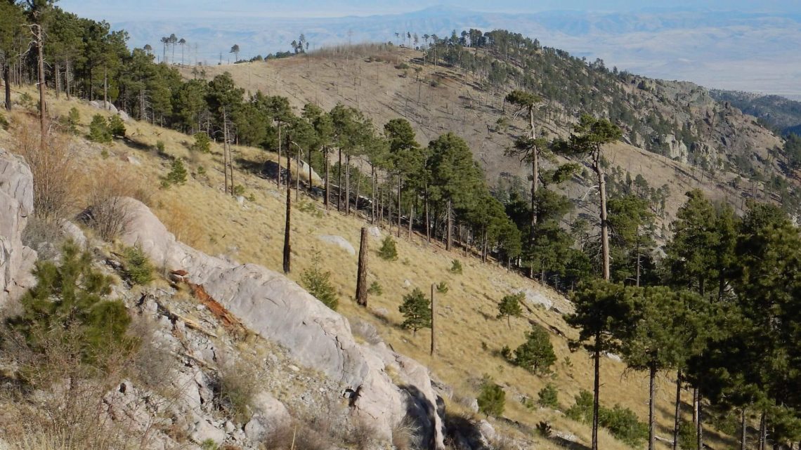
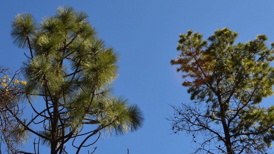
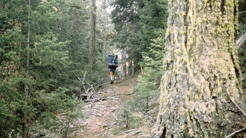
The Chiricahuas are among southern Arizona “sky islands”—ridges rising 5,000 feet above the Chiricahua grasslands. Their high ridges were shrouded in old-growth mixed conifer: Douglas fir, white fir, Southwestern (Chihuahua) white pine, and Engelmann spruce (southern-most extension for this species). The forest canopy was so thick you only rarely glimpsed the valley. Trails were often needle-carpeted highways. It was like walking the halls of a great cathedral with towering walls as shown in 1992 photo.
Horseshoe 2 Fire of 2011—third and largest in string of wildfires—desecrated the old-growth cathedral! Besides killing most big trees on crest and slopes it transformed shady canyons into washed out boulder fields, aided by heavy rains.
Fatefully, we were in southern Arizona in May 2011 on road trip from East visiting favorite places; we avoided Chiricahuas because of big white smoke cloud.
On 2013 day hike, we climbed to denuded Crest from Turkey Creek and wandered around dazed, circling Chiricahua Peak trying to get our bearings from poor map, burned signs, and changed landscape that did not fit our memories.
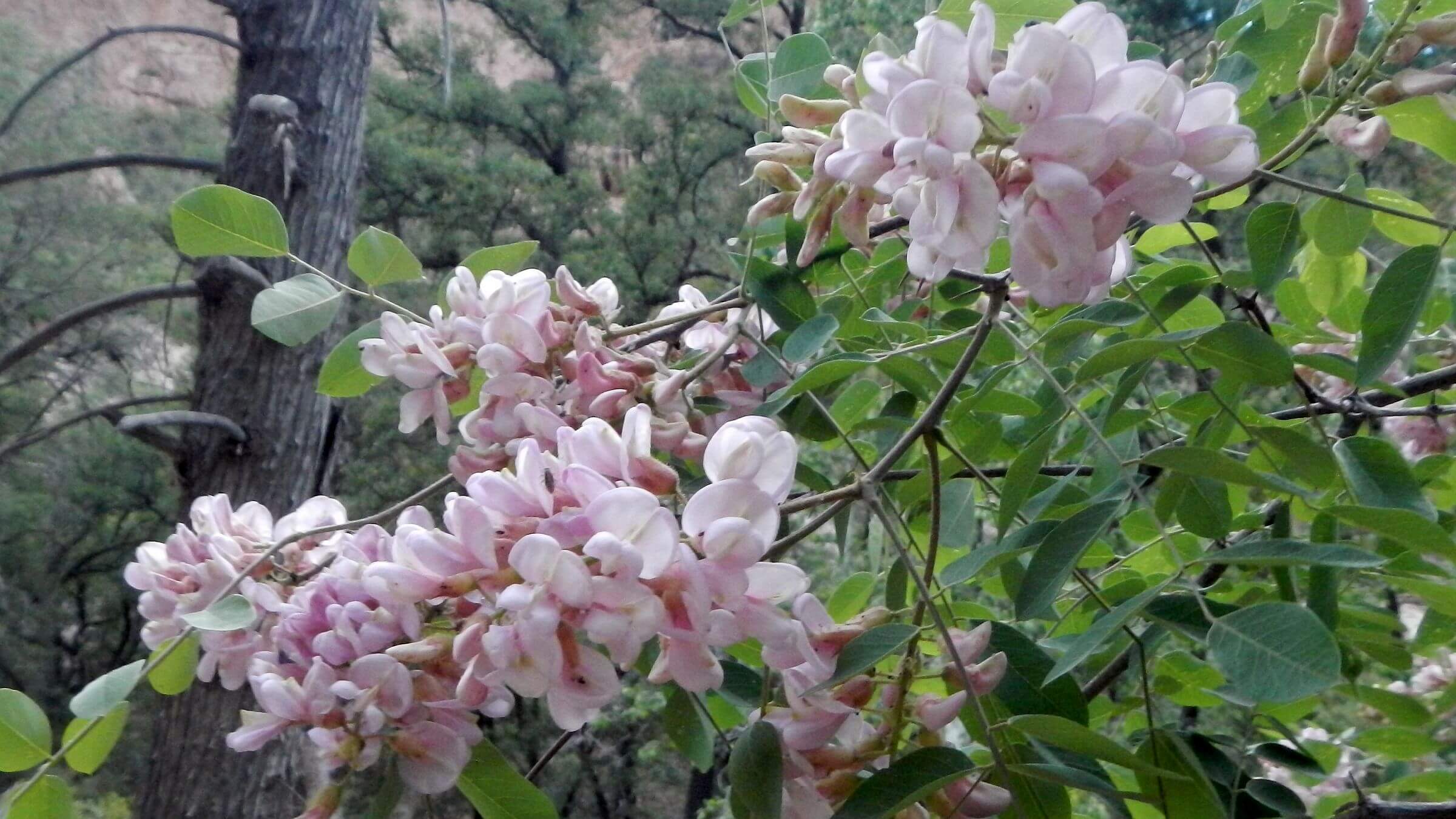
In 2015, we tried to redo 1992 hike from Rucker Canyon area but trail shown on map ended with big cairn at a saddle above Price Canyon. We returned to Rucker and hiked Red Rock Canyon to join Price Canyon higher up the watershed; vaulting over black logs past young pine, oak, and Arizona cypress; and mincing through flowery, thorny post-fire desert ceanothus. Barren crest trail hell-hot in April at 9000 feet but passable from volunteer work. Cima Cabin and Monte Vista Lookout had been saved by fire crews.
Our 2024 return via South Creek found Crest conditions improved—once we got there!
2024 continued: on a route less traveled
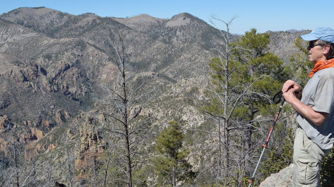
Far above South Fork Cave Creek, our contour trail joined better trail ascending a lightly burned piney ridge. I saw a sign for Burnt Log Trail—we had passed the turnoff for this trail some miles back on South Fork. On up the ridge, we found trail of sorts contouring around backside of a peak, crossing several washed out drainages. We lost it briefly, found nice switchbacks through pine forest, then very rocky route climbing steeply up side of a peak. And then—surprise—junction with the Crest Trail and a short spur trail marked Sentinel Peak. The peak register was signed by several day hikers and one trail runner on a 25-mile round trip from Rustler Park!After 1.5 miles on the Crest Trail, we found a newly signed trail to South Fork Cave Creek. Turns out we had missed the new trail! The “crappy trail work” was an old unmaintained fire trail contouring around and climbing up backside of Sentinel Peak.
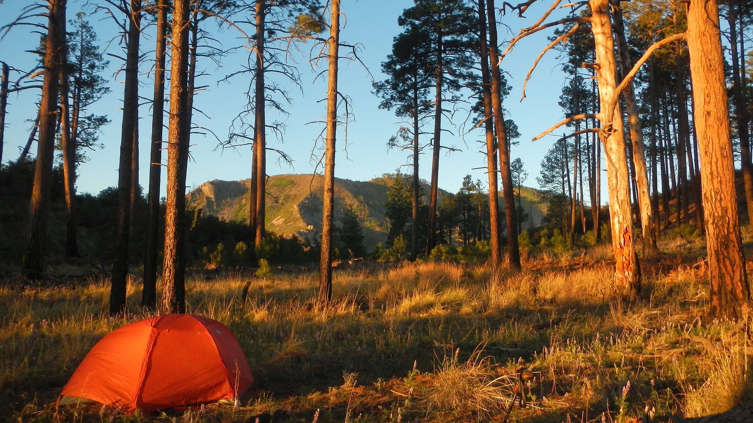
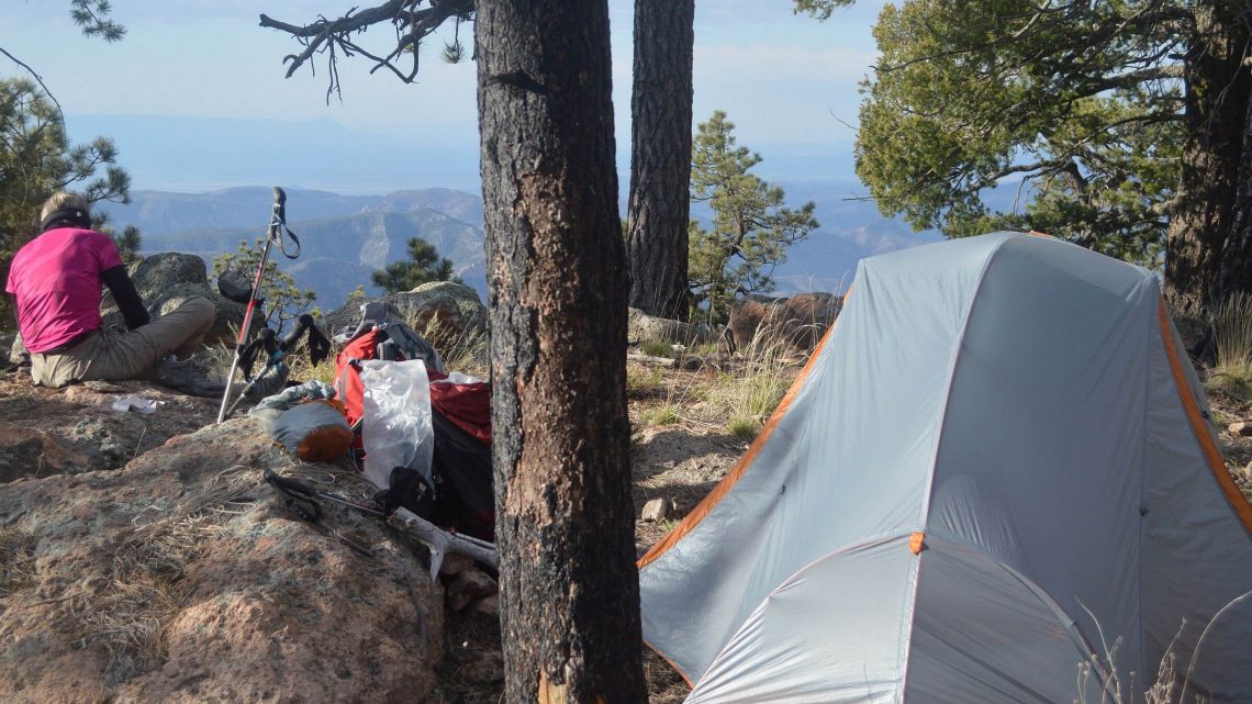
We continued on Crest Trail, climbed to an unmarked junction with Snowshed Trail, and found the Juniper Spring box high on the crest. David pumped just enough water from cloudy spring box for camp, a flatter ridge down from the spring. We didn’t bother cooking in the howling wind.
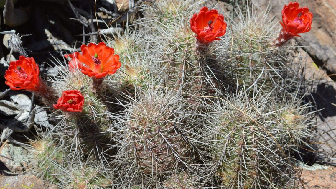
Next morning we followed better Crest Trail a short distance to better water. Eagle Spring, just below trail, was running well with a brimming box despite denuded vegetation. A fine place to make breakfast. Winding through drainages, we saw young pine coming in. Encouraging!
We also saw young forest at Aspen Saddle—barren in 2018—where trails snake west and east around Chiricahua Peak and one route climbs the peak. We took eastside trail and hiked spur trails to Headquarters and Ojo Agua Caliente springs. Trail to Headquarters was uncleared mess of downed logs and spring was damp but no running water. Ojo Auga Caliente only a trickle.
On far side of Chiricahua Peak we met group of day hikers, then one lone hiker. A side trip to Anita Park found new grass and young pines—much better than the windy blackened log “moonscape” where we camped in 2018. Trail down to spring was cleared and spring pool had been fixed up with new rockwork.
We hid our backpacks a few yards down Greenhouse Trail for afternoon hike over Flys Peak and return on Centella and Bear Wallow trails north of the peak.
At Fly Saddle/Round Park we met two volunteers installing a sign. They said fire crew had cut dozens of juniper posts for new signs. Both had worked on South Fork Cave Creek Trail and said it’s common mistake to miss the trail and go up old unmaintained Burnt Log/Horseshoe Trail as we had. Junction is marked by a broken sign we never saw! One of the volunteers had done the nice Anita Spring trail work and fixed the spring box. They were hoping to get a grant to fix up rough section of Crest Trail to Sentinel Peak.
Southside trail up Flys Peak poor but little problem because vegetation so open; other trails cleared with dozens of logs cut out by volunteer crews. (A Portal group, the Sierra Club, and a group that flies out twice a year from all over U.S. are among the dedicated volunteers bringing back trails in the Chiricahuas. Most are certified sawyers which means they can use a crosscut saw required by the Forest Service in wilderness.)
We made our way down to Cima Cabin, locked as usual. A huge tree had fallen, main stem just missing cabin but branches did some roof damage. Cabin use is now restricted to fire and trail crews; they had cut up fallen tree—with some new log-section chairs!
After camp by Cima (our tradition) we worked our way down Greenhouse (a 3000-foot drop on about 100 switchbacks), a mile down very rocky road and then across the head of Cave Creek Canyon on Basin Trail, and up steep Herb Martyr Trail to camp in burned Pine Park. Beautiful sunset and wild turkeys striding by our tent.
Snowshed Trail below Pine Park was quite good; new sign marked junction to Herb Martyr Campground. We followed the other way along a mile of fence that marked boundary of Southwest Research Station, then on Cave Creek Road to Sunny Flat and our vehicle.
I didn’t quite complete my goal of checking out the South Fork trail work—but it was great to see the new signs, improved trails and recovering pines on the Crest.
2018 post-fire: bad trails, black meadow
We started at Turkey Creek for two loops. First explored northwestern end of wilderness—new for us. Lighter burned rangeland along Turkey Pen and Rock Creeks offered good hiking on old ranch roads and trails; most creeks were running or at least had pools even after dry winter. We were surprised at extensive check dams on Turkey Pen side drainages, a private-government erosion control project.Witch Ridge Trail mostly nonexistent with tread inches wide, cloaked in brush and downed trees. Avoiding a huge slump, we clawed our way up game trail on slippery gravel, then rejoined trail up a ridge, but soon gave up beating through manzanita and made nighttime nest in the brush. We got as far as Rattle Rock Saddle next day but gave up at broken trail sign and plunged down to Rock Creek for route out of area.
Next loop revisited the Crest. Steep trail up Pole Bridge Canyon was excellent; we should have been to Monte Vista Lookout by midday. David got there but I didn’t. I had forged ahead of him on a break but missed a switchback and followed wildlife route. By the time I got back, he had passed me but I didn’t know it and went back to find him.
We reunited when he returned to look for me, but ran out of daylight and had to camp at Anita Park (which has viable spring below). This former choice meadow camp among old-growth conifer was now ugly flat in severe burned area in chilling wind.
Next morning at barren Aspen Saddle, more wind threw us around until we turned off on Snowshed Trail sheltered by ridge and descending slowly through a devasted basin. It deteriorated after a mile. Minimal tread, vegetation, washed out drainage crossings, and trail finding made for a wearing three hours. On last stretch of thick oak brush and desert ceanothus, David grabbed his hand clippers and clipped our way down to Pine Park—lightly burned ponderosa stand. We descended to Cave Creek on unburned Herb Martyr Trail switchbacks and camped, enjoying brief serenade from a whip-poor-will.
Slogging up rocky jeep trail and lightly-burned Greenhouse Trail the next day, I couldn’t believe we had dashed down and up this loop in a day years ago. Volunteers had clipped brush and put up big cairns (stone markers) but tread was poor and trampled by cows. I chased two. On Cima Creek, trail was fair on pine slope but slow going over rocky crossings.
Later that day we met volunteer trail crew at Fly Peak Saddle. On northside of Flys Peak we hiked good trail to Centella Ridge junction for camp. On sunset hike to Centella Point, I froze as seven turkey hens ambled along, followed by a big “patriarch” redhead tom. David, camera in hand , caught up after turkeys had disappeared down a drainage.
On brief morning trek to Rustler Park, we heard a sharp bark—young tom on side slope, courting or seeking a fight. At piney Rustler Park Guard Station, trail volunteers milled. Forest Service had rebuilt Rustler Park Campground in barren burn with new restrooms, metal boxes to protect food from bears, and ramadas replacing lost forest canopy.
After contouring on Crest through cool pines, return route down Saulsberry Trail was poor—eroded side slope trail, downed logs, and ample brush. Trail from saddle was better but steep. We camped in oak and a few pines on last flat spot before the plunge to confluence of Saulsberry, Ward, Turkey, and Mormon creeks. Next day I skittered down, negotiated washed out crossings and a few pools, and hiked last bit of road into Turkey Creek.
David, a bit behind me, photographed a green tent just inside the wilderness boundary. Guess I missed the only other backpackers in the Chiricahua Wilderness.
show less
Google Map
(Click upper-right box above map to “view larger map” and see legend including NAVIGATION INSTRUCTIONS; expand/contract legend by clicking right arrow down/up.)