Sierras Revisit: Crowds on the beaten path, solitude off it
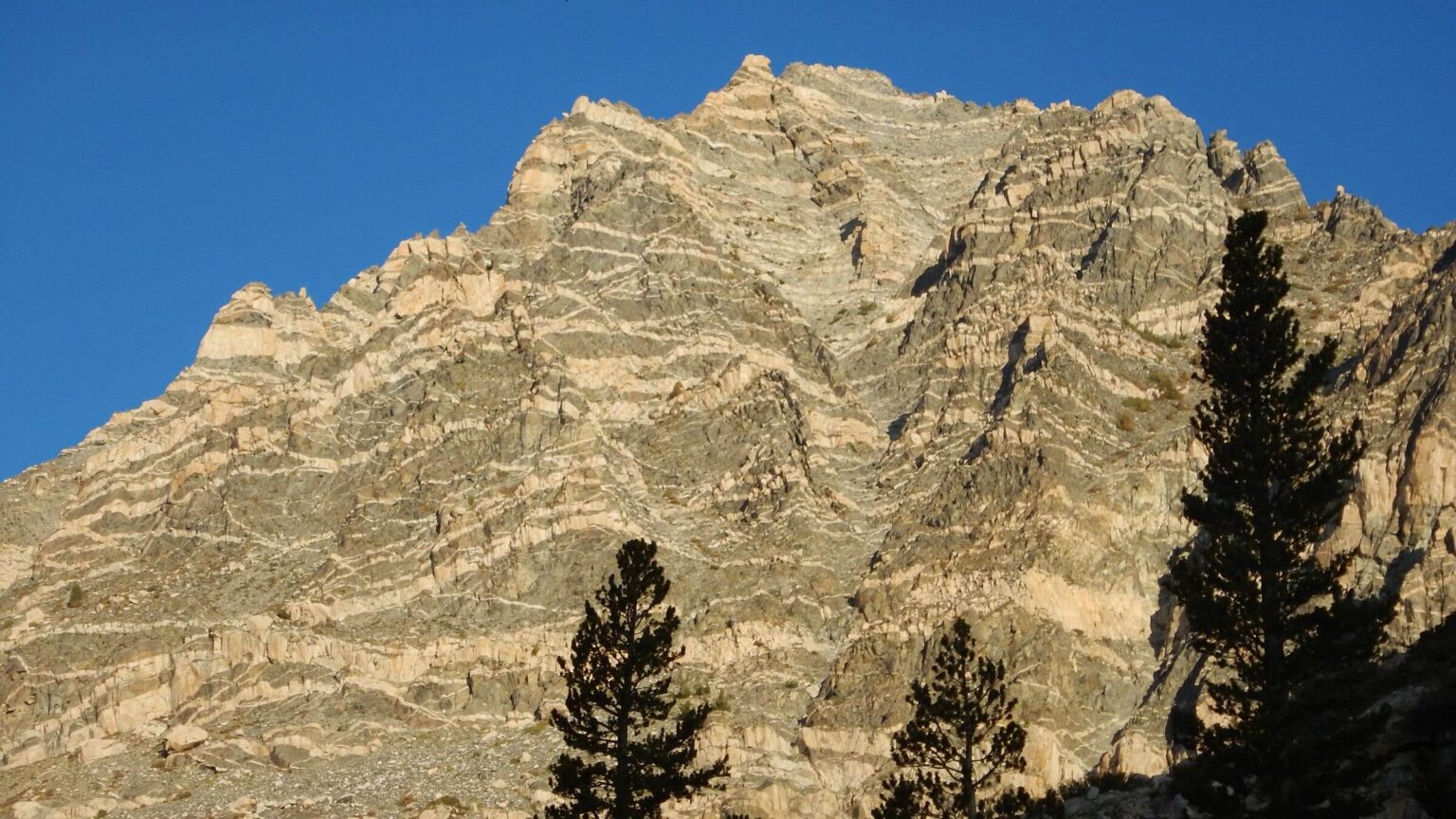
I first saw the Minarets from a high pass in California’s Sierra Nevada (“snowy range”) as a college student, helping with a church youth group backpack trip. The jagged peaks in the Ritter Range northwest of Mammoth stuck in my memory.
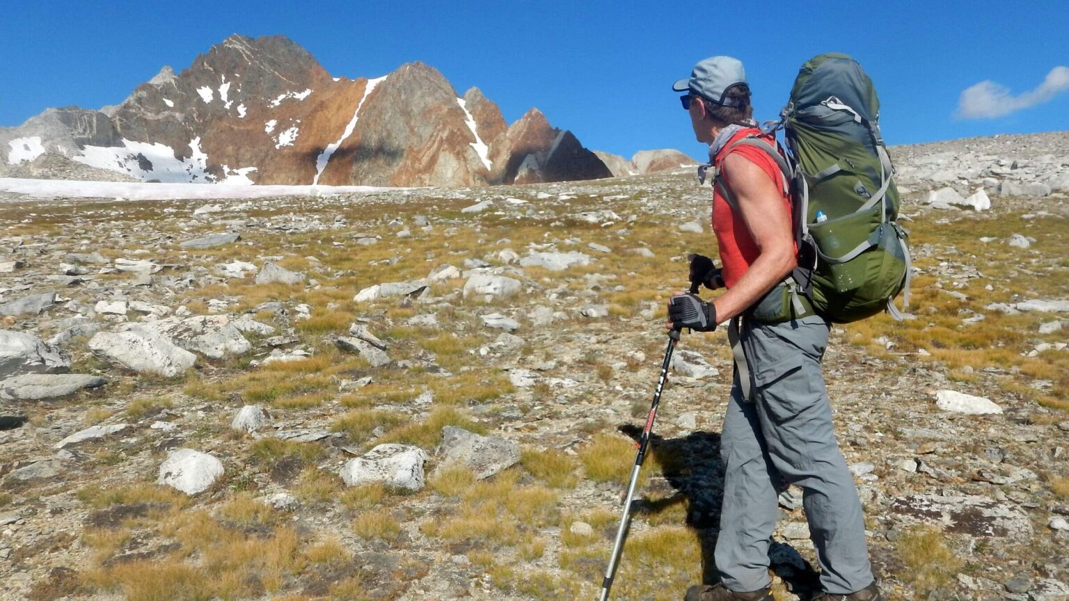
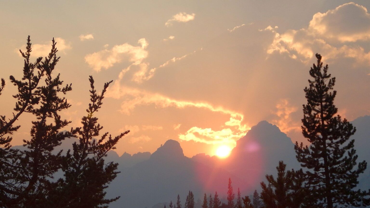
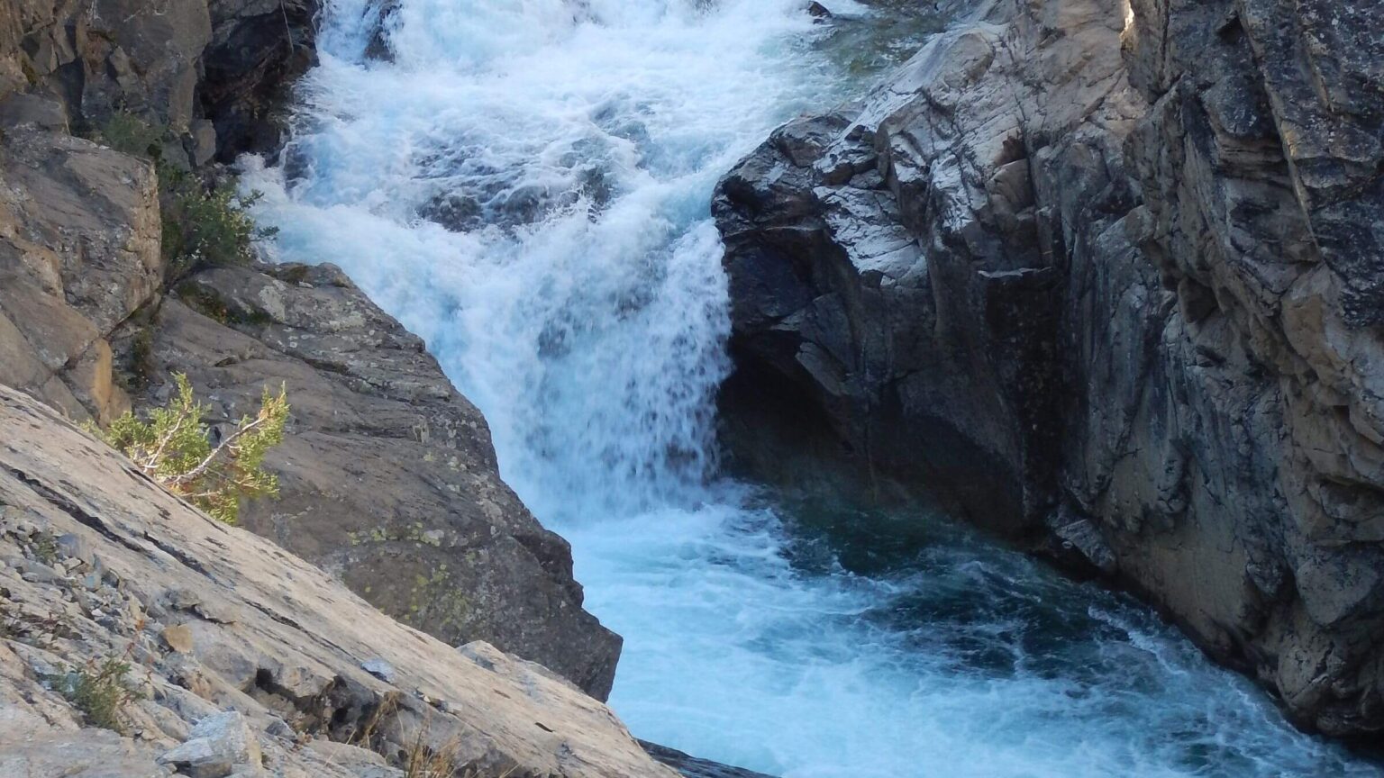
More than 40 years later, I was scrambling up a trail beside falls at top of Minaret Creek, which cascades thousands of feet to the San Joaquin River. We camped at the first flat, gazing 3,000 feet up towering spires, looming out of pink-gray sunset haze—smoke from a distant fire.
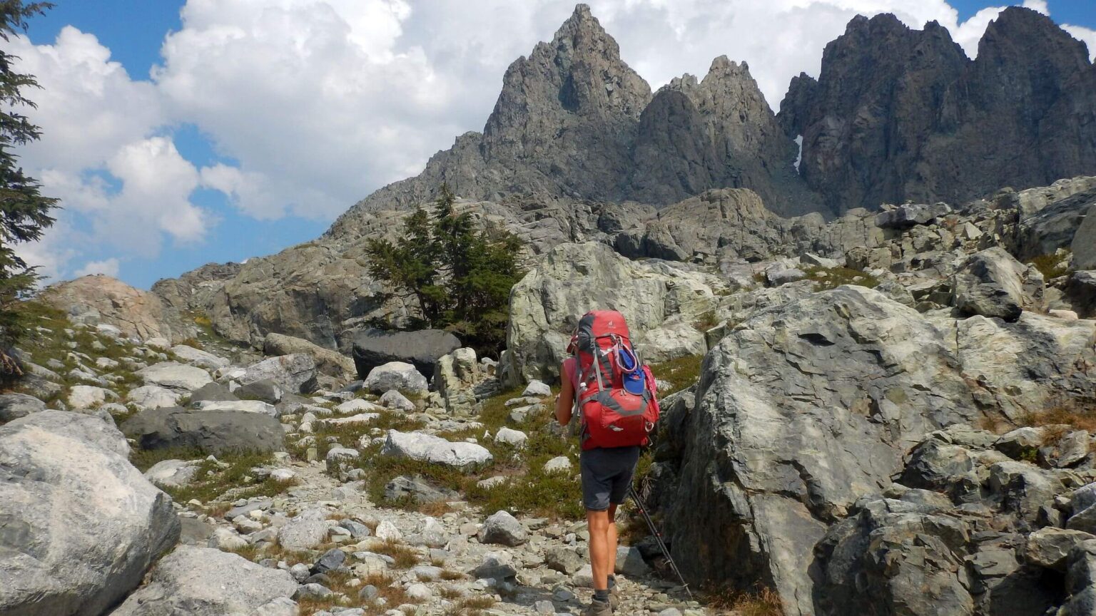
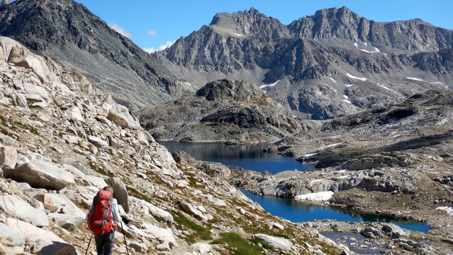
I had added the Minarets to the itinerary for a three-week Sierras trip to celebrate our 40th wedding anniversary. After trail to Minaret Lake, the wilderness topographic map showed them trailless over pass into next basin. Minarets were as glorious as I had dreamed: green meadows and forests along imposing walls/spires.
NOT part of my dreams: the crowds. A lightly clad jogger on a 30-mile training run, couple doing loop backpack, two guys (who lost route above lake and returned) on long day hike loop. Camps in every nook around blue jewel Minaret Lake. Backpackers skidding down steep zigzag route from the keyhole pass.
Was it difficult? “I cried,” confessed one young woman.
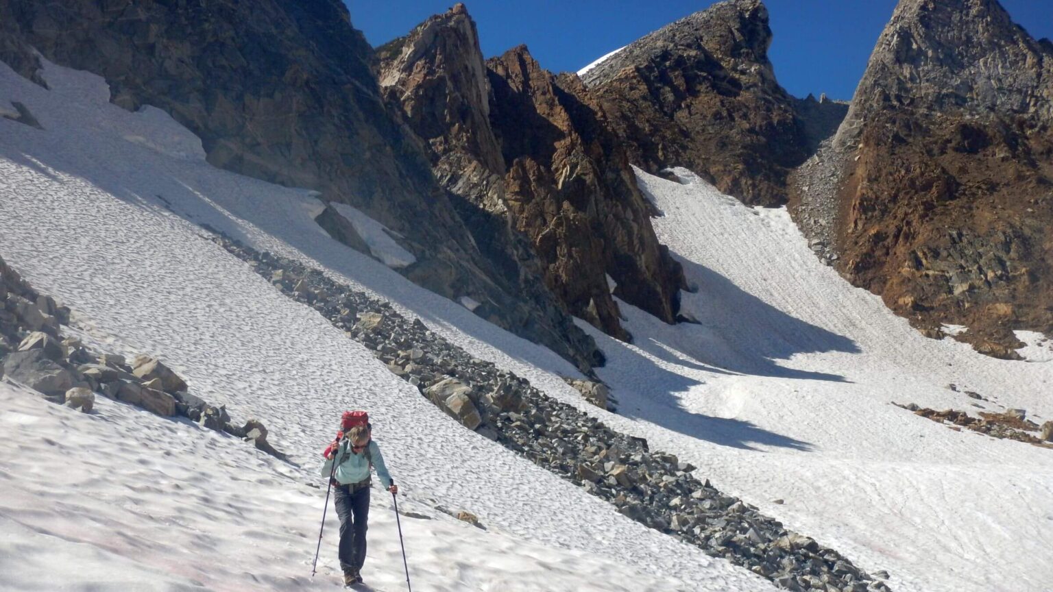
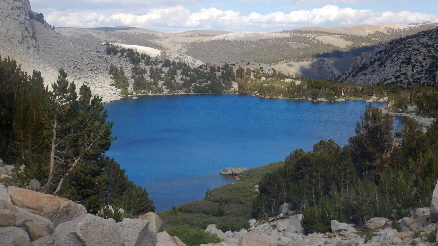
On other side of the pass, we edged cautiously along icy contour on snow tracks above partly frozen lakes (a slip—as David did days earlier—would have meant sled-ride on backpack into the water). One group clambered across with a boxer on leash, jerking the skidding dog back from a snow slide down. Dropping down a scree chimney, we met a dozen hikers scrambling up, some in sandals. On Edsel Lake, dozens of bright tents, more backpackers coming, and a couple perched on a precipice above blue and white fissured lake ice. At least the two rock climbers who brushed past us for an assault of 13,000-foot Mt. Ritter turned back in face of thickening thunderclouds.
Crowds were common for our 2017 High Sierras return—visitor use had mushroomed since our visit 40 years ago. We weren’t prepared for sheer volume of hikers near national parks and resorts, or on the John Muir Trail (JMT), a portion of the Pacific Crest Trail (PCT) through alpine terrain and spectacular pass crossings, one of the world’s most popular short thru-hikes. But we also experienced solitude off the beaten path.
Sierra Nevada Trek was a 261-mile loop through John Muir, Ansel Adams, and Sequoia-Kings Canyon wilderness in California’s High Sierras. Starting and ending on east side of the Sierras, it did part of High Sierra Route and John Muir Trail (JMT), a parallel segment of Pacific Crest Trail (PCT), most of the popular North-South Lake Loop, and some little-used side trails.
The trek was designed to celebrate our 40th wedding anniversary, figure out the route of our 1977 “honeymoon hike” in the area, and visit new country of interest. We deciphered our old route based on two old maps and photos from 1977 and from memories compared to the 2017 revisit.
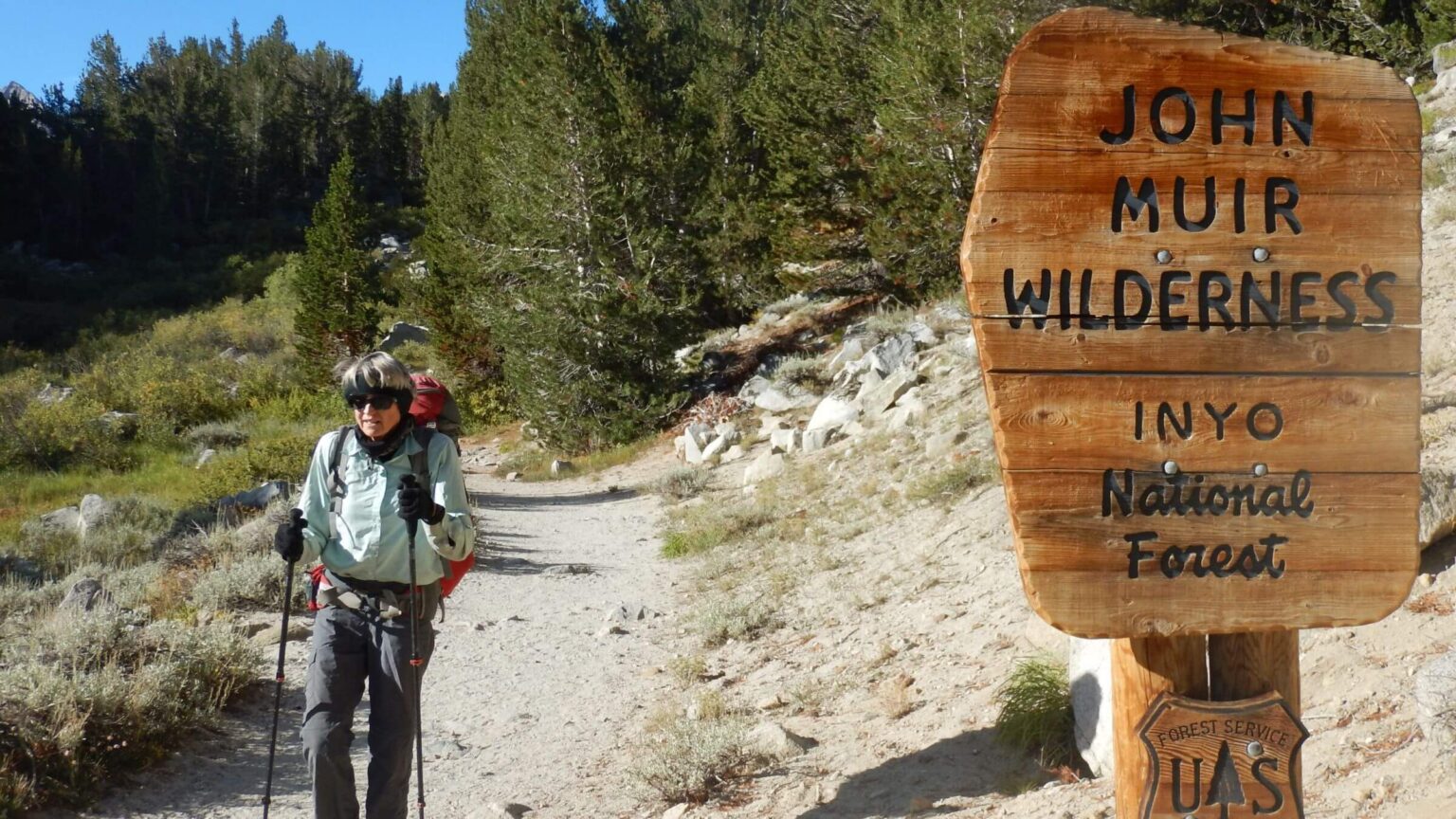
Wilderness hiking permits are administered by two federal agencies. Wilderness rules required bear canisters and dire warnings about potential dangers. Depending on trailhead, get wilderness permits from Yosemite National Park or Inyo National Forest. Each agency has its own complicated process for permits and reservations. Trip planning up to a year ahead is advisable.
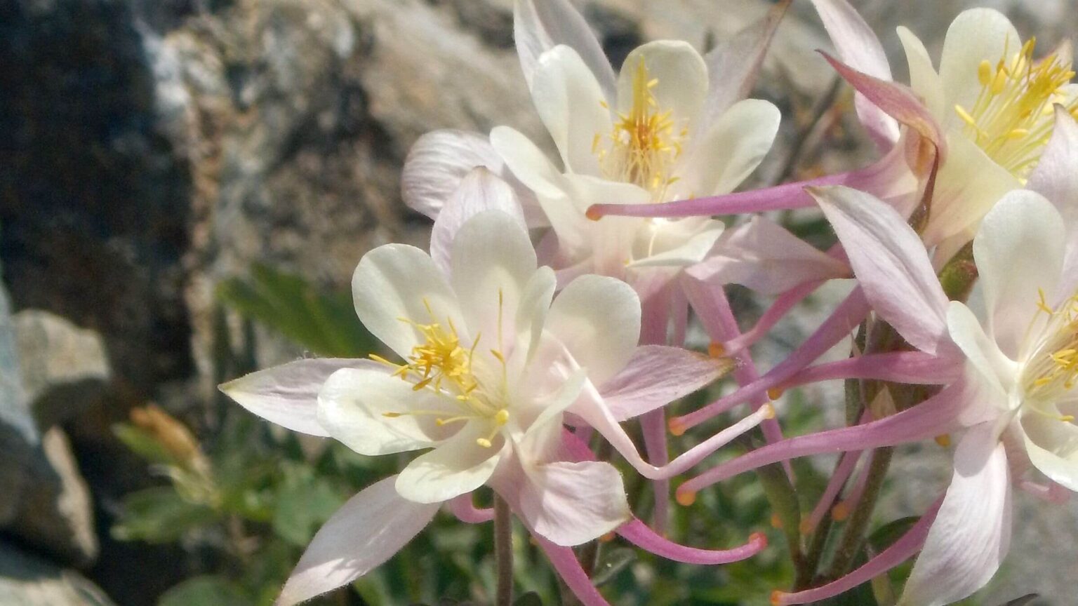
We were surprised to encounter high creeks, snowy passes, and abundant wildflowers in September (after exceptionally snowy 2017 winter), as well as large southbound JMT crowds from Yosemite National Park to Mt. Whitney late in season (supported by inholding lodges). Side trails into lake basins and to a historic hot spring showed much lighter use.
Crowds dominate popular Sierras on holidays, near trailheads and weekend destinations; also on JMT and popular loops. We met hordes on “trailless” route through Minaret mountains that offered convenient Labor Day weekend loop between two trailheads with bus access from Mammoth Lake resorts. We met or tag-teamed with others on JMT and loop routes but had solitude on secondary trails.
Visit statistics: 21 days, 261 miles, at 1.8 mph, and 425 feet per mile of average elevation change. Trip also included 4 food-drop stops at resorts near wilderness; 3 stops included overnight stays with half-day rests.
Go to map below for more information on trailheads, daily routes, mileages, elevation changes, and photos. (Click on white box in upper right corner to expand map and show legend with NAVIGATION INSTRUCTIONS.)
show more
Mystery Trek of 1977
David and I met in a hiking club and married in Las Vegas (my hometown and home church, not a wedding chapel), so the nearby Sierras in California were a logical honeymoon location. David planned this first backpack into an unknown area by searching through cumbersome map file drawers at Oregon State University library, accessible to him as a student.We got married on Memorial Day weekend and headed into the mountains on Monday as crowds were coming out. We drove to a trailhead west of Bishop and started hiking up a steep valley through stair step hanging basins.
Most of that trip was a blur. I remember two rare displays of human frailty from David. Living near sea level in Oregon the prior year, he slowed down with thin air on the high passes. He also tired one day with more miles ahead to camp. I took his sleeping bag—a one-time role reversal.
We had heavy packs including snowshoes for early June pass crossings. David recalls envy from PCT thru-hikers who had to time pass crossings for early morning to walk on top of frozen snow from previous night. We could go mid-day, enjoying warm sun reflectance under blue skies as we crossed passes on wet snow in shorts.
Our 2017 return was aimed to figure out the 1977 trip. We had two old topographic maps marked with pink marker, indicating a route starting in Eastern Sierras near Bishop, meeting the PCT and following it up Evolution Basin and over John Muir Pass into Kings Canyon.
The PCT segment we hiked in 1977 doubles as part of the JMT, probably most popular part of the PCT. It’s a scenic 213-mile slice between Yosemite National Park and Mt. Whitney. In 1977, only a few people were doing long thru-hikes and the JMT was not so well-known.
That has changed drastically in last few years as short thru-hikes have replaced the traditional hike-to-a-lake-basin backpack. Park Service reported 3,500 JMT hikers in 2016—only counting those who snagged a permit within a 45-person-per-day NPS quota and entered from a park trailhead. Hikers coming from adjacent Inyo or Sierra national forests weren’t in this count. We found the numbers rather overwhelming in 2017.
Readjusted Trip 2017
We could not reenact our trip on May 28 anniversary date, thanks to a record snow year in the Sierras (David recalls 1977 was a drought year). Northbound thru-hikers from Southern California were reporting impassable passes and chest deep creeks all summer! So, David pushed our trip back to end of August-September. Using maps, GIS, websites, PCT thru-hiker blogs, and phone calls to the Forest Service and Park Service, he tried to plan a trip to start and finish at same point in Eastern Sierras. He planned to hike north for loop through the Minarets, hike south through Evolution Basin, and not repeat routes—this ended up as loop on and around the JMT for a 21-day, 261-mile trip, much longer than our seven-day, 84-mile honeymoon trip.Much had changed since 1977, when we just picked a spot on the map. Now permits for all entry points and a “bear canister” were required (instead of hanging a bag as we generally do). Officials claimed that smart bears untied bag ropes and “kamikaze cubs” might jump from limbs to take down anything hanging from a tree. After costing out canister rentals vs. purchase, we bought a big one and planned our food for minimum storage (a week of freeze-dry dinners for two too bulky for one bear canister!), with food drops at three resorts near our route.
Interestingly, we saw no bears the entire trip but spotted dozens of canisters. One High Sierra hiker mentioned a bear encounter in camp far away from the JMT (so maybe the smart bears have gotten the message and left JMT with its multitude of canisters).
In 2017, one could still get permits for national forest access in person (now only available in advance through recreation.gov site). We got ours at the interagency White Mountain Visitor Information Center in Bishop, along with a leave-no-trace lecture and dire predictions for crossing snowy passes. Backcountry ranger also wasn’t sure our end route over Morgan Pass was safe; bighorn sheep had kicked down a lot of rocks onto the old mining road we would hike. Did we have a bear canister? (They had a roomful of rentals if not.)
Next, we delivered a supply box to Parchers Resort (others were mailed) and took side trip to check out the last segments of our planned trip: Pine Creek and alleged rockfall on Morgan Pass Road. At Pine Creek trailhead, we saw many day hikers and a “pack station” (corrals for outfitter who packed in campers via horses and mules). We then left our vehicle at turnoff for Morgan and jogged up a couple miles to check out rockfall warning; we found some big rocks on the road but no recent rockfall—no doubt the sheep on ridge above were long gone.
En route to Morgan we had passed a gate and turnoff for Pine Creek Mine. David had noticed on maps a possible shortcut for our return loop through the mine area. The gated mine road had a sign with phone number; I left a voicemail about possibly passing through. Next morning, we started our trip at Mosquito Flat trailhead at end of Rock Creek on east side of Sierras.
Eastern Sierras: Solitude and Snow
We saw few people on the east side: a father-daughter duo on rainy Mono Pass ending their High Sierras week and two Forest Service employees happily out of the office for trail “reconnaissance”—the outfitter who heavily used Mono Creek had willed their district some trail repair money! A couple days later we met a few solo hikers en route to trailless basins.Camped the first night in wet meadow on the Hopkins Pass route, around midnight screams from the ridge above us resounded through the basin. After crossing Hopkins next morning and skidding down snow to McGee Basin, we found signs of the possible night screamer: big mountain lion tracks on the trail route (matching David’s GPS course) as we hiked on snow above partially frozen lakes. On one contour, David slipped and skidded on his backpack some distance—lacking the cat’s natural “crampons”—but fortunately the slope was not steep enough to send him into the lake. Near the pass we met a human day hiker with metal crampons. We continued up in his tracks. (Snow was hardpacked regardless of temperature, perhaps due to extreme compression from such heavy snowpack.) We wound down from pass through a redrock basin and camped with only mosquitoes for company.
We knew we were close to the JMT the next day when we met a large international group waiting for their gravity water filters to fill water bottles. “Want water? Want water?” they all asked as we passed through. Our trail met the JMT on far side of bridge across Tully Creek. We dropped off to a creek side camp to cook breakfast. I heard a steady stream of JMT hikers passing above us. (Since we had met only PCT hikers on our 1977 visit, the popularity of the JMT section for a three-week hike wasn’t on David’s radar when he planned our 2017 return.)
Labor Day Weekend Throngs
This section of gentle JMT in and out of lake basins offered maximum people encounters: southbound JMT hikers from Yosemite Park, holiday weekend anglers from trailheads near Mammoth, and even some camouflage-clad bow hunters. After groups of chatty exuberant young women and a few fast, focused solitary guys, we thankfully pulled off the beaten path into an old-growth forested flat to camp. Next morning, I flushed a deer on my route down to the trail; wildlife sightings were quite rare on the JMT. At next creek we passed several camps.We had mailed a box to Red’s Meadow Resort. Here we confused the staff by asking for our box, removing food for a three-night loop including the Minarets and then returning it. (We had reservations for a cabin stay at Red’s later in week to do laundry, shower, and repack from our box.)
Labor Day weekend was a zoo! Red’s is the terminus for bus route from Mammoth. Dozens of day hikers poured off a bus. Many more thru-hikers lounged around tables and benches, sorting resupply boxes and checking iPhones (Red’s had WiFi). The café had a one-hour wait. We got a snack from the store instead. I checked my phone and had a message from the Pine Mine foreman. Permission granted for shortcut to Morgan Creek!
A day later, after crossing ridge of Minarets, we donned raingear for afternoon showers and forded rising Minaret Creek. I offered one backpacker my sandals for crossing; she declined and promptly slipped barefoot on rocks and fell in. We rejoined the JMT, where plans to camp at Shadow Lake were thwarted by “no camping” sign at entrance trail. (We were surprised at limited camping on the JMT.)
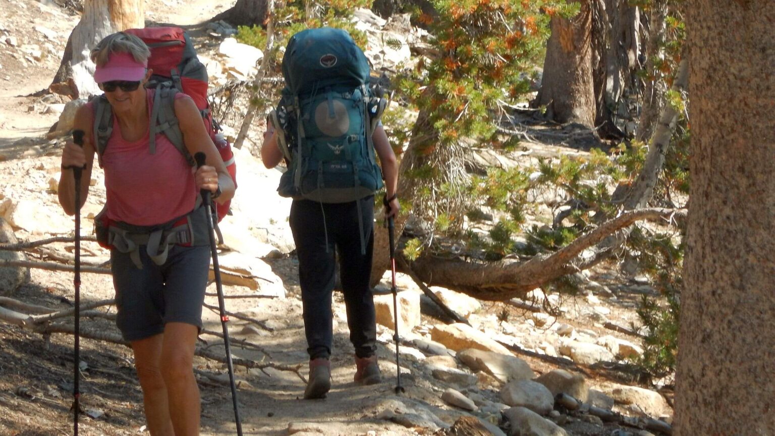
We found a narrow flat spot for camp off the trail on a ridge above Garnet Lake. We heard hiker voices on JMT far into the evening. Next morning countless camps and backpackers trooping out from Garnet and Thousand Island Lake with others at small lakes in between—last day of Labor Day weekend. Most JMT hikers were young and grateful; I learned that snagging a permit was quite difficult.
More solitude once we turned southeast on the PCT. We saw two older guys with day sacks (apparently dropped off by an outfitter), a day hiking couple with a lost dog, and a fast-moving group of young backpackers who hustled past in the mud, apparently trying to catch the last bus out. Across the canyon we saw Shadow Lake with falls dropping to the river.
Back Off the Beaten Path
The day after Labor Day, Red’s Meadow Resort was quiet. One group shared washer and dryer with us; we hung out in our raingear with the friendly Southerners. We had hustled through Devil’s Postpile to make it to Red’s café while breakfast was still served, and it did not disappoint! We ate dinner there and a second breakfast before we left, enjoying portions designed for thru-hikers.After Red’s, we gladly forsook the JMT. Our last crowds were a horseback group and day hikers on side trail to beautiful Rainbow Falls. “Fish Creek” turnoff took us above thundering Crater Creek—a tributary to Fish Creek which we would have to cross far below, a high-water concern in David’s planning. We met two veteran visitors (one had a dog, not allowed on JMT) and then some young lady hikers who’d hung out all weekend “at the hot springs.”
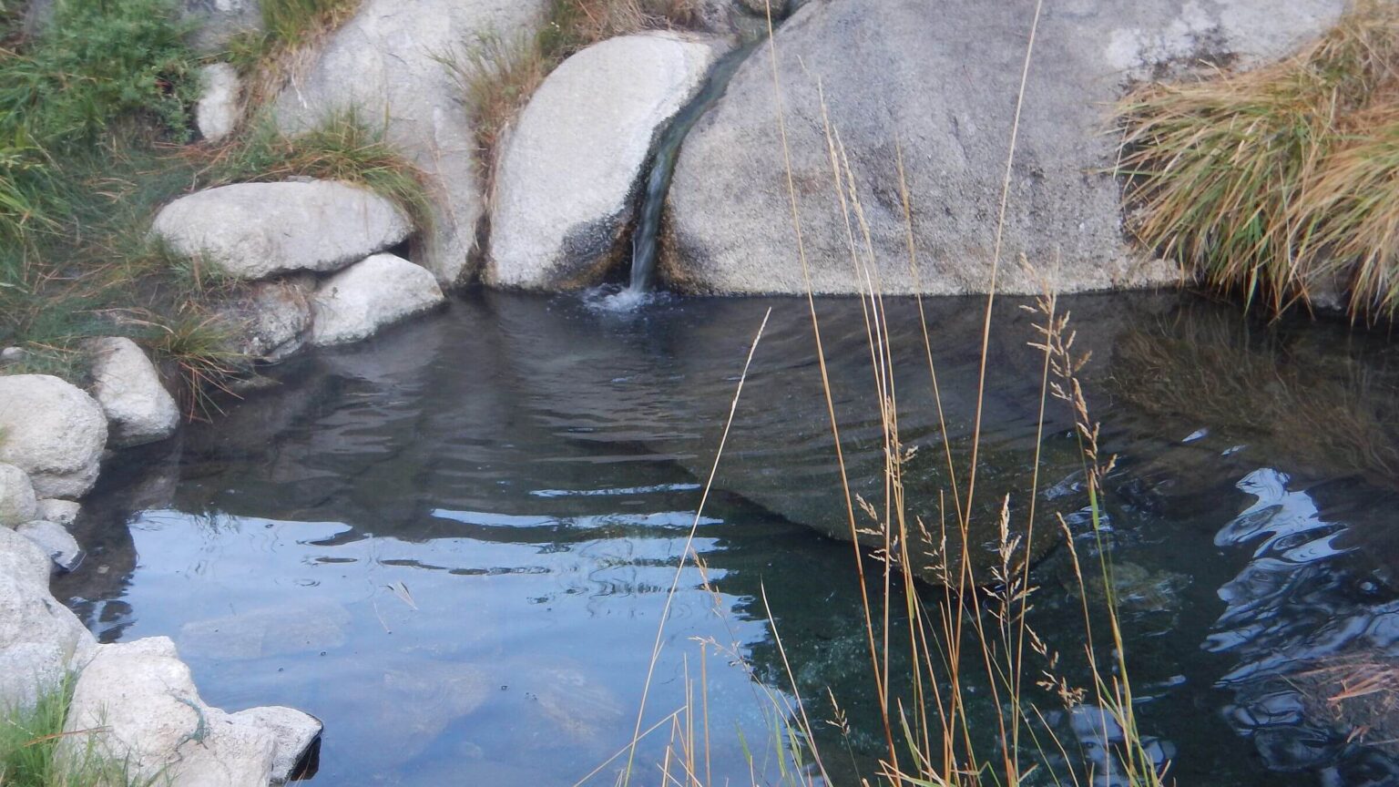
We had not heard of hot springs but sure enough, map showed Iva Bell Hot Springs about 14 miles from Red’s just off our planned route. To our relief, excellent switchback trail through pines descended to bridge across roaring Fish Creek. After rainy afternoon hiking through brush and avalanche debris upstream, we reached a trail junction. Nearby campers confirmed that the springs were on up the Fish Creek after a scary creek crossing and a confusing maze of “social trails” that climbed to a wet meadow running with warm rivulets. Someone had dammed up two pools. Area was heavily overused (and toilet paper disgusting), but we had a nice piney campsite to ourselves.
Rain quit at sunset. After dinner we hiked to a pool through wet meadow wearing only breathable raingear. After a hot soak in the moonlight, we donned our gear. When we got to the tent, our bodies had heat dried themselves and the raingear!
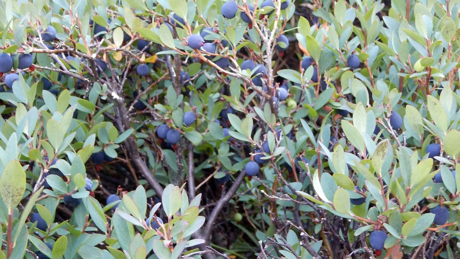
In planning trip David was concerned about “unmaintained/primitive” trail to Marsh Lakes area, but it was better than expected; switchbacks took us to meadow along spectacular Minnow Creek. We passed a small lake where David gorged on blueberries, then on past signs for several lake basins, a tent and angler on Grassy Lake, finally hiking along and above lakes with “Indian” names to camp just below Goodale Pass. While David set up the tent, I clambered uphill to a small pass back to Marsh Lake basin. A large gray animal was loping up until he saw me; he turned and disappeared. Wolf?
VVR: Thru-Hiker Fellowship
After snowy pass we descended dry good trail by spooky-named Graveyard Meadows and Graveyard Lakes; at lakes junction, we met two anglers who came cross-country from the lakes we skipped. Cooking breakfast we were overtaken by Jo Jo, a JMT thru-hiker. He was taking the direct route to Vermillion Valley Resort (VVR). A previous thru-hiker, he was anxious for “the campfire chats.” He said this fishing resort across Lake Thomas A. Edison from JMT is very hiker-friendly; many hikers left JMT to visit via ferry. (Our side route went directly to VVR. I was glad we had planned a food drop and half-day rest here.)Besides reasonable food and supplies and free laundry, VVR offered a big tent with cots for $15 or free camping on their grounds. Bonus was their nightly fire circles with big stumps for thru-hiker gatherings; I enjoyed one that evening. “Jimmy” was doing JMT and hoped to do PCT next year. “Everyone starts it for the trail but finishes it for the people.” Jo Jo did JMT two years ago during a smoky season; he came back to see what he missed. A Pennsylvania couple was starting a guided trip. Their young guides were Southerners: six sharing a house in Fresno for the summer. We camped in the free space; someone set up his tent right by ours and began snoring. You get what you pay for!
Next morning, power outage! I joined shivering hikers outside the café. Staff eventually opened without power, making meals and hot coffee on the wood burning stove. Most thru-hikers took the ferry back to trail, but we hiked trail around reservoir and up Bear Ridge to meet the JMT.
With crowds and rain on the JMT
We saw hikers and camps near rushing creeks and spectacular lakes on a rainy afternoon. Along Bear Creek, we saw trail departing for Italy Lake and wondered if we had come that way on our 1977 trip. As we hesitated, Jo Jo caught up and we hiked together, chatting for a couple miles. His wife prefers international treks with overnight lodging, so he does the JMT solo. Where the trail crossed Bear Creek we stopped to camp; Jo Jo, wearing trail sandals, plunged on through.Next morning after gorgeous Selden Pass and Sandra Key Lakes, we descended to the river for a side trip down rocky road to rustic Muir Trail Ranch (MTR) with unfriendly signs and no food, although 90-year-old Sally, local history repository, said cabin renters got good meals. We weren’t aware of this pack-in ranch prior to our trip, but many thru-hikers had stopped to pick up a box mailed to a nearby lake resort, then packed in by stock. The lodging was completely booked by a group that comes yearly. An old sheep ranch, MTR’s main revenue is a pack string that takes weekend campers and tired JMT hikers to lakes at head of Evolution Basin. Upriver we entered Sequoia-Kings Canyon Wilderness and passed junction to Piute Pass we’d later loop back over. Passing camps on the river, we took the last flat pine bar.
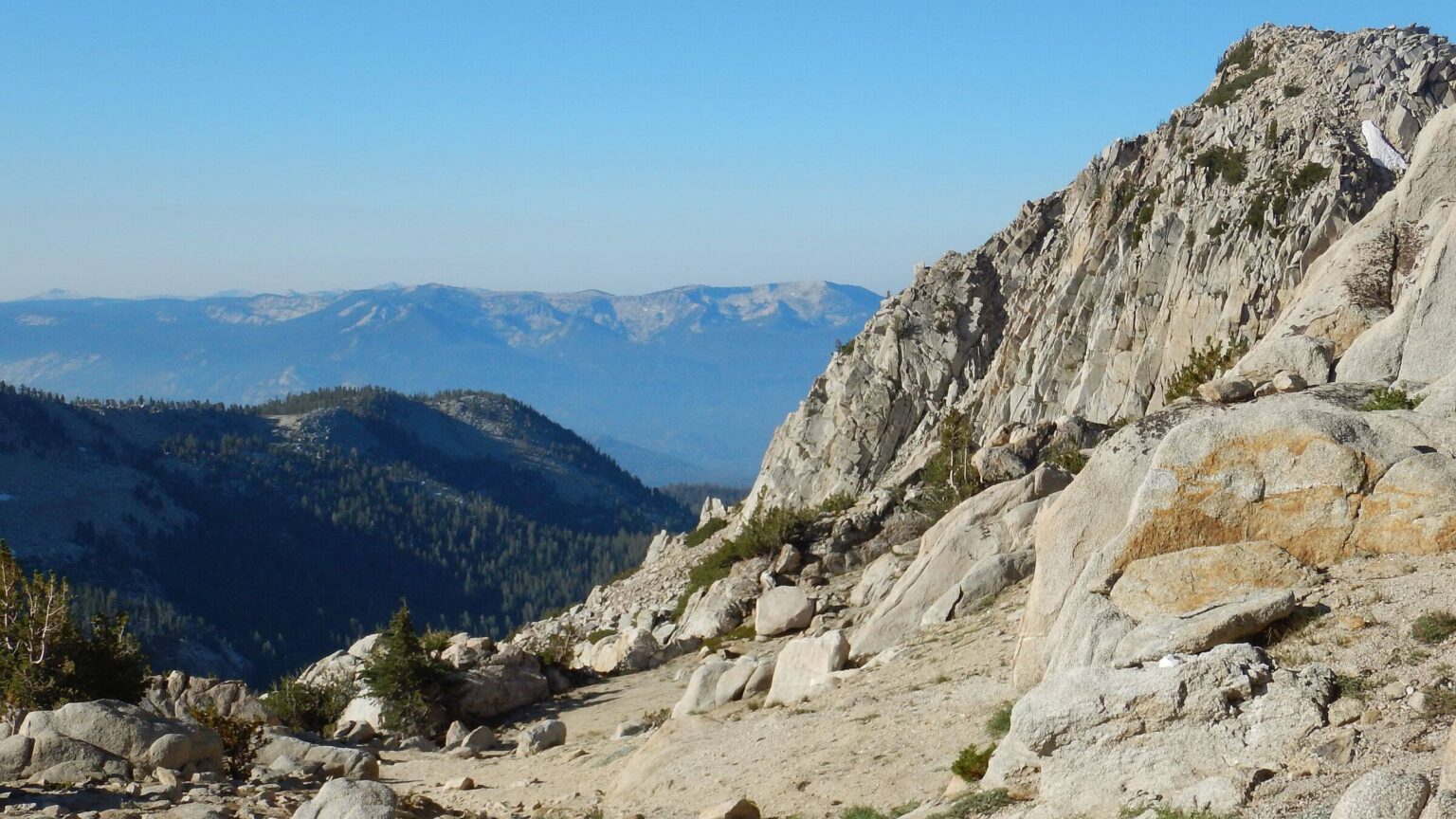
Early next morning I saw Jo Jo (in blaze orange shirt) striding above us on the trail. After switchback climb along sheer cliffs, we reached rushing Evolution Creek where signs routed us from high waters to a mellow crossing and milling hikers. Periodic showers as we slogged on, passing tents of hikers waiting out the rain. The park ranger at McClure Meadow warned of a big storm. We passed camps at Evolution Lake, and maybe Jo Jo shaking out a tent. At treeless Sapphire Lake, we were passed by jogging thru-hiker who planned to cross Muir Pass before dark. We chose to camp instead. Black clouds soon became a thunderstorm with driving rain—fortunately after dinner while nestled into our tent. Next morning our tent sat in a puddle. On up the trail we met Jo Jo, drying out his gear, and said goodbye as we’d soon leave JMT. At higher lakes, shell-shocked campers reported lightning strikes. On the pass, Muir Hut built in 1930 as storm shelter had inside-door lock and broken window; maybe the jogging thru-hiker broke in during storm because door had inadvertently locked.
Dropping down the trail with views of hanging lakes feeding the Kings River, we met northbound section hikers and others who mentioned a “North-South Lake loop.” We made a side trek to Le Conte Ranger Station, a luxurious cabin perched above the river. The ranger was surprised to hear the Muir Hut was locked and had a broken door window. We left the JMT for good, switchbacking up Dusy Creek to shelter from the rain in a lodgepole pine grove.
Autumn on the Eastside
After mild weather, rainstorms, and big trees of the Western Sierras, we crossed Bishop Pass into the colder, drier Eastern Sierras (in the rain shadow) into autumn chill. Bitter wind met us at the pass, along with a couple just finishing North-South Lake Loop for THEIR 40th anniversary! (This 54-mile loop links North and South lakes by crossing Piute Pass, then down to JMT, up Evolution Basin over Muir Pass, down to Kings River and over Bishop Pass.) We now realized we were also doing most of this loop as part of our larger trek. Like the famed JMT, David had not realized existence or popularity of this loop while planning our trip. Turns out most hikers do a “car switch” or take public bus 12 road-miles between the lakes. We took trails across.We got our last box at Parchers Resort below South Lake . All cabins rented but owner let us use her cabin to wash up the next day; although the café was closed for renovation, lobby and coffee were warm on a chilly morning. The owners recently bought Parchers, a favorite vacation spot for their family for many years. They’ve done the JMT and love thru-hikers.
We liked solitude of Table Mountain pass, along with Tyee (where we saw a day hiker and dog) and George Lakes (one tent). An old photo shows us crossing this this pass in 1977 (see Camp16 on map below). I thought perhaps this was the long mellow pass that slowed David down in 1977, but he thinks Muir Pass.
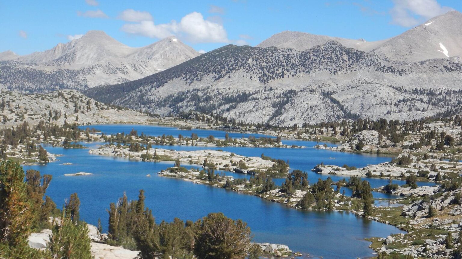
We dropped down long switchbacks to gleaming Sabrina Lake; David recalled a similar descent last day of 1977 trip, so perhaps near the end of our loop? We had planned on a big restaurant brunch at the lake café, which did not disappoint, including pie! We then hiked road to North Lake and soon were climbing up Piute Pass along hanging basins and striped granite towers that again seemed familiar. At gorgeous Loch Lake, we met anglers returning from a few days in trailless basins on other side of Piute; I regretted lack of time to visit the vast Desolation Basin.
At Piute and French Creek junction (after five crossings!) and southbound trail to JMT, we met hikers we had seen near Muir Pass. “The figure-eight people!” said one, referring to the shape of our loop. We headed north over rocky Pine Pass to Honeymoon Lake, where we would camp, then hike up Italy Pass to see if we came this way in 1977. The lake was cold, windy, and crowded. Fish jumping but no one fished! We met two European guys who come to the Sierras every summer. The Alps are too civilized, one said. “The ‘huts’ are like a hotel. Here is wilderness. We can go where we want, camp where we want.”
Several routes to Italy Pass. We took one along green meadows and shallow lakes and returned on another. From the pass we could not see down to Italy Lake. Route down did not look familiar, nor did we remember a snowy watery lakeside crossing reported by those who came up. We returned, packed up camp and descended to Pine Lakes, camping below. An empty pack string passed, perhaps source of most Honeymoon campers and/or maybe others packed into Desolation basin. This string was probably from the pack station we saw weeks before at Pine Creek.
Next morning, we hiked long switchbacks down a steep granite canyon with views of Pine Creek plummeting 3,000 feet. We saw equipment and trucks scurrying around Pine Creek Mine.
Dogs barked, sensing us from some distance. We left main trail for shortcut to the mine, an old road and decrepit bridge crossing creek. Passing “No Trespassing” signs, we walked up to a group on site. “You’re right on time!” The mine foreman, Shaun Smith, said a movie crew was using mine sites for filming. He seemed please to help our trip and offered water. On down, a woman looked out the door of an office building. “Do you know you are on private property?” I mentioned Mr. Smith. We crossed bridge and started up big switchbacks along narrow Morgan Canyon. I noticed the woman striding across the site—maybe to check out our story. Across canyon, precarious remains of an old wooden tramway.
After lazy switchbacks, a cold basin with Morgan Mine remnants, and beautiful Morgan Lake, we crossed a gentle pass and descended to camp at far end of Long Lake, huddling in trees out of the wind. One tent in a campsite below us. While filtering water at the lake inlet, David met one of the campers, a botanist doing fieldwork. Meanwhile I explored the area, hiking horse trail over low rise to the “Hidden Lakes” nestled in a valley crisscrossed with horse routes.
The next bitter morning I wore three layers of clothing and my raingear as I trekked old road winding through small basins by Heart, Marsh, and Mack lakes. Two perky climbers strode past; near the Rock Creek trailhead we met day hikers in shorts. A little warmer in the valley.
We now think we did the North-South Lake Loop in 1977 with a side trip to Honeymoon Lake and Italy Pass. An 84-mile trip in five full days (plus two short first and last days) was about 15 miles per day (perhaps slowed some days by snow crossings). Not too different from nearly 14 miles per day (excluding stopovers) for our 2017 visit.
Forty years later, with outfitter “pack stations” at most trailheads and a growing hiker market for short “thru-hikes” and loop trips, Sierra solitude is harder to find, but is available for those who explore the trails and routes paralleling the overused JMT.
show less
Google Map
(Click upper-right box above map to “view larger map” and see legend including NAVIGATION INSTRUCTIONS; expand/contract legend by clicking right arrow down/up.)
Downloads
Links
- Maps
- Supply stops: Red’s Meadow Resort, Vermillion Valley Resort, and Parchers Resort
- JMT Wilderness Conservancy