Cows Outnumber Migrants in Remote Border Wilderness
We were warned about illegal migrants using this corridor. But we didn’t see a single migrant—although a trail from Mexico near Border Tank was most well-used path in Pajarita Wilderness.
Scraps of sun-faded clothing, food packages, water bottles, and other trash, especially in a large flat camp area above Sycamore Canyon, indicated many migrants—but aging of materials probably indicated no recent use.
Other surprises in this small, rugged wilderness on the Arizona-Mexico border:
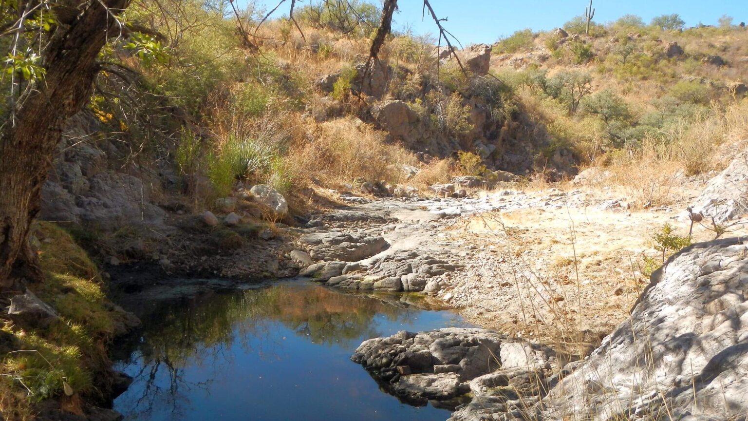
- Water running well. Many deep pools in Sycamore Canyon despite a dry year, pools in Tonto Canyon; even appropriately named Border Tank had some stagnant water.
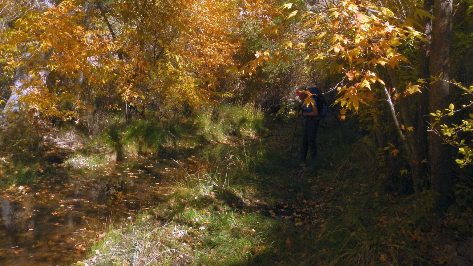
- Large sycamore, ash, and cottonwood in full fall glory throughout Sycamore Canyon.
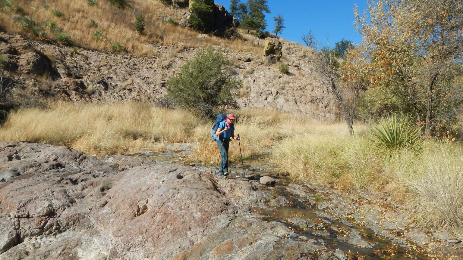
- More cows than people. Many cow trails on creek bank, too thorny to use without cowhide. We “herded” six the second day until our route left Sycamore for a flat, descent into side canyon, over next ridge, and up Tonto Canyon. Cattle use predominated; poop even on roads. The only people were a young couple we met coming out first day, who seemed awed by red rock monuments and narrows.
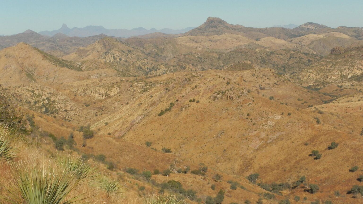
- Rugged terrain. Most hiking was in creek bed on rocks. We planned three days to hike a loop including the two canyons, rounding back on unpaved forest roads with 4.5-mile side trip to peak outside wilderness. But the 22-mile trek took so long, we skipped the peak because we needed to get back to Tucson that evening.
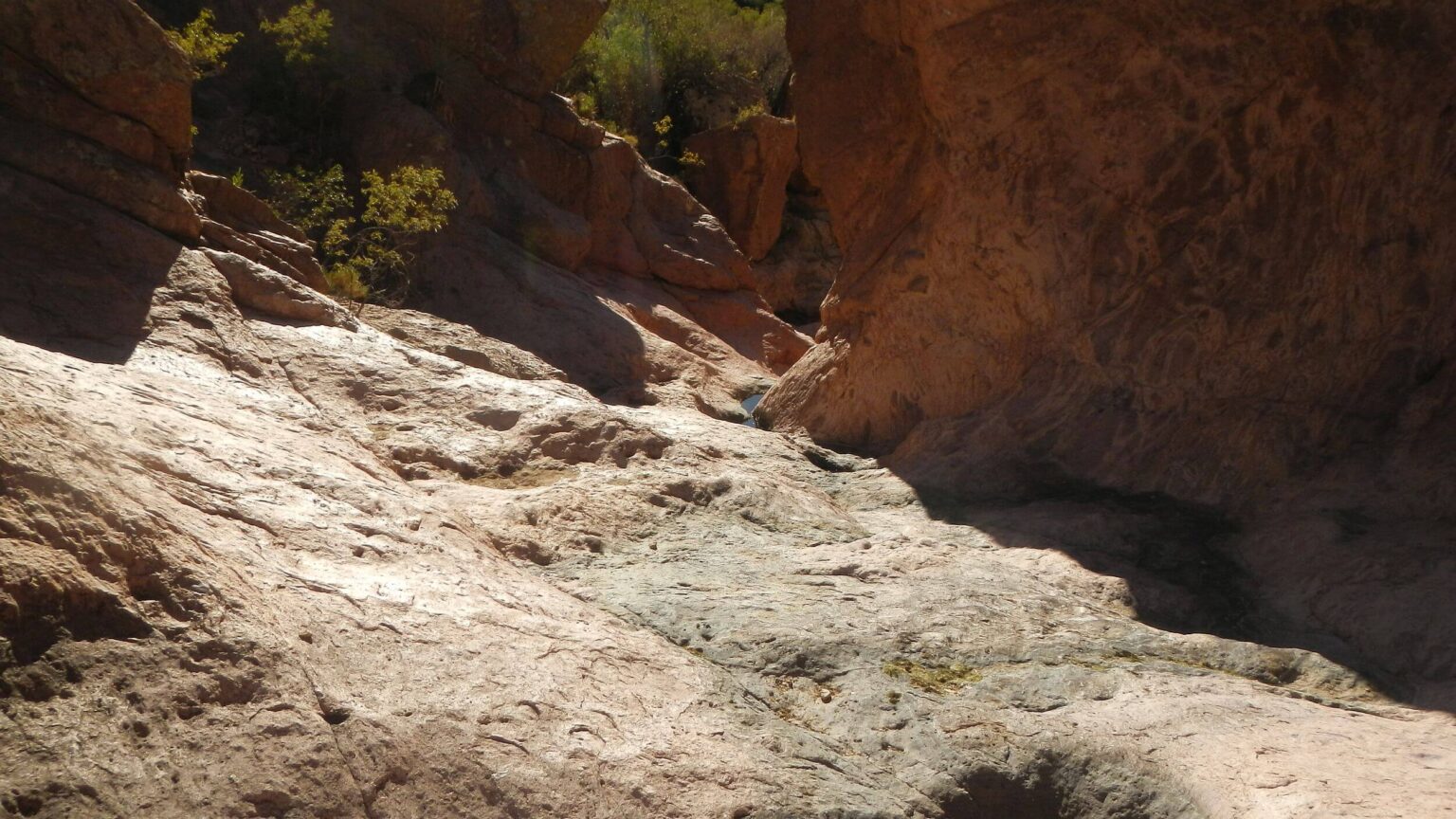
- “Canyon country” in upper Tonto Creek with narrows, pools, and red rock. Some steep scrambles David had to help me over. The 3-mile clamber took all afternoon and we settled for early camp in flat above Border Tank—4 miles earlier than planned! Comfortable camp among mesquite trees with sunset colors and full moonrise.
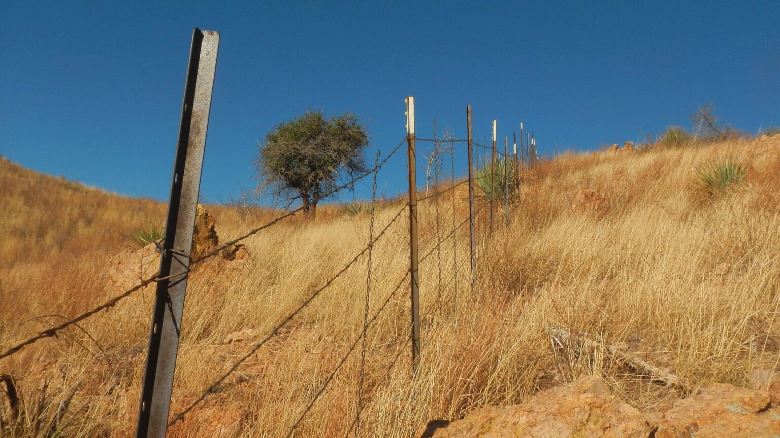
- International border. At head of Tonto was fence between U.S. and Mexico. My cell phone texted: Verizon wanted international fees! I turned off phone.
- Last cross-country scramble (3 hours for about 2 miles) mostly on undulating ridge with rocky terrain, non-native grasses, and acacia that cut through long pants before trail. Some blackened yucca regrowth and abundant grass only sign of recent range fires.
- About 10-mile finish on road. We picked up water drop and made breakfast in road bend out of wind, spooked by UTV roaring by. Viewed Baboquivari Peak on Tohono O’odham land and wilderness mosaic below of sand colored ridges and canyons. Passed lovely evergreen oak grove and sign for Bear Canyon Ranch, maybe culprit for all the cattle.
Pajarita Wilderness offers a nice November day hike down Sycamore Canyon for red rock monuments, pools ,and fall colors. But negligent management and minimal trails make backpacking more difficult. This borderland gem is relegated to cows and surrounded by Border Patrol activity.
Pajarita Wilderness is a 7,500 ac area highlighted by Sycamore Canyon with year-round water. It is unlike most mountainous southern Arizona wilderness. This was our first visit, a quick trip done right after 2024 presidential election to escape cultural division and chaos. We underestimated time to hike the rugged more or less trailless wilderness and had to drop planned out-and-back hike to Atascosa Peak just outside wilderness. Quick facts can be found on University of Montana wilderness website.
We visited during extreme drought in fall season, so did not see many of the unique plants and birds that characterize this wilderness. Nor did we find specific online information about the widely quoted figure of “660 plant species” someone identified. But we did find recent study about a tick in this wilderness where about half those sampled carried a bacterial causing a Spotted Fever in humans. (Probably not a good place to visit in spring/summer.)
We found rich physical diversity in rocks and canyon, as did others visiting this wilderness. Despite warnings we found no recent evidence of migrant use. Humane workers attributed influx and reductions in migrant numbers to policy changes.
Border Wall construction had stopped at wilderness boundary. Barbed wire fence was only impediment to wildlife activity. Saw what seemed to be large cat scat—mountain lion or maybe jaguar.
Trails minimal but our route was fairly easy to navigate with little brush, even though slow going. Cindy asked to have her pack ferried on climbs up a few narrows. Active cattle have made routes in some places. Near Border Tank we found a clear trail coming from Mexico.
Completing a loop on roads was okay. We encountered little vehicle traffic except for a few deer hunters and some Border Patrol officers in vehicles and ATVs. Water drops on way into wilderness and near Atascosa Peak Trailhead worked fine for this dry section.
Visit statistics: 3 days, 22 miles at 1.6 mph, and 325 feet per mile of average elevation change.
Go to map below for more information on trailheads, daily routes, mileages, elevation changes, photos, and fire map (3 fires between 2011 and 2022 probably range fires with little impact on canyons, perhaps more grass on ridges.). (Click on white box in upper-right corner to expand map and show legend with NAVIGATION INSTRUCTIONS.)
Google Map
(Click upper-right box above map to “view larger map” and see legend including NAVIGATION INSTRUCTIONS; expand/contract legend by clicking right arrow down/up.)