2024: lost trails and hikers in historic wilderness
The Galiuro Wilderness in southern Arizona once had 100 miles of legacy trails—still shown on Forest Service maps.
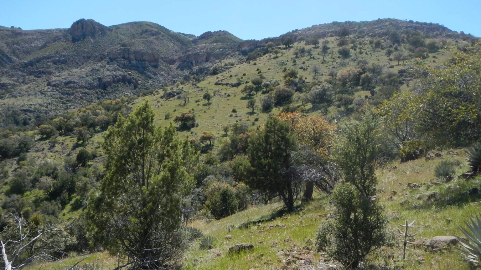
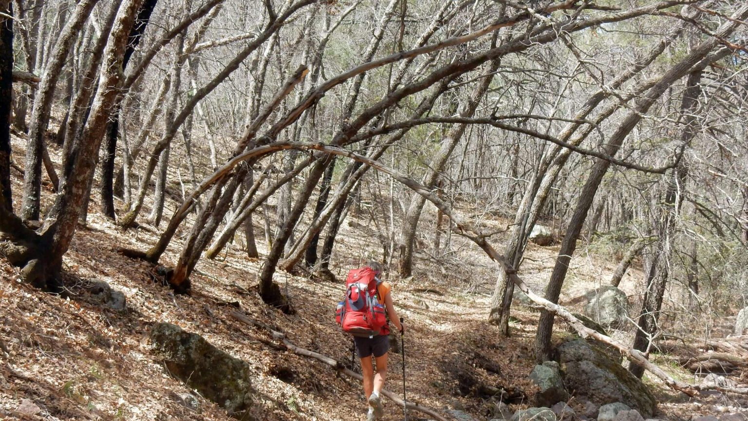
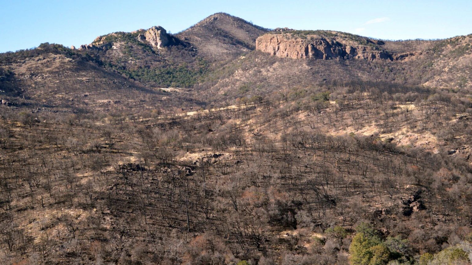
Our 3 loops in this remote wilderness northwest of Wilcox found increasing trail loss to brush, downed logs, and washouts. From 2014 Oak Fire, trail damage is escalating in northeast quarter of the wilderness; brush is swallowing trails even outside burn area.
Our third revisit in April 2024 was our first Galiuros hike with friends since 1975—but I spent most of first day alone, misled by watch with a “rerouting” function I didn’t know about.
This trip—a short loop from Deer Creek Trailhead and day hike to famous Powers Mine—also found trail conditions much worse than earlier visits in 2015 and 2016.
The nine of us had three different trip objectives. Guy and Jan, and John and Jane, planned out-and-back hike to Galiuro favorites: Powers Garden Cabin, Powers Mine, and Holdout Spring at head of Rattlesnake Canyon. University faculty Jim, Wayne, and Peter came for post-fire photo mapping (comparing to previous post-fire visits).
David and I had added Galiuros to a planned Chiricahua Wilderness visit. Both areas are far southeast of Tucson so we planned three-day loop in Galiuros “on way” to Portal for lodging.
We all started at Deer Creek Trailhead with aim to camp near Powers Garden. Guy and Jan started first. Jane and John started just before us.
David lagged behind, setting up GPS, changing batteries, and photographing lush spring vegetation. He had loaded his GPS coordinates for our trip on my Garmin Fenix 7 watch, bought to keep us on track after losing each other on past trips. I soon passed the university trio taking their first photo on a ridge above Deer Creek.
I would not see David again until evening.
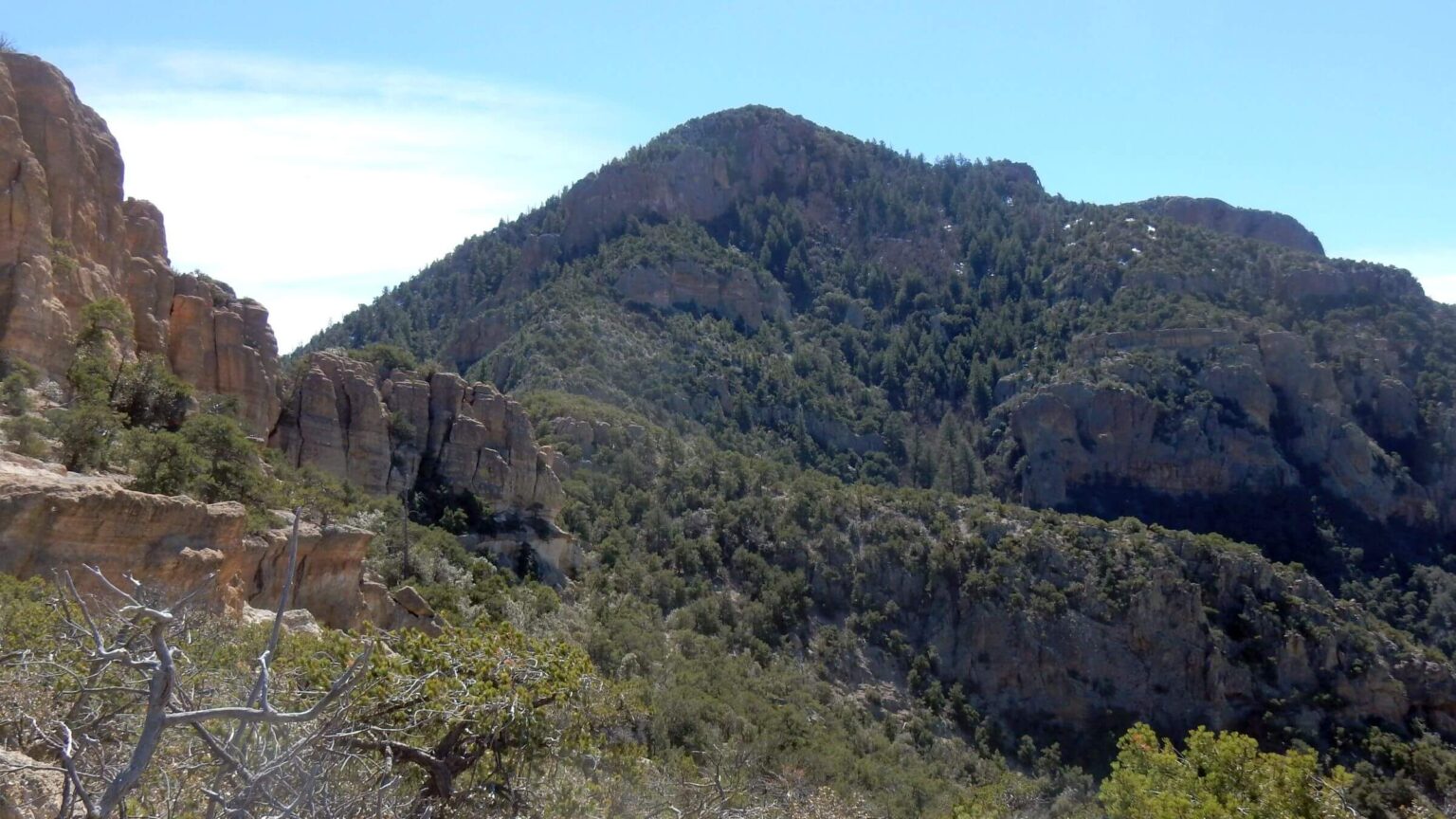
Galiuro Wilderness encompasses two isolated ridges about 120 miles from Tucson that is rarely visited. Despite deteriorating trails, erosion hazards and increasing brush and deadfall, this historic area is worth a visit for seasoned hikers with good navigation and GPS skills.
Quick facts found on University of Montana wilderness website.
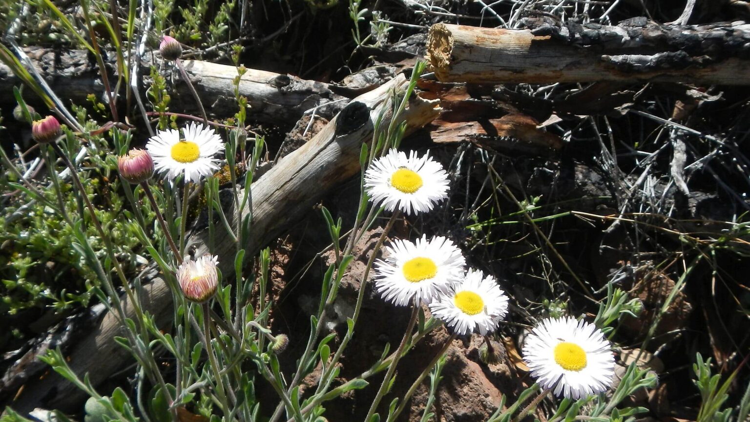
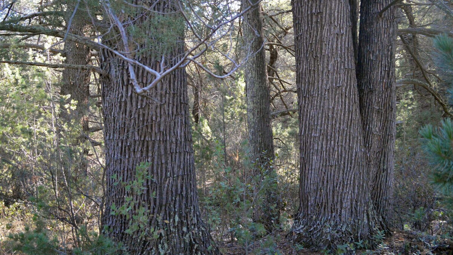
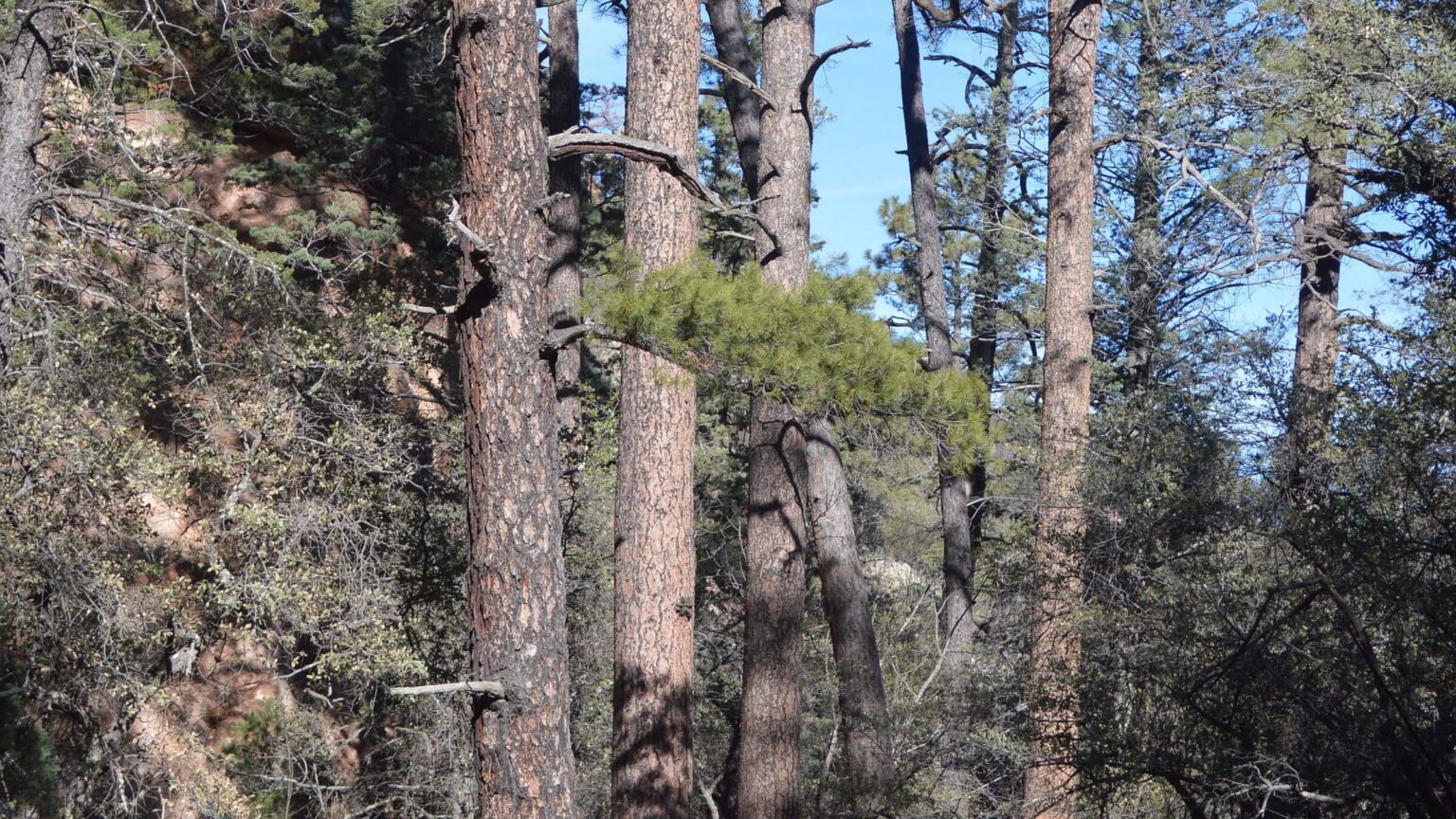
Galiuros’ rich history in mining, farming, and grazing visible in remnant structures and roads. Ridges offer panoramic views of other Arizona sky islands; canyons boast remnant groves of towering old-growth ponderosa pine and Arizona cypress, waterfalls, and creeks.
Oak Fire of 2014 burned 14,000 acres in northeast quarter, blackened most trees on side slopes and ridges (canyon bottoms fared better), and started trend of stream blowouts and deadfall. See fires on map below.
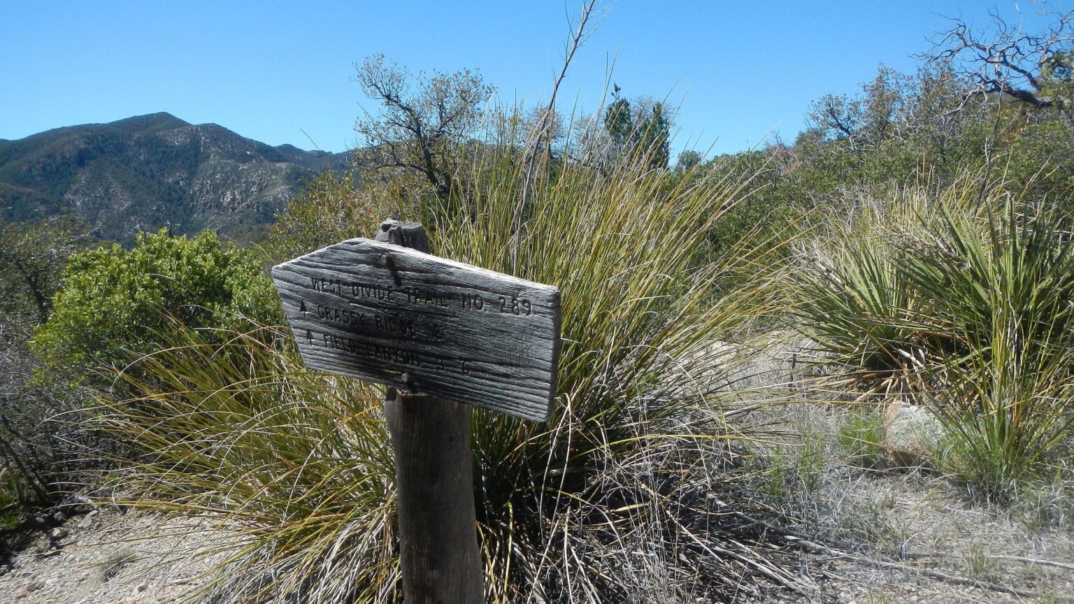
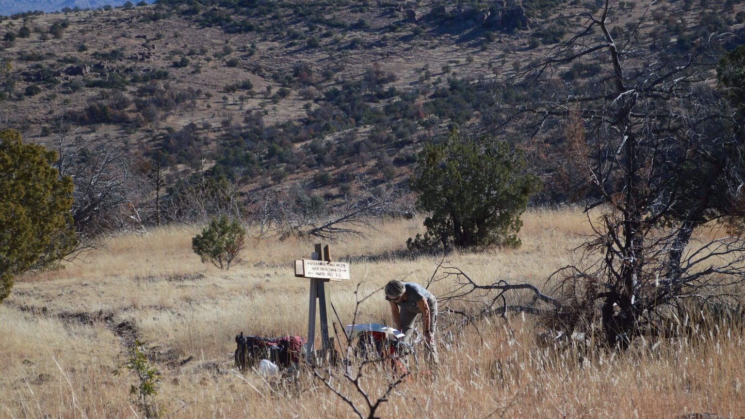
Legacy trails rapidly disappearing from brush growth, fire damage, and maintenance neglect. Old signs indicate access north to Aravaipa Wilderness, west on ridge to West Divide, and south to Redfield Canyon Wilderness—but no trails found.
April 2024 visit checked trails we had visited right after 2014 Oak Fire. Sadly, deterioration much worse. Brush regrowth and washouts rendering area virtually trailless.
January 2015 and March 2016 visits tried to reconstruct a weekend 1975 visit as university students from Tucson.
Visit statistics all trips combined: 14 days, 136 miles (hiking at 1.6 miles per hour in 2024), and 525 feet per mile average elevation change.
Go to map below for more information on trailheads, daily routes, mileages, elevation changes, photos, and fire map (9 fires between 1994 and 2021). (Click on white box in upper-right corner to expand map and show legend with NAVIGATION INSTRUCTIONS.)
show more
Galiuros history
Native Americans related to Apaches were first recorded people in the Galiuros. Miners came after the United States bought the area in the 1854 Gadsden Purchase, producing more than $4 million worth of lead, silver, copper, and molybdenum from 1905 to 1959. Era remains are found along Rattlesnake Creek. The Power family bought an Angora goat ranch at Rattlesnake Springs, now Powers Garden, and continued mining; this family had colorful history.Forest Service classified it Galiuro Primitive Area in 1932. Lying astride two 7000-foot block fault ridges 19 miles long and 6 miles wide, Galiuro was one of the initial U.S. wilderness included in Wilderness Act of 1964.
1975 visit: looping legacy trails
We first visited the Galiuro Wilderness in 1975 as University of Arizona students. Vague memories include a bone-jarring, long ride on a dirt road straight from a highway turnoff to a shady canyon, then a hike up brushy switchbacks to a ridge.David and I forged ahead of the group for a roundtrip ridge hike to a peak, then dropped down a piney canyon for camp and fire-grilled burgers. Our friends did at least part of the ridge hike and marched into camp after dark, headlamps glowing, whistling the Colonel Boogie March.
Next day we all hiked past mining equipment, green pastures, and fruit trees at Powers Garden; climbed up to a ridge; and got back to the cars by evening for the three-hour drive back to Tucson.
Forty years later, David and I did revisits in 2015 and 2016 trying to piece together details of that trip—although we still aren’t sure what peak we hiked to, and many ridge and canyon trails we raced along were nearly impossible to hike from post-fire erosion and vegetation.
In 2024, 10 years after Oak Fire, everything was much worse.
Misled by maps
In the 1970s, we used contour maps created, updated, and field checked by the U.S. Geological Survey (USGS). Unfortunately, USGS stopped field checking for trails in 1992 and launched a new map series in 2009 where trails (inconsistently) come from a variety of sources (to save USGS money). Therefore, the only “for sure, accurate trail maps” today are from GPS tracks by someone who has hiked and recorded tracks for an area.Although we had previously hiked this trail in 2015, David was such a GPS novice that he did not know how to record tracks on the device he carried; so, in 2024 we were at the mercy of whatever Garmin had cobbled together.
On our 2024 trip, I forged ahead of David to the first trail junction, then started down into a drainage. The GPS on my watch indicated I was “off trail,” although I remembered the route from our 2015 trip. Confused, I returned to junction to wait for David. Our university friends arrived and said David had raced ahead looking for me. Freaked out, I dropped into the canyon, ignoring my watch, and found trail to Mud Spring junction where John and Jane were having lunch. Jane said they were going “up and over” on Tortilla Trail.
I took off on most heavily used trail, trying to catch up to David. My watch showed me parallelling and merging with Tortilla Trail (although I wasn’t!). At a saddle, I saw no trail but watch indicated that Tortilla Trail was close, so I descended along hillside to a dam and found trail on creek bottom I recognized from our 2015 visit.
From there it was fair trail (brushier than I remembered) around drainages, over a little pass, and slidy drop into Horse Canyon, blocked by young trees and more unpleasant than our last visit. I crossed Rattlesnake Creek, running nicely, and got to Powers Garden junction. Where was everybody?
Guy had mentioned camping at Powers Garden, another half-mile up Rattlesnake. Nobody there and no answers to my calls as I wandered through the flat. I returned to the junction, planning a bivouac in my sleeping bag as David had our tent. Then Peter from the mapping trio showed up. He said everyone was behind him and suggested we find a campsite. We went back up Horse to a grove of ponderosa pine for camp.
Peter (God bless him!) built a fire while I pulled on warmer clothes. In succession, everyone showed up, with Guy and Jan—who had left the earliest—dead last. Around the campfire, Jim insisted we tell our stories.
As it turned out, I had followed the Sycamore Trail that parallels Tortilla Trail but descends Sycamore Creek, while Tortilla crosses head of the creek and climbs to ridge above Horse Creek. Luckily, memory got me onto Tortilla. Everybody else had correctly followed it. But where Tortilla crosses upper Sycamore and climbs up other side, Guy and Jan went up old mostly nonexistent trail shown on old map to Topoff Gap, which drops into Horse Canyon above Tortilla Trail. They bushwhacked down.
Guy had left some markers so John and Jane started up his route but turned back—and met David. He had correctly followed Tortilla Trail but saw no tracks in mud on first stream crossing and came back looking for others.
Why was David behind? At first ridge before junction, he realized he had put a Garmin map on my watch and his GPS that looped around instead of dropping into the drainage (so my watch “thought” I was “off trail”). He assumed I had followed watch track around and went looking for me. By the time he concluded I had not gone that way, I (and everyone else) was far ahead of him. Then he met John and Jane who thought I was off trail. Jane asked, “Has Cindy had any experience with bivouac?” Well, almost.
The mapping trio did not get lost—having visited the area in 2020 and knowing the pitfalls—but were stopping for photo points. They caught David, John, and Jane shortly after they returned to correct trail. Peter passed David when he stopped to filter water at a nice tributary about half-mile before camp.
More drama: missing mine, bad brush
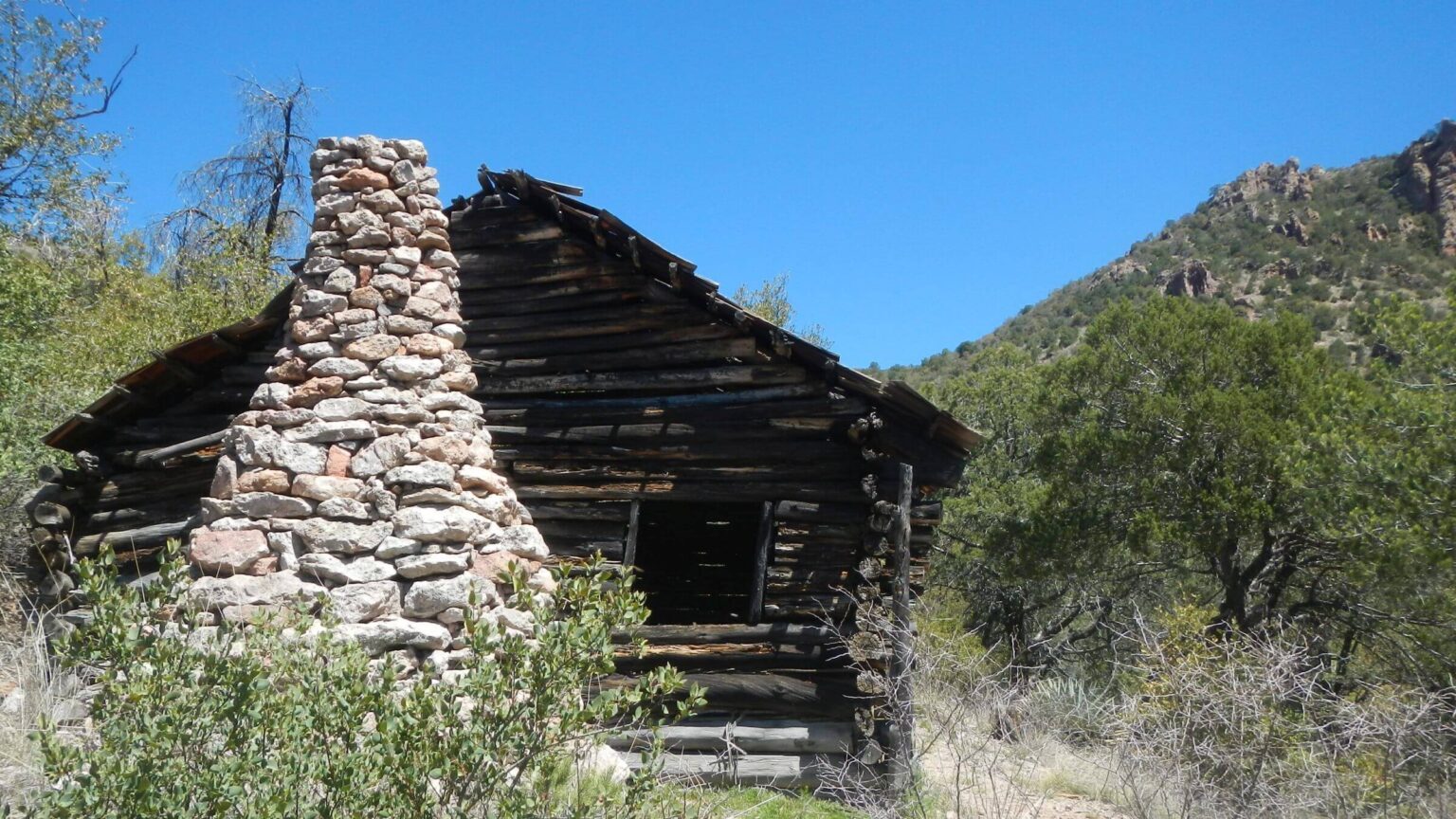
Next morning we left camp early for planned long day with side trip to Powers Mine, then up Rattlesnake to camp on East Divide. Mellow Rattlesnake trail much worse than our last visit in 2016 with more vegetation, downed logs, and rocky crossings where creek had flooded. We dropped packs at turnoff to Powers Mine, an old road winding around canyons to join nonexistent (but well signed) West Divide Trail, which used to follow ridge on west side of Rattlesnake.Rocky road down canyon was cloaked in oak and white thorn acacia; just awful. David, far ahead on long canyon contour, yelled “turn around” (concerned that we might not make planned camp destination). I did not but continued past Powers Cabin hidden in brush. David had turned off to cabin and I had hiked right past him! But he thought I had headed back to Rattlesnake.
After a while, I turned around and this time found turnoff to Powers Mine Cabin. But I saw no sign of road crossing mine or old mine equipment we had seen in 2015; apparently hidden in post-fire brush!
Thinking I was ahead, David had headed back to Rattlesnake junction—unbeknownst to me! I climbed to pass, calling at intervals. Finally, I started down toward the junction and saw him coming back up! We had wasted an hour.
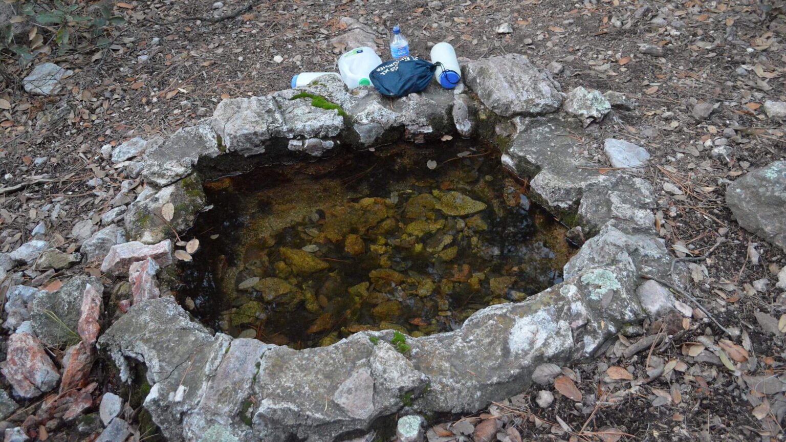
Upper Rattlesnake, once easygoing piney trail, now covered by heavy oak brush and almost impassable. It took over THREE hours to hike 3 miles to Holdout Spring. Side trail was in open pine forest and the spring beautiful. We hiked 1.5 more miles with little brush and camped near some pools.
Deadly sideslope, bad burn, saddle surprise
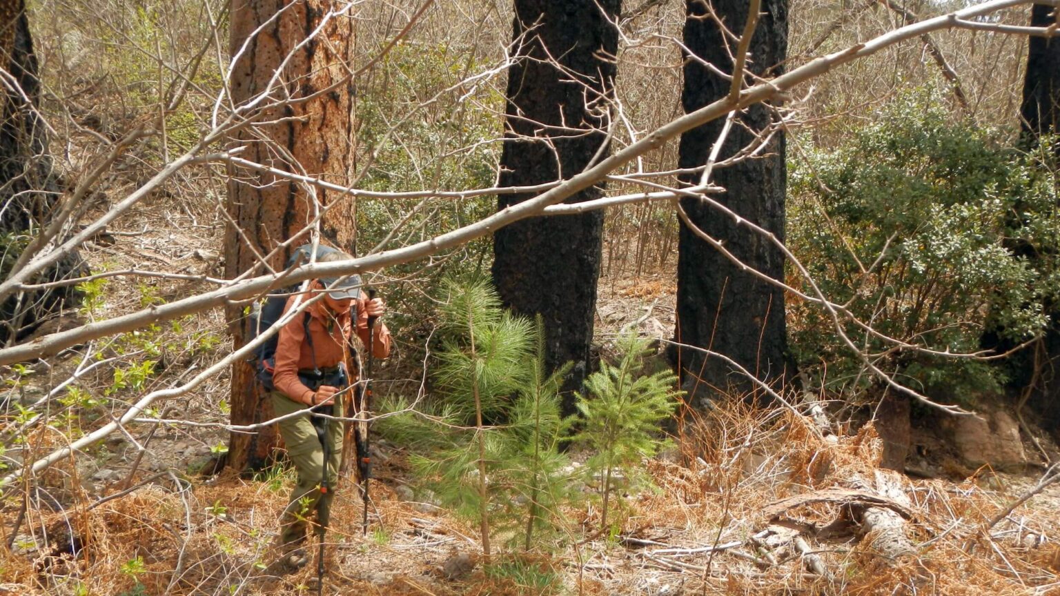
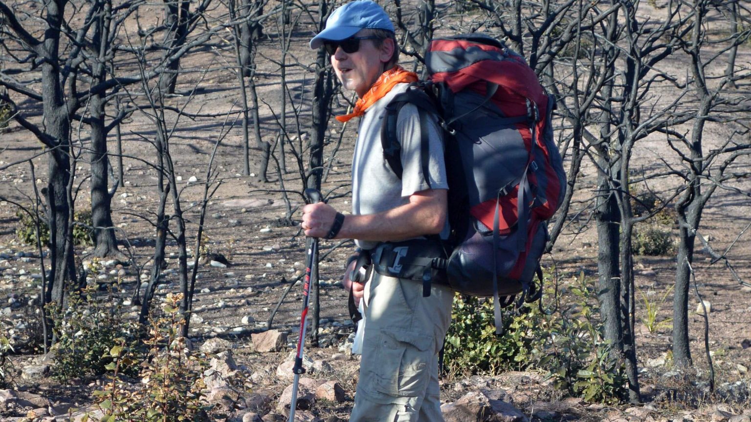
Trail out of Rattlesnake was nice contour up around ridge, until we got to a bad washout. Once scary—this time it was deadly—about 15 feet across a 45-degree sideslope on hard-packed clay with ball-bearing pebbles. Cliffs above offered no way to cross higher. David somehow crossed twice with our packs. I started across with feet pointed up rather than sideways. About halfway David grabbed my arm and yanked me across, just as my feet slipped out from under me.Switchbacks above fine to East Divide junction and good trail until nonexistent Paddys River Trail marked by broken sign. Then we entered Oak Fire burn scar: slow going through oak, downed logs, slidy rocks and poor tread. We dropped plans to hike out that night and got water for camp in a drainage. We attempted in vain to contact our Portal lodge; no cell service and inReach texts wouldn’t work on their landline.
David wanted to climb Kennedy Peak so we left main trail and followed route marked with cairns (rocks) half a mile. Descending to Kennedy Saddle, we found Wayne already camped! The mapping trio had camped at Holdout and followed us all day, passing when we climbed the peak. Jim and Peter were making their way down to their vehicles, Wayne said.
Next morning we wondered how our friends had managed in the dark as we stumbled over downed logs and through brush on switchbacks into a drainage. (In 2015, no obstacles on trail through black trees.) Down lower, trail improved although the marked trail to Mudd Spring was gone. We met David’s route around the basin, which he had taken to look for me, cut back to the first junction, and descended to shuttered Deer Creek administrative site under leaf-shedding oaks. (Evergreen oaks shed old leaves in spring as new leaves produced.)
We finally got in touch with our Portal lodging back on a main road and learned all rooms booked for the night ahead. They kindly dropped our charge for the night we missed; we had a valid excuse!
From the Galiuros, we took diagonal shortcut toward Chiricahuas with plans to camp out before next hike. But as we got closer, we saw snow glistening on distant Chiricahua Peak. We changed course, deciding that Mexican food on way home with a return to Chiricahuas a month later might be better plan.
I learned by text that our other friends returned from Powers Garden a couple hours after us and were also on their way home with a stop for Mexican food. They had hiked to Powers Cabin, but only Guy had found the old road, machinery, and mine. Jane sent a photo of her shirt ripped by catclaw.
With the Powers Road access still blocked by ranchers, deteriorating trails, and no sign of trail repair, we will have to leave this remote gem to brush and rockslides.
2015 return: trails closed or gone
In our first return January 2015, we planned to enter from north on Rattlesnake Mesa (Powers Hill) Road into the wilderness. At the unmarked turnoff from Aravaipa Road, a sign stated: “Road closed, no turn-around.” Ranchers had closed access over a feud with Arizona Game and Fish (which negotiates public access). We stopped at a ranch up the road to ask and no, we couldn’t hike in. (Road was still closed in 2023 but listed as a trailhead on a Forest Service website; by 2024 my Arizona Game and Fish contact had retired.)We drove south to Deer Creek Road and found Forest Service trailhead with a kiosk, new signs, and a hand-drawn map of the old trails system—wistful thinking after fires, floods, and neglect. But thanks to fire and perhaps fire crew work, no brush slowed our way up and over a ridge to camp in pinyon-juniper woodland. Next morning Tortilla Trail dropped down to springs, a large ugly tank, and only hikers we saw on the trip. We contoured, climbed, and then dropped down Horse Canyon to the big ponderosa pines of Rattlesnake Creek. We took a brief sad hike up the trail on opposite ridge toward West Divide Trail, but the brush-choked path turned us back after a mile. We camped in the canyon in a cluster of pine near the historic Powers Garden Ranch. In the evening, we hiked a mile or so north on the road down Rattlesnake Canyon, crisscrossing the wash on sticky clay.
Awakened to frost next morning and went south up old road in high grass beneath large ponderosa pine, Arizona cypress, and evergreen oak. Creek soon appeared, running rusty and bubbly, maybe due to old rock crusher, cabin, and mine works we found. We dropped packs at junction and hiked up road over ridge and down to Powers Cabin—saved by firefighters along with Ingersoll Rand air-compressor tractor and other mine equipment. Trail was sketchy after Kielberg Tank, although map showed it continued to Redfield Canyon. We returned and hiked up Rattlesnake to camp at Holdout Spring—crystal-clear water in a quaint rock-lined box. We may have camped here our first night in 1975 and planned hike to ridge to check out route.
Next day we found good trail to ridge but no sign of a connecting trail to Redfield shown on map. Unburned East Divide Trail offered views of the Rincon Mountains near Tucson. We came to a junction to High Creek Trail and East Divide Trail going on to Bassett Peak. Perhaps we came up High Creek Trail and maybe hiked to Bassett or much closer Sunset Peak? We got as far as trail contouring around Sunset Peak but found no spur trail to the peak. Bassett was many miles further.
We hiked back down Rattlesnake Creek and turned up Corral Creek, a logical route to loop back to High Creek via East Divide Trail. Creek was intermittent and clear but the watershed burned. Past Corral Creek waterfall, steep switchbacks ascended to barren ridges dotted with blackened tree skeletons. We camped in an unburned oasis of oak and pine at Kennedy Saddle. Kennedy Peak was burned. A small jar held papers signed by visitors between 2001 and 2014. That night we saw lights from Bonita School and Mt. Graham Observatory 25 miles to the east.
We hiked out on a heavily used trail to the Deer Creek administrative site (corrals and locked bathroom) and road back to our vehicle.
I was curious about High Creek Trailhead. We drove back to Bonita, then turned west on an unsigned road that led straight toward mountains like the road we recalled from 1975. But it ended at a locked gate. Confused, we followed the road north, crossed a creek, then doubled back to an American Recovery Act sign. On our return, we met an Arizona Game and Fish official who explained that a private ranch had closed off the road straight up High Creek; the road we had followed was a Forest Service bypass to the trailhead.
A second visit was needed.
2016 return: redoing our hike (maybe)
The following March we took the High Creek reroute. A sign at the trailhead warned “Caution: entering burned area.” Creek was unburned but trail blocked by oak limbs probably felled by wet heavy snow. High Creek dropped off in falls and pour-offs. Four steep switchbacks ended at East Divide Junction and a “Bassett Peak 8.6” sign. We camped in the saddle a quarter-mile north and filtered water from a nearby spring.Next day we timed a round trip to Bassett Peak to see if one could drive from Tucson, hike to peak and back, and then drop down Rattlesnake Creek to camp at Holdout Spring in a day. We started from the saddle at 7 a.m. Mostly cleared trail ran up and down ridges below towering red sandstone figures. At a junction, signs for Ash Creek Road and Bassett Peak. Trail contoured around peak and a steep flagged route ascended. At the top we were sad to find a smashed jar and no register—hopes of finding our 1975 signatures dashed!
We returned past Sunset Peak glowing in sunset hues. Wearing headlamp, I stumbled on uphill slog over the ridge in the dark, then long half-mile drop on rocky trail to the junction. After 13-hour hike we got to the saddle at 8 p.m.; no time for 3 more miles to Holdout Spring!
The gentle contour down reminded me of the old trails. But farther down, more downed trees and brush two years after the fire. Corral Canyon was much worse—blown out by a flood event. By 6 p.m. we were nowhere near the spring and had lost the trail. After we made camp, I found it heading up a side canyon on other side of a sediment wall. Next morning, we reached the barren ridges we had seen in 2015, now covered in grass, brush, and flowers.
After slow going through burn we got to Kennedy Peak. Descent into Douglas Canyon on East Divide Trail was decent wherever pines survived. More fire zone to saddle and junction with (nonexistent) Paddy’s River Trail. We wound around ridges and down to Rattlesnake Junction. Bright colors below: a circle of people with florescent packs off the trail. We passed our saddle campsite and made our way down High Creek Trail, reaching our vehicle at 7 p.m.
In the politics and culture of fire, much more money is spent on initial fire suppression than restoring infrastructure for public recreation. Forest Service spent $3.8 million on “managing” the fire—protecting historic structures and cutting potential hazard trees.
In 2015 the Coronado National Forest website posted a news release announcing a $20,000 matching grant for post-fire trail repair in the Galiuro Wilderness and two other areas.
I was told that the nonprofit Wild Arizona trail crew had surveyed trails in the Galiuros. We saw some flagging on brushy Upper Rattlesnake. Inquiries to Wild Arizona and Forest Service Safford District officials did not identify any future trail restoration plans.
We wish more post-fire effort went to trail work. One fire crew (equipped with chainsaws) could probably rebuild the well-designed Galiuro legacy trails in a few months.
We think we figured out our 1975 trip, but there are still mysteries. That 1975 trip took two days; our loop took 3.5 days in 2016. David doubts we hiked 23 miles in a day, including 17-mile round trip to Bassett, even in the 70s. But we will never know for sure. We were younger and trails were better 40 years ago.
show less
Google Map
(Click upper-right box above map to “view larger map” and see legend including NAVIGATION INSTRUCTIONS; expand/contract legend by clicking right arrow down/up.)