
Storm ambush typifies Colorado revisit
After 214 miles and 20 days hiking Colorado high country, we were wary about rainstorms.
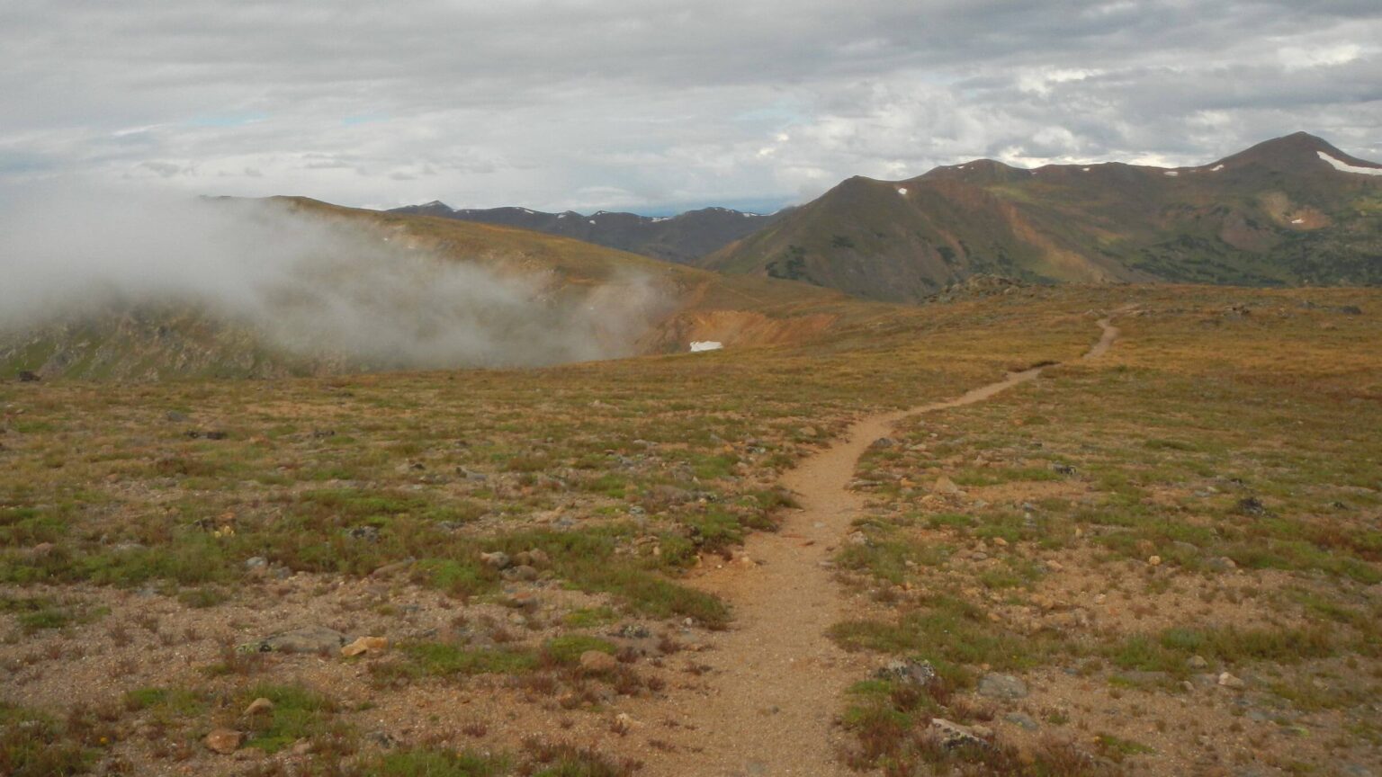
With gathering clouds on 13,000-foot Mt. Flora, we decided to camp at Berthoud Pass below—4 miles short of our next planned camp in a little drainage below Vasquez Pass. Trail from Berthoud would follow high exposed ridge and we didn’t want to hike in a late afternoon lightning storm; made more sense do it in early morning.
After dry trek start in late July, we had encountered much stormier weather in August. We’d been drenched several times by noon, afternoon, and evening showers.
We have a little history with rain in Colorado high country starting in 1980s during graduate school at Colorado State University. We once spent almost a week hiking in daily rain and being chased by crackling lightning on the Continental Divide in the Weminuche Wilderness near Durango. Another storm chased us completely out of 12,000-foot Lizard Head Wilderness.
We gave up summer hiking in Rocky Mountain National Park (Park) after a lightning storm trapped us behind line of hikers mincing down from 14,000-foot Longs Peak; another storm sent my sisters and us fleeing down switchbacks from Flattop Mountain. Our experience taught us to avoid high country after noon when morning heat inspired cloud buildup and violent storms.
On this 2024 trek, we trooped down Mt. Flora with day hikers, then turned aside to a spruce nook just off the Berthoud Pass parking area. This campsite sheltered us from periodic evening sprinkles. Next morning we awoke in predawn dark, breaking camp at 6:30 in light drizzle. Cars already parked in the big lot off Highway 40 indicated a few day hikers already on the trail. A couple about our age exited their vehicle and soon passed us as we hiked up gentle switchbacks.
A violent hailstorm overtook us. We threw on raingear but hail and wind were so bad we eventually sheltered in a cranny of stunted trees off the trail. After weathering the worst, we emerged into spitting rain and wild wind. We met several day hikers coming down, already chased out of the high country by the storm.
We passed the day hiker couple emerging from another tree shelter. They followed us and finally passed. The guy seemed grim and intent. I asked the woman where they were headed and she rolled her eyes. “With him,” she said and strode off to catch him. They slowly pulled ahead.
Rain tapered off but topping 12,500 foot ridge, violent winds threw me down. David caught up and pulled off my oversized pack cover—acting as a giant sail! We dropped down and skipped next part of Continental Divide Trail on 13,000 foot ridges in Vasquez Peak Wilderness. Periodic rain on Jones Pass Road; on far side a spruce grove camp sheltered from hard evening rain.
Colorado’s summer rains made hiking nicer than most of the dry, smoky West—but did not follow patterns we experienced in 80s and 90s when violent afternoon thunderstorms were the norm in western mountains. In 2024, we had clear skies most days, but rain showers half the time at almost any hour.
NCWT is 330-mile traverse in Northern Colorado connecting 10 wilderness areas, one-third on Continental Divide Trail (CDT) or CDT alternate route. Plan was to revisit 6 wilderness areas including Rawah, Comanche Peak, Rocky Mountain National Park, Never Summer, Indian Peaks, and Eagles Nest. We also visited Neota, James Peak, Vasquez Peak, and Ptarmigan Peak wilderness along CDT. Sizes ranged from 10,000 to 78,000 ac, except for Rocky Mountain and Eagles Nest wilderness area at 249,000 and135,000 ac, respectively. For more quick facts, visit Wilderness Connect for each wilderness.
Longest part of trek spent in Eagles Nest (8 days), intended to relive and extend a 1996 backpack (see map below). Next were Rocky Mountain National Park and Indian Peaks, about 5 days each. The rest were hiked through in a couple days.
Required camping permits shaped route through Rocky Mountain National Park (Park) and Indian Peaks wilderness and timing for entire trip (we got permits several months in advance, already too late for optimum planning). Park difficult because bear canister required for food. We minimized canister use by hiking in-&-out of Park to camp outside on Days05-07 (using some time to hike Neota Wilderness on Day06). We cached bear canister at Park boundary, used it crossing Park then left it at Grand Lake lodging for later pickup. We also did out-&-back hikes in Indian Peaks Wilderness instead of desired loop because permits unavailable for popular eastside campsites.
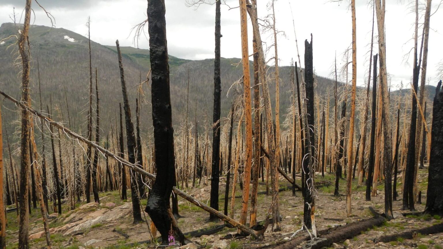
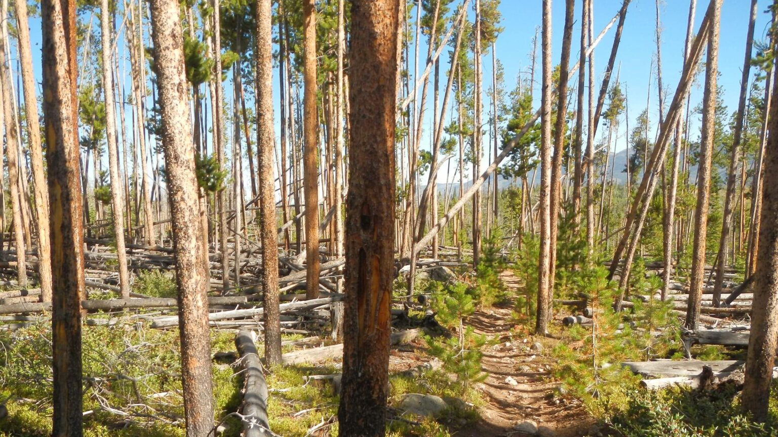
Fire damaged trails were not an issue. Only three fire scars were encountered (all 2020 fires, check last box on map below for details) and trails were well repaired/maintained in burn areas.
Trails well maintained throughout entire trek. Besides the fires, trek passed through some areas with tree blowdown and excessive tree mortality from bark beetles but logs well cleared.
Solitude was surprisingly high except near trailheads, at a few popular lakes, and on some mountain peaks. This was because visitors were mostly day hikers or a few backpackers clustered at popular lakes. We camped in view of another tent only 1 night of entire trek.
Supply stops were frequent (check first box on map below for details) because wilderness areas were relatively small and trek crossed many roads and passed some facilities on wilderness boundaries.
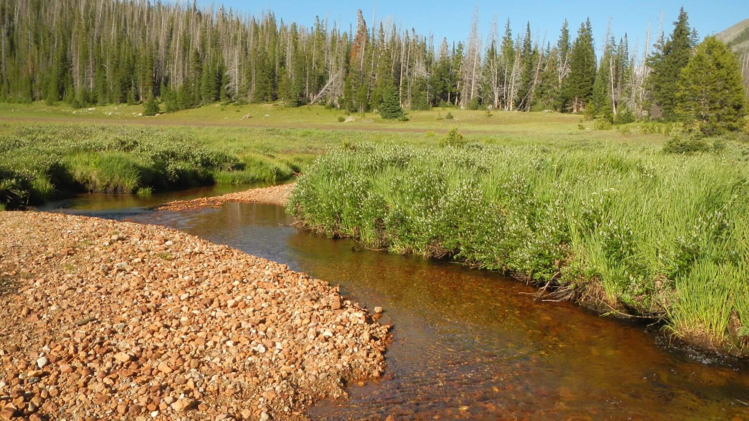
Elevation, weather, and water were influenced by being on or near Continental Divide most of trek. Campsites averaged 10,000 ft elevation and highest point was 13,275-ft James Peak. Weather was pleasant with scattered clouds or sunny most of trip; with no hot days. Only once (Day21) did we seek shelter from ridge-top thunderstorm and later that day altered route because of high winds. Other rainy days or nights were minimal; donned rain gear about 7 times for a few hours each. Little to no regional forest-fire smoke after first few days was huge plus. Water was generally abundant; all streams and springs on map were flowing.
Visit statistics: 32 days (including 7 nights at resupply stops), 330 miles hiking, at 2.0 mph, with 425 feet per mile of average elevation change. A 6-mi bus ride in Vail between trailheads.
Go to map below for more information on trailheads, daily routes, mileages, elevation changes, and photos. (Click on white box in upper-right corner to expand map and show legend with NAVIGATION INSTRUCTIONS.)
show more
Rawah, Commanche Peak & Neota: end to dry smoky summer
Summer in West was hot and dry with smoky skies. Maybe same in Colorado—our friend Dave reported 100 degrees in Fort Collins! But by the time we traveled to Colorado we had experienced a few afternoon storms and cooling temperatures.After a day placing food drops on the first part of our trek on Arapaho National Forest and near Rocky Mountain National Park (Park), we hit our first big thunderstorm on 12,000-foot Trail Ridge Pass in the Park on our way to Fort Collins. Clouds were gathering over adjacent Neversummers as we took a brief hike near top of pass; raining hard by the time we got back to our vehicle. Driving down through fog, we saw an elk herd calmly grazing in the rain.
We stayed overnight in Fort Collins with friends Marlene and Dave who also kept our vehicle for our month trek and drove us to our trailhead by Rahwah Wilderness! Dave also lent a map and regular weather advice via text during our trek.
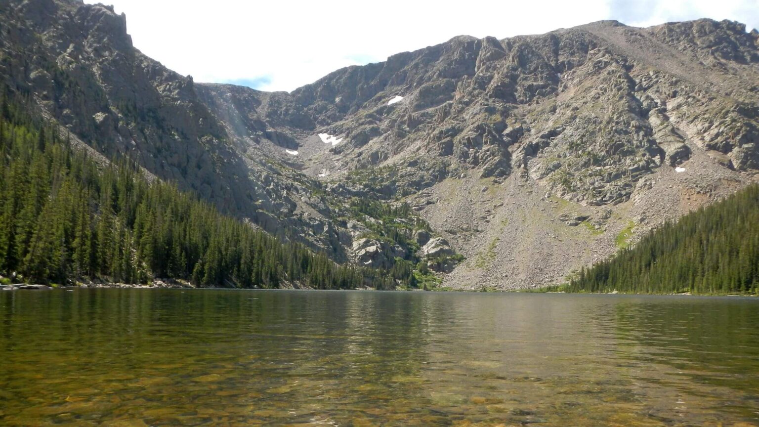
I remembered the Rawahs as wet and boggy, but no rain this trip and only damp trails crossing this mellow wilderness of lakes, grassy meadows, and creeks beneath a meandering ridge. Skies were blurry gray from regional fires. I also remembered hiker hordes but we only met two women backpackers and a dog doing a loop, one backpacker headed towards trailless lake basins, and a family near the Blue Lake Trailhead on Highway 14.
Heat and smoke vanished towards end of Day03. We’d left the Rawahs, crossed Highway 14 and hiked road to Peterson Lake. Biting flies required a stop for long pants and long-sleeved shirts. Heading down to lake we were hit by a storm and put on raingear. Rain quit when we reached trail at end of lake and retrieved our food from an undisturbed “bear bag” hanging in lodgepole pine off the trail. But the campsite David had picked (from Google Earth imagery) in a creekside meadow was too wet. We hiked down trail and camped in small pine flat—an old campsite indicated by fire circle remnant.
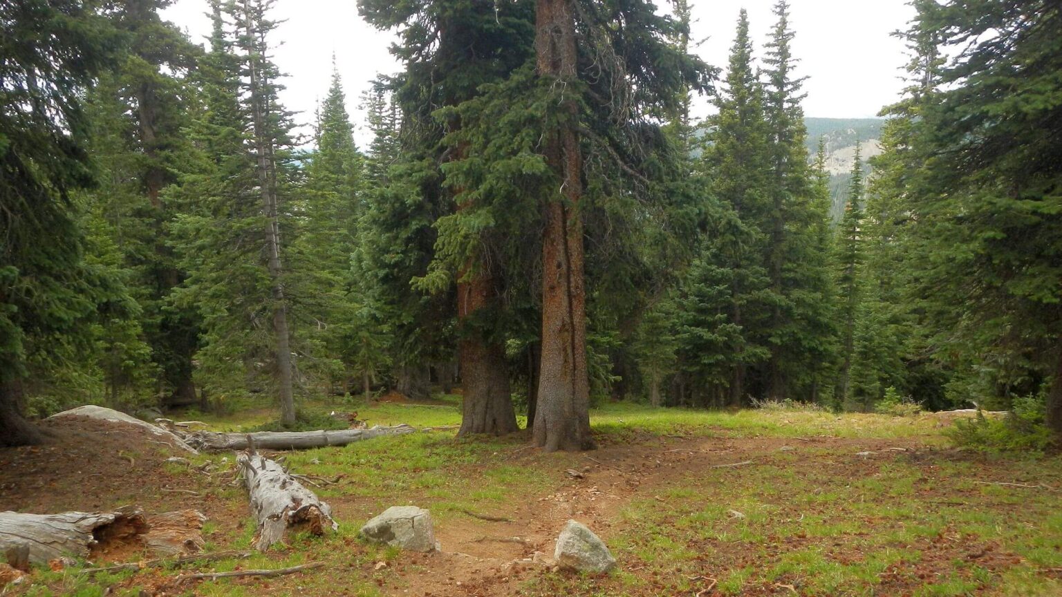
Other than thigh-deep crossing of Cache La Poudre River (bridge out) the next morning, we had dry day climbing into Comanche Peak Wilderness. The Mummy Mountains of high rolling balds was a 1980s backpacking favorite, offering solitude from crowds in adjacent Rocky Mountain Park. We saw no one as we hiked minimal trails marked by large sheepherder cairns (towers of rock) and camped early in an outfitter’s spruce niche, sheltered from evening showers.
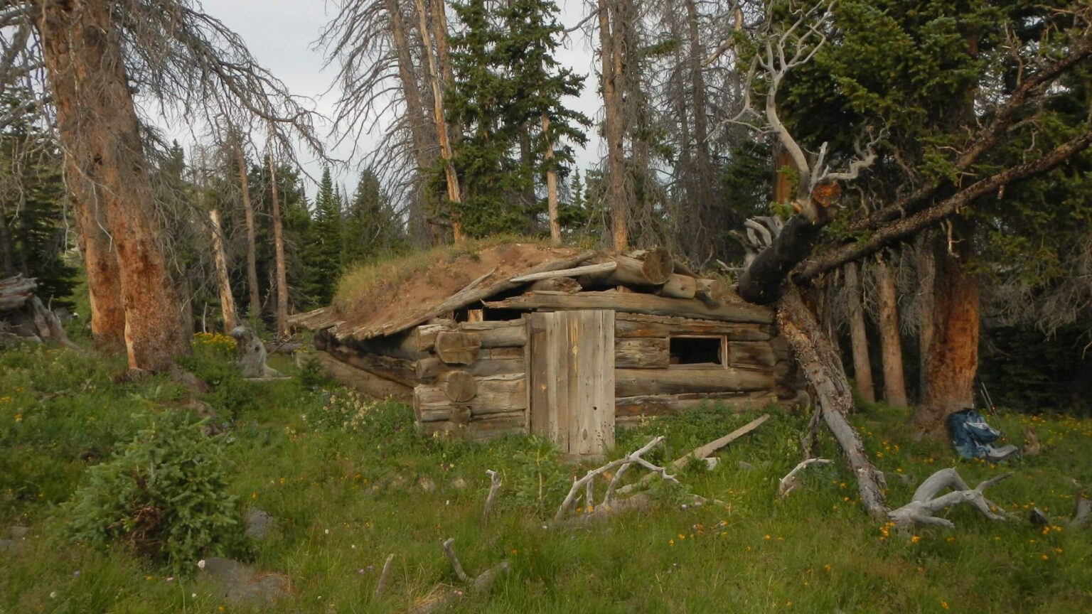
Blue sky morning to follow cairns up past a dilapidated sod-roof cabin, leaving Comanche Peak Trail to hike cross-country up a ridge; then down a basin to drop to Mirror Lake on wildlife route—which David liked and I did not. Now within Park, we hiked trail past several unoccupied campsites (all requiring reservations & booked when we considered reservations). Showers arrived just after lunch break; dressed in raingear we met two groups headed to lake so 2 sites used. Also met group of guys planning to camp on nice “camps at Hague Creek” not marked on map nor listed as Park campsite but signed from trail. More anglers and day hikers passed our campsite just off Corral Creek trailhead back in Comanche Peak Wilderness.
A clear morning for road hike around Long Draw Reservoir. On short trail into Neota Wilderness, we met several day hikers, retrieved a food bag, and set up camp in trees. After breakfast we explored Neota another 1.5 miles to trail end. On return met guy with a fishing pole and black lab who said he was “looking for wildlife.” Hard rain hit at camp so we hung out in the tent, then emerged to make dinner. Violent rainstorm later that night.
Neversummers: stolen water & backpackers
In the early 1980s, we hiked in rain all day on road along what probably was the Michigan Ditch along west side of Neversummer Wilderness (closer to Highway 14). This time we hiked Grand Ditch on Park side. The soaring Neversummers—where clouds often gather to rain on the Park—are headwaters of the Colorado River. Streams tumble into the ditch to fill Long Draw Reservoir and send water via Cache La Poudre River to eastern Colorado farms. One of many “trans-basin diversions” in Colorado mostly developed in late 19th century.A large truck passed us. The Water Supply and Storage Company, which has operated the Grand Ditch since 1891 uses the road for ditch maintenance. We were surprised to see buildings, overnight residents, trucks, and caterpillars on a “cherry stem” (exempted from wilderness) road.
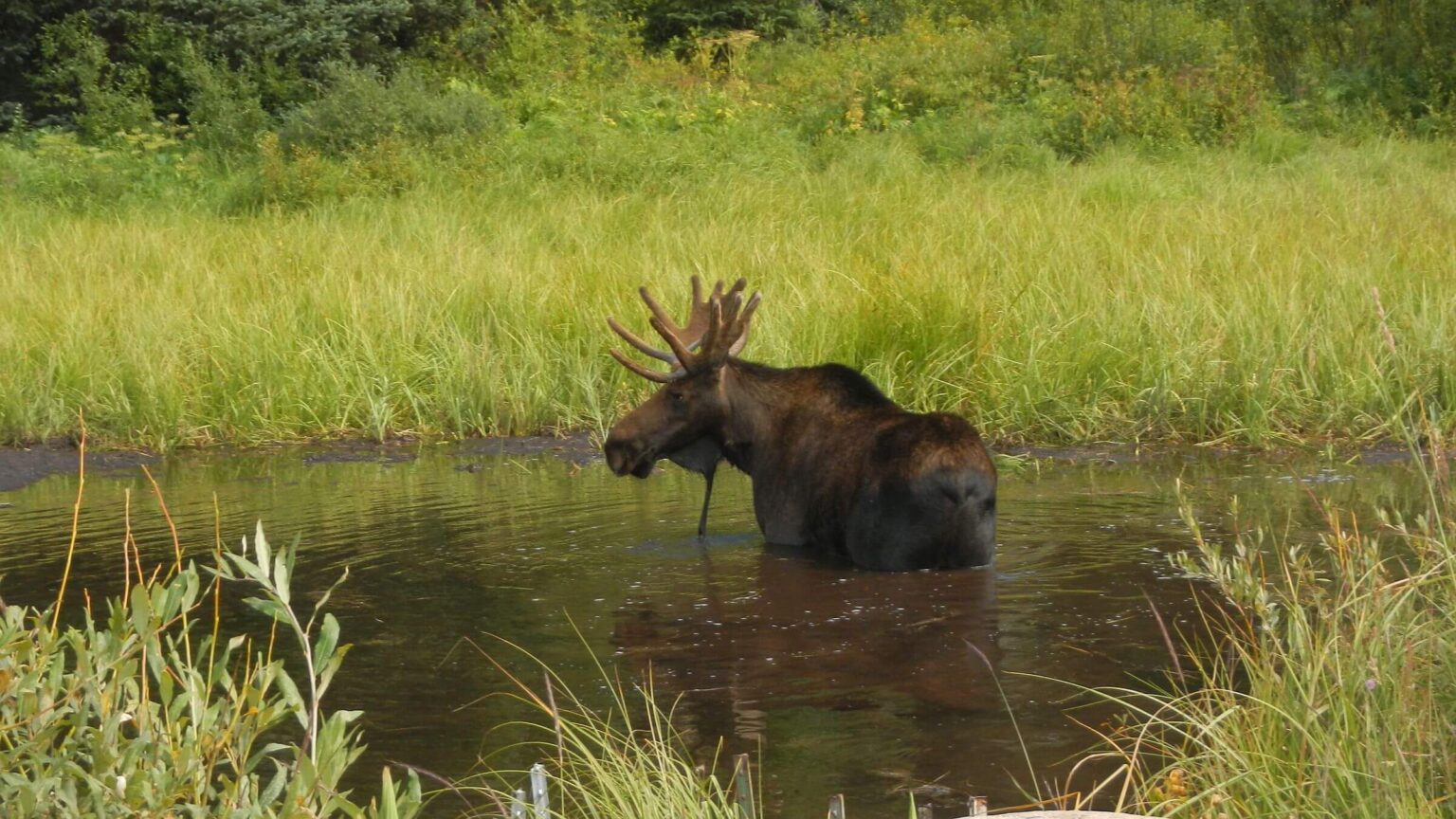
We wound below the peaks and basins, passing waterfalls and a few bridges for trails into the basins; saw our first moose standing in the ditch. We met a couple with backpacks emerging from Lake of the Clouds on ditch bridge. Another bridge and stiff climb up side trail led to one of many unused Park campsites to cook breakfast, dry gear in stiff wind and enjoy valley views and a friendly doe.
After leaving Grand Ditch and Park, we started meeting people: a day hiker returning from Parika Lake, and next morning two women breaking camp at lake (we camped a mile below).
Wind was horrendous on pass above Parika, lesser for long drop into basin and gradual ascent to Bowen Pass, passing a turnoff where Continental Divide Trail (CDT) continued north. We skipped direct trail to Bowen Lake and wound around on Cascade Mountain ridge—stone markers, minimal trail, and wild wind. Only into Bowen basin did wind abate slightly. Surprised at many tents, we dropped below lake to camp. Met a young woman whose trail crew were some of the campers. Next day we met the trail crew and backpackers doing various loops; and played tag team with the Parika campers who camped at Bowen Lake.
At Park boundary David retrieved our bear canister. He had crammed it partially under a log with several rocks piled over it. Good thing because something—likely a bear—had moved a couple rocks. We hung several “bear bags” during our trip and only the bear canister was disturbed!
Rocky Mountain Park: empty camps & rules
The Rocky Mountain Divide Loop includes 28 miles of CDT rarely used by CDT trekkers but popular for short term backpacking trips within the Park. Trekkers following the 3100-mile CDT from Mexico to Canada often take a 9-mile shortcut from Grand Lake to Bowen Trail, eschewing Park rules for bear canisters and mandatory campsites.David had trouble finding available campsites online for Park loop so we were surprised to see many empty campsites along the way. Our first night in Park we camped alone at Onahu Bridge; 17.5 miles later, same experience at North Inlet Falls. We suspect most sites are reserved way in advance (only way to get them), and then life happens and plans change.
Official campsites were rather ugly with highly compacted soils and vegetation denuded as Park requires camping only in a few limited sites and does no site management like rest rotation.
We met 16 backpackers, most hiking our loop in the opposite direction. Two guys with light packs caught us at water stop where they had dropped down from Haynach Lakes Trail to Tonahatu Trail we were on. They were doing the Pfiffner Traverse a 75-mile trek along Continental Divide from Trail Ridge Pass to Berthoud Pass through Park, Indian Peaks and James Peak wilderness. We also were passed by day hiker and a woman trail runner doing 24 miles of the loop in a day.
We met moose on both ends of our Park loop. We left Onahu Bridge early for long day; packing up by headlamp, we saw shining eyes of a moose foraging by our camp. That afternoon on endless switchbacks down to North Inlet another moose saw us and trotted ahead down the trail before heading uphill so we could pass.
Next day we met countless day hikers from resort town of Grand Lake; the CDT goes right through town with large monuments welcoming thru-hikers. We hiked straight to a local restaurant for a giant meal to start our 1.5-day layover. Met several CDT hikers—one short cheery 20-something said she’d crossed Gila River in New Mexico—chest deep for her!
Indian Peaks: weekend hordes
Our hike to popular Indian Peaks Wilderness followed CDT around Grand, Shadow Mountain and Granby lakes past hikers, boats, onshore boat picnickers and barking dogs; we also met northbound (NOBO) CDT trekkers. A brisk SOBO passed us after we returned from wrong turn; she said something as she jogged by. A laidback NOBO with trail name Early Worm—“I get up early and take my time,” he explained—said the trail runner was logging 40 miles a day!We camped on windy ridge above Lake Granby and met 2 more NOBO trekkers planning to make the 11 miles to Grand Lake that evening!
Steeply descending and climbing CDT along ridge then road hike through campground finally got us to Monarch Lake—trailhead into Indian Peaks—swarming with hikers (I counted 45-50 backpackers, 7 dogs and 15-20 day hikers). We were meeting the weekend crowd coming out.
In the 1980s we rarely saw anyone in the Indian Peaks. For this trip, David could not even get a campsite on the popular east side so we did out-&-back hikes from west side, nixing a loop over Divide. We set up base camp at confluence of Buchanan and Crater creeks.
First day we got as far as Gourd Lake up Buchanan drainage, dodged showers and met a couple. Next morning we hiked rocky trail up spectacular Cascade Creek named for its stupendous waterfalls, meeting streams of backpackers from overused Crater Lake (we skipped, in retrospect we also missed view of dramatic Lone Eagle Peak above lake) and some who came over Pawnee Pass from east side. We’d hoped to make it to pass but ran out of time, returned to our camp, packed up, and made late breakfast in rain as hikers trouped past us.
Crowds down Buchanan Creek but brief solitude after turn on Arapaho; we sheltered in hunter camp in spruce from the rain. Next day on way to pass we met 3 groups and dodged a storm, took rocky old road through series of wet basins before descent to North Fork Middle Boulder Creek, camping below Diamond Lake. East side access from Fourth of July (Mine) Road meant many people: families at Jasper and Devils Thumb (named for formation that looks like crooked hooked finger) lakes.
We tag-teamed with backpacker finishing his loop through basins and back on High Lonesome Trail, and were passed by trail running couple bounding up incredibly steep trail to ridge. There we met couple with dog huddled in rock shelter, two women backpacking loop from King Lake, day hiker racing, and one serene CDT hiker in toe socks and sandals who had come from other side of James Peak (our next day’s destination).
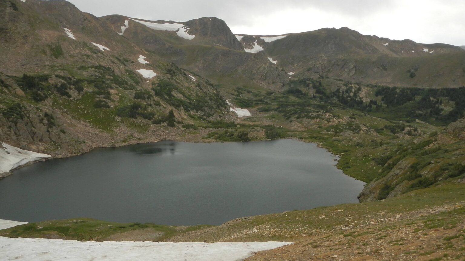
Just before Rollins Pass we dropped to barren 12,000 foot King Lake, last stop in Indian Peaks, meeting angler headed back to his vehicle parked on road. We camped in stunted spruce-fir below treeless lake and found side trail to outlet and lovely smaller lake for water.
James Peak: funky fog & grumpy bull moose
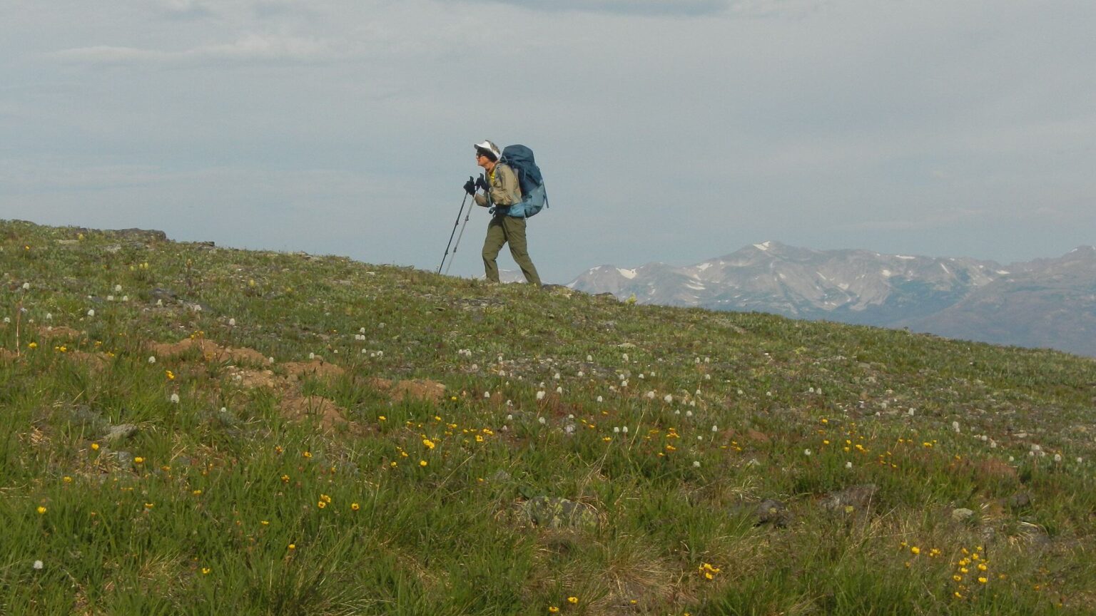
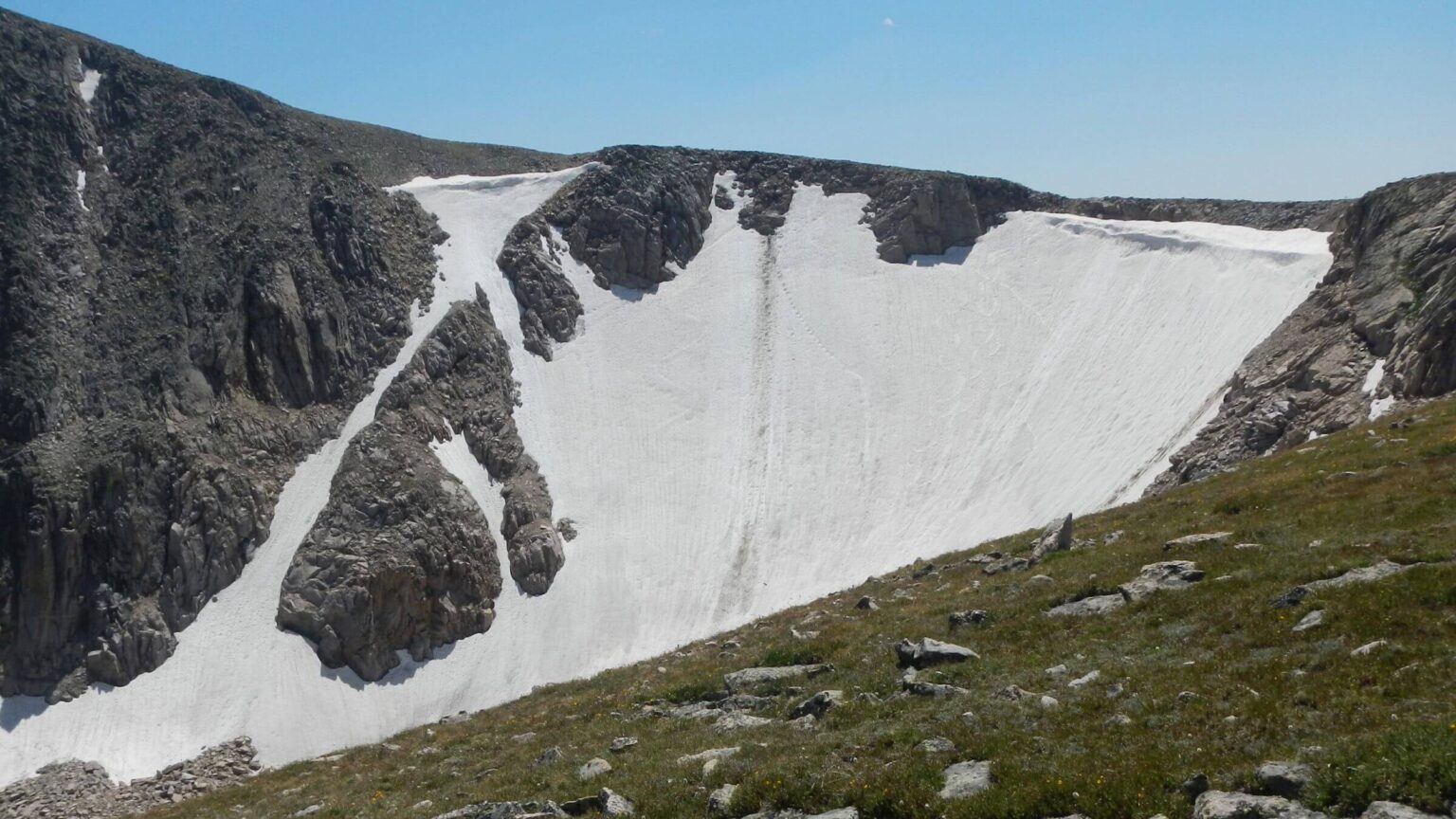
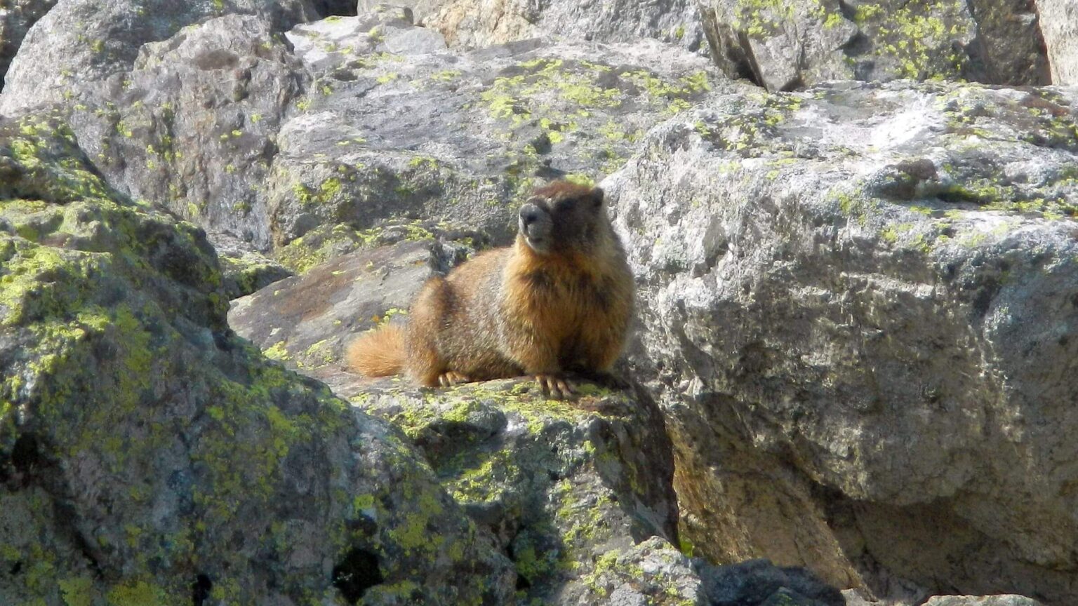
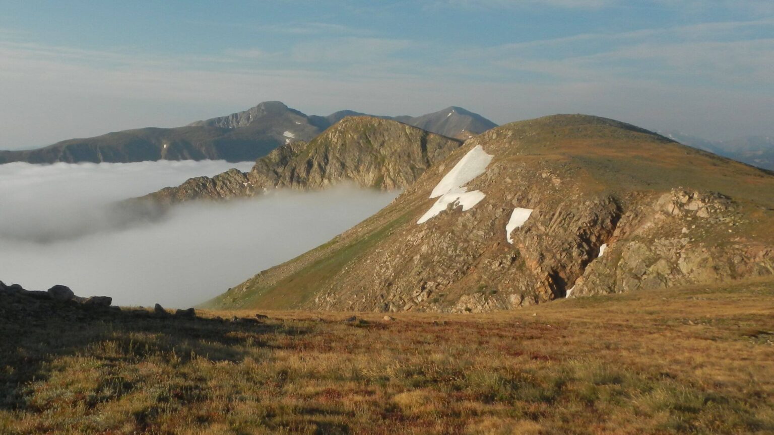
We started early from King Lake, unnerved by thick fog blanketing valley below. On CDT, a route through alpine terrain marked by poles, fog licked at the ridge and obscured views of lake basins below until Rogers Pass where it broke to reveal Iceberg Lakes. Up steep James Peak trail, marmots scattered; a large golden-brown critter galloped ahead on trail. Pikas dashed away while a hen ptarmigan and half-grown chick, brown for summer, sat tight.On windy cold James Peak two day hikers joined us briefly; most people come up gentle switchbacks from St. Mary area. Rocky switchbacks became mellow road and I saw reservoir and vehicles in the distance. David found shortcut trail to St. Mary’s Glacier—now just a snowfield but popular with visitors. His trail ended at glacier; we skittered across and slid down rough route to a small lake where official trail took off in switchbacks through woods.
Then fog became violent thunderstorm! We slipped on raincoats but David didn’t want to take time for rain pants and gloves—mistake! I froze as we scrambled shortcut to road into Silver Lake—our next layover destination. Road flooded at bottom so we went up and around to lodge. Around the corner a large bull moose stood in middle of our path. His back hair was bristling—not happy! We backed up a side road and waited until Mr. Moose moved on. A mile later we stepped into the heated hall of Silver Lake Lodge.
Our hostess Margaret offered tea and promise of dinner; hot bath made everything all right. Next day was rainy, enjoyable from inside the rustic lodge; during brief clearing we hiked to Silver Lake to check out Glacier Trail we had skipped. The village charges $25 for trailhead parking!
Vasquez & Ptarmigan peaks: path less taken
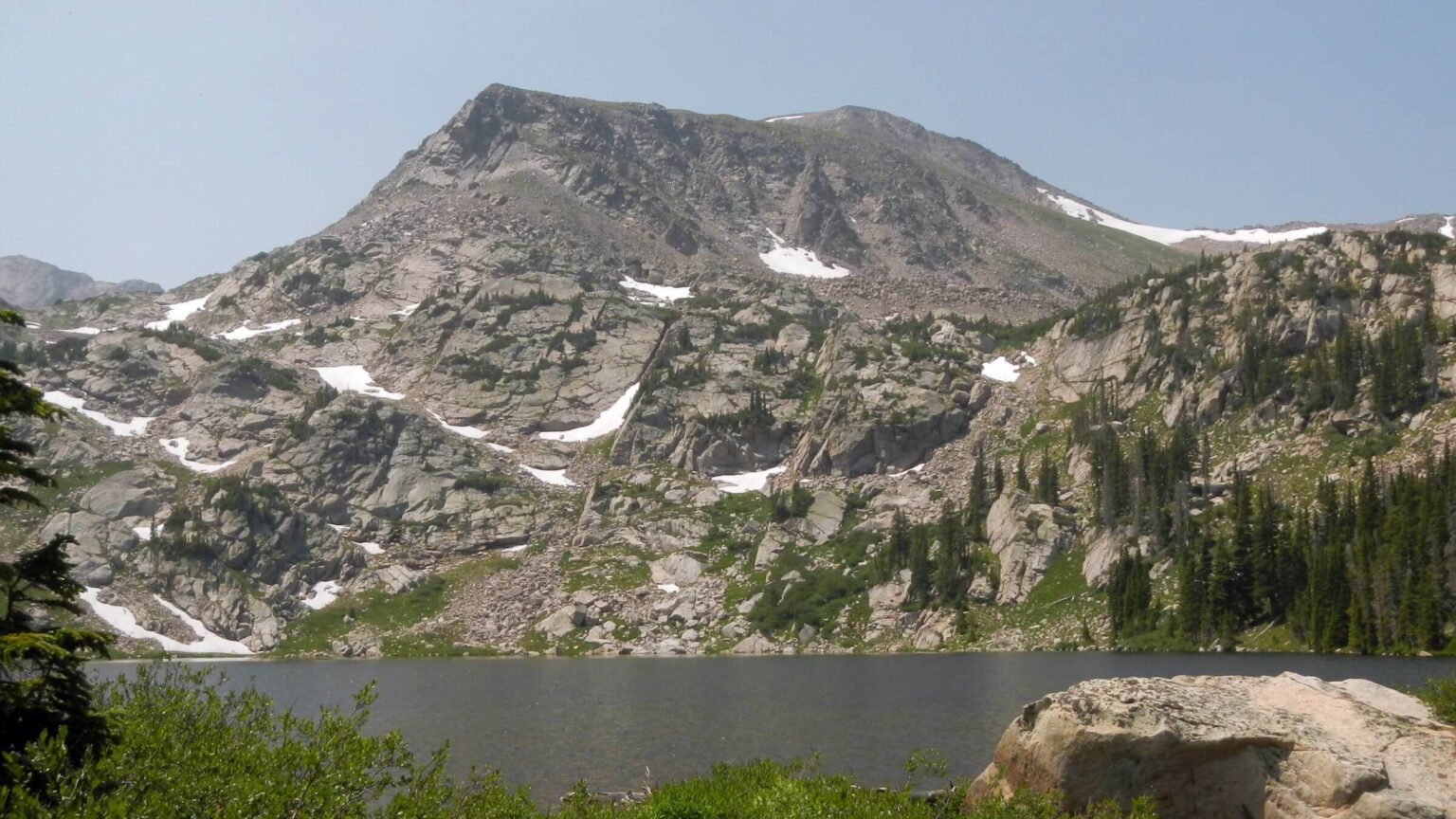
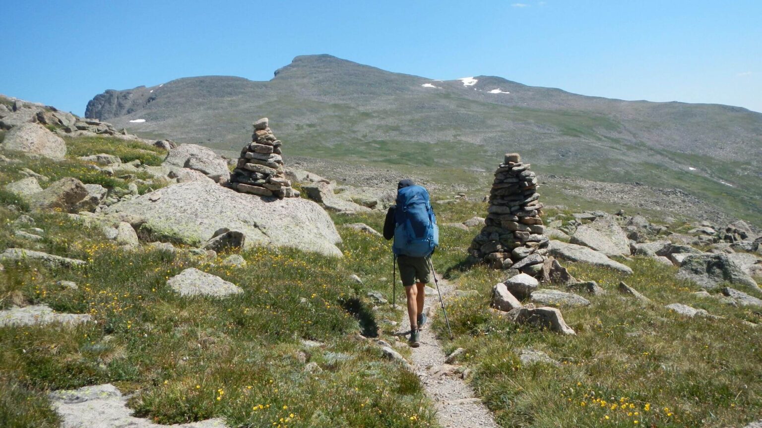
A maze of roads got us back on CDT following excellent Mills Ridge Trail—outside wilderness, well-constructed and maintained with power tools (huge difference for worse at wilderness boundary). We passed Tom Mill Lake, shallow reservoir with a parallel road and parked ATVs; then switchbacked on well-placed flat rocks through huge scree section, climbing then contouring around Breckinridge Peak with view of beautiful lakes below, with final climb to 13,000-foot Flora Peak to meet many day hikers up from Berthoud Pass.Our early camp at Berthoud aimed to avoid rain got us opposite result: rain and high winds next morning! We decided to skip most of Vasquez Wilderness to avoid high ridge route of CDT, dropping to Jones Pass Road by the horrible sprawling Henderson Molybdenum Mine complex on wilderness boundary. We hiked up road to pass in periodic showers passed by many SUVs; dropped down long road into Bobcat Creek and sheltered in burned spruce from more storms.
Our foray into Ptarmigan Wilderness followed apparent outfitter trail fluctuating good or poor on a very cold frosty morning. We stopped at first meadow opening to dry our gear.
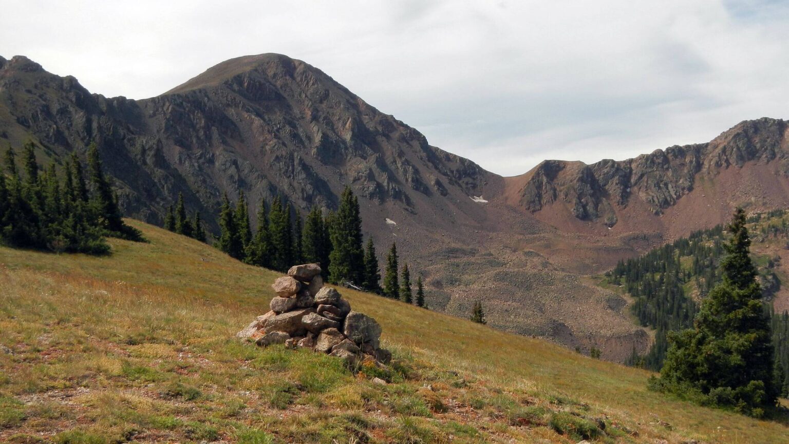
On pass above us we saw 2 backpackers and puzzled what loop they were doing in this obscure area. Good switchbacks to a saddle and unsure route along a ridge several miles adorned with big cairns. Multiple routes, poop, minimal grass and eroded soil indicated heavy domestic sheep use.
Long drop to South Fork of Williams Creek where main trail continued down creek; we stopped to camp at junction to Ptarmigan Pass. Next day quixotic trail to pass with good switchbacks disappeared in sections. At pass we took a contour trail rather than the one over Ptarmigan Peak because of impending rain; peak might have been better as contour trail sketchy and ended in a third mile cross country trek to ridge trail. But nice views, springs, and campsites.
Near wilderness boundary we met a day-hiking couple. Without really studying GPS, we dropped down better traveled trail on switchbacks, but it was wrong one! Backtracked to rocky road heading directly to Silverthorne. Rain came and we suited up. Confusing route down.
We missed another junction. David led us on horrible shortcut through hardwoods and brush to meet wide steep trail ending on a road. We found a connector trail behind a house that led to Ptarmigan Peak trailhead with kiosk and many cars of hikers we had not met. Another mile of paved road and two cold wet hikers gratefully entered hotel lobby for next break. Decaf coffee won my heart instantly; in-room jacuzzi also helped.
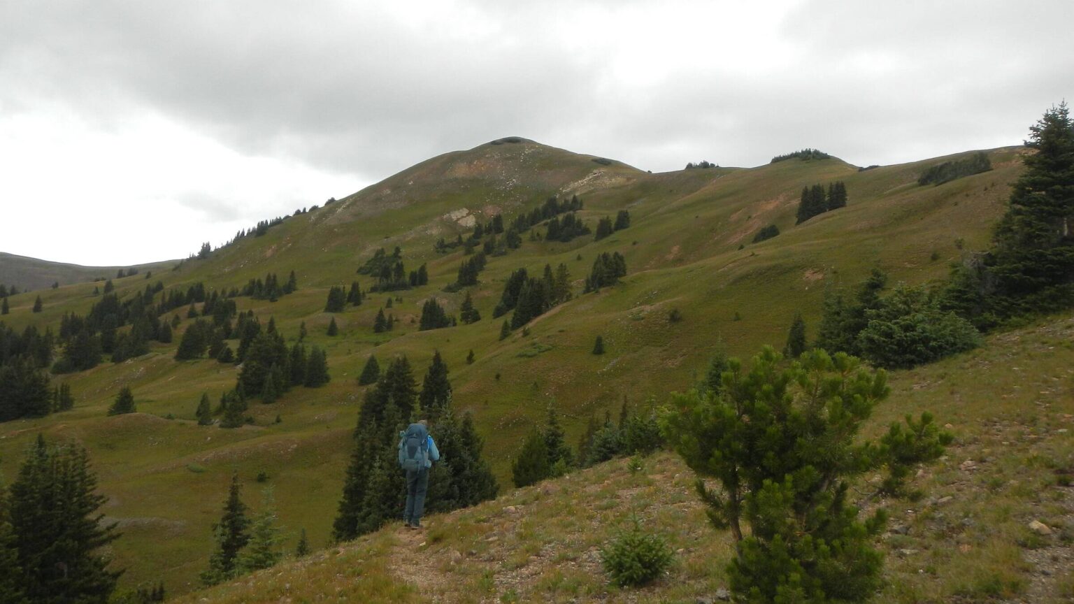
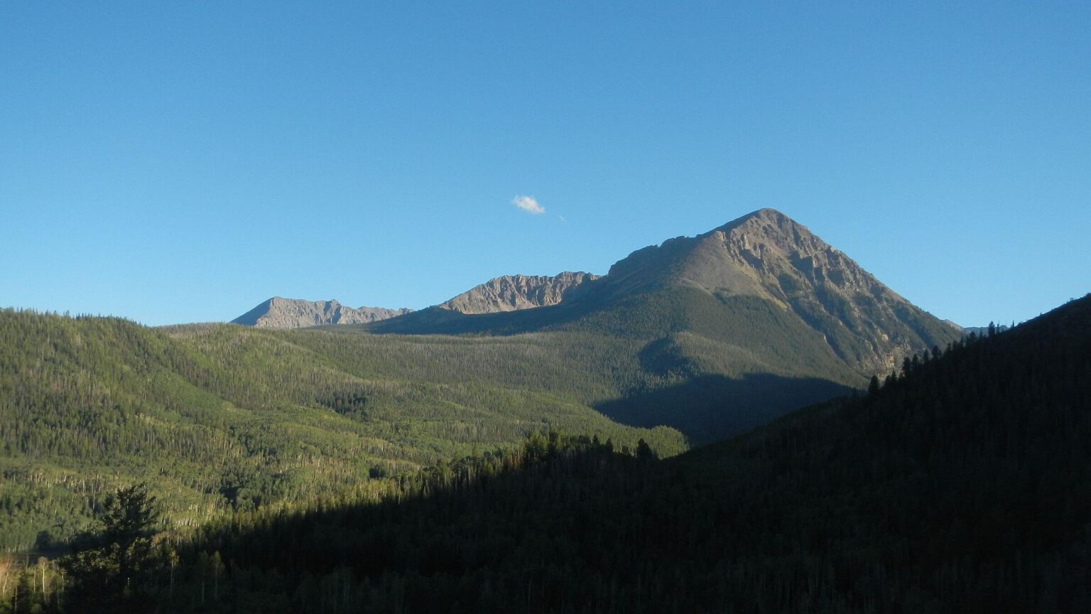
Eagles Nest: CDT alternate & surprising solitude
Eagles Nest Wilderness encompasses Gore Range named for a horrible European famous for slaughtering wildlife. In 1996 we first visited the area from Indiana, flying out and renting a car in Denver. We drove to Silverthorne and left car at Meadow Creek Trail (near I-40), hiked part of Gore Range trail, went up Slate Lakes Basin, ascended ridge on route (following an Outward Bound group) and descended Booth Creek to catch free Vail area bus along Interstate-70 to Gore Creek trailhead to finish a loop (see map below).Our 2024 trip was planned for longer loop on Gore Range Trail. We hiked bike path through Silverthorne to a park/soccer field and caught the Mesa Cortina Trail into Eagles Nest. Met day hikers and CDT hikers—latter surprised us as main route follows Continental Divide to the east of Silverthorne. We then learned that our Jones Pass route into Ptarmigan Wilderness was a CDT alternate allowing resupply in Silverthorne! The trekkers followed Gore Range Trail west and south to rejoin the main route on south side of I-70. That is probably why we saw backpackers ahead of us on way to Ptarmigan Wilderness.
We left CDT route heading northwest on mid-slope trail on back side of Gore Range ridge with views of farmland far below. First few miles were ugly lodgepole blowdown; a day hiker told us that happened about 10 years ago. We met backpacking couple returning from Willow Lakes basin and two Forest Service trail crew guys whose work sawing logs was evident for several miles. We took a poor trail up to marshy Boulder Lake for camp.
Next day a backpacker headed to Slate Lakes was our only contact as we followed undulating trail through basins and along grassy creek sides. A long drop to Black and Blue lakes, reservoirs with road, cattle and many cow pies. Poor route across basin and trail up far side was thin and washed out. Got to shallow Surprise Lake at sundown. Many campsites, all to ourselves!
Solitude ended the next day. Gore Range Trail continued north; we turned onto rocky Cataract Trail and met 13 backpackers coming down from Cataract Lake, deserted when we got there. Continuing up basin we met two groups of guys, one doing loop from Elliot Ridge and the other from the Piney Lake/Soda Lakes Trail we encountered the next day.
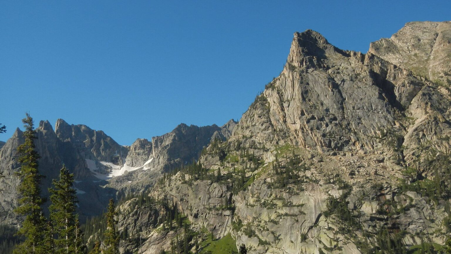
Cataract Trail worked its way up and down windy ridges, and passed by Heart Lake and Eagles Nest Peak, the wilderness namesake. Gentle climb to head of Cataract basin and camp in spruce just below Elliott Ridge. On evening stroll we saw a momma moose wading in a tarn; her baby napping on the shore. Youngster saw us, got up and swam to momma! More rain that night.
Gentle ramble over Elliot Ridge and road down to Meadow Creek Junction. We took most direct route—Piney/Soda Lakes, an awful trail clambering up and down many basins then contouring forever on brushy trail above Piney Creek, finally to junction of Upper Piney River Trail and wide path to Piney Lake, a big water body 12 miles by road from Vail. Passing boaters, boarders, swimmers, hikers, and sun-bathers, we joined crowds for burgers and beer at Piney River Lodge. We noticed scantily clad young hiker couple at lodge who donned sweaters in the shade.
Hiking road from the lodge, we stopped with several motorists to snap photos of a big bull moose and cow in wetlands by the road; unperturbed by all the attention.
We camped on ridge top in aspen trees out of sight to a camp with big tent, truck, and motorcycle. I heard engines in the middle of night and camp abandoned the next morning—maybe they had to get to work in Denver Monday! Nine-mile road hike into Vail for our last resupply break. First stop was a breakfast café where all the staff enthused over our backpacks! Everyone loved hiking. We met the young hiker couple from day before—they were celebrating anniversary of wedding at Piney Lake!
Last leg: free bus, steep climb & goat invasion
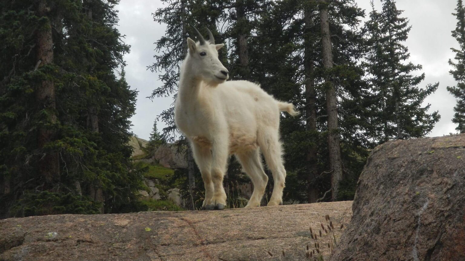
We again finished our trek with free bus from Vail, going to end of its route along I-70 a half mile shy of the Gore Creek Trailhead where we also reconnected in 1996.Rocky, heavily overused trail. We took steep side trail to Gore Lake, met 14 hikers scampering down, some with dogs, and trail runner bouncing from rock to rock. One girl with dogs said, “the goats chased me and I ran away!” Lovely Gore was a mirror ringed by red ridges. White mountain goats ambled by; I snapped pics of nanny with kids.
Other backpackers had best camp nestled in spruce flat; we made do in another nook. Soon we had visitors! Some 15-20 goats made forays from large rock just above camp: adults, kids, and adolescents. We ran at them, yelled and rattled Sierra cups, fearing they would knock over our tent. After David roared at them, throwing rocks, they backed off and suddenly the whole herd took off for the higher ridges. Storm clouds were gathering and we think they had rock shelter up higher.
We broke camp early in morning rain. Much nicer and faster bopping down the trail, a series of short drops and meadow sections. Rain stopped at junction but I left my rain pants on for wet grass along the creek trail. Very windy on Red Buffalo Pass; we huddled in brush out of wind.
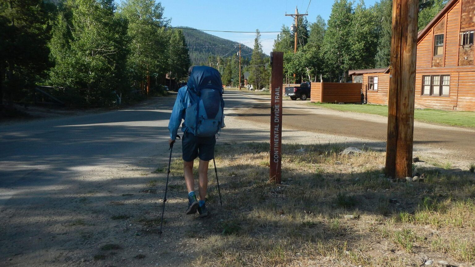
Descending into a basin we saw CDT heading off to another pass from unsigned junction. We went down Willow Creek Trail crossing many side drainages and passing trails to Buffalo Peak, apparently a popular day hike. In the flats we camped in mix of lodgepole and aspen blowdown way too close to trail, getting stares from passing hikers. Rained off and on during night but only sprinkles to break camp and hike last 4 miles back to Silverthorne, meeting large group of young people and other morning hikers. We hiked right into town to pick up a one-way rental car for trip to retrieve our vehicle in Fort Collins, ending 330 miles on foot! No rain the rest of the day.
show less
Google Map
(Click upper-right box above map to “view larger map” and see legend including NAVIGATION INSTRUCTIONS; expand/contract legend by clicking right arrow down/up.)