
(For above slider, click photo & caption will appear below) I wanted a minimum 70-miles of backpacking to celebrate my 70th birthday. When David had reached this milestone in 2021, he took a 70-mile solo trek on several trails in the Rincon Mountains east of Tucson.
I couldn’t go. Just out from my first knee replacement surgery, I was the reluctant trail chauffeur, dropping him off at Douglas Spring trailhead (his favorite from late 1970s) and meeting him 6 days later on the Arizona Trail (AZT) above Molino Basin. It was my first hike since November 1 surgery and I was pleased to hike four rugged trail miles without difficulty.
So 2025 was my turn for a birthday trek. Since Arizona was in drought, and I sprained my ankle on dry slidy soil during our last trip near Tucson, I suggested a wetter area. We agreed to hike across part of the Los Padres National Forest near Santa Barbara, CA. Unlike Arizona, South Coast had big rainstorm in January. California’s very wet winter of 2023-2024 had also recharged many springs so there would be ample water, local contacts told us.
David planned a 108-mile hike from west to east on part of the 400-mile Condor Trail across forest. We would cross San Rafael, Dick Smith and Sespe wilderness areas and three ranger districts: Santa Lucia, Santa Barbara, and Ojai. I was a district ranger in Santa Barbara in 2007-2009 and we hiked part of area twice: once in 2008 to check out burn scar of the 240,000 2007 Zaca Fire and a 2009 follow-up; both trips through badly burned pines. This trip would be a homecoming.
A late change in weather forecast showed second rainstorm to hit two days into our trip. Our first four days had many stream crossings—first Manzana Creek and then Sisquoc River before climbing to Malduce Peak pine country. I suggested instead going upstream on Manzana to higher ground to possibly hike in snow rather than rain in river country. David wanted to stay the course but get to South Fork Guard Station, a cabin, on evening of worst rain day.
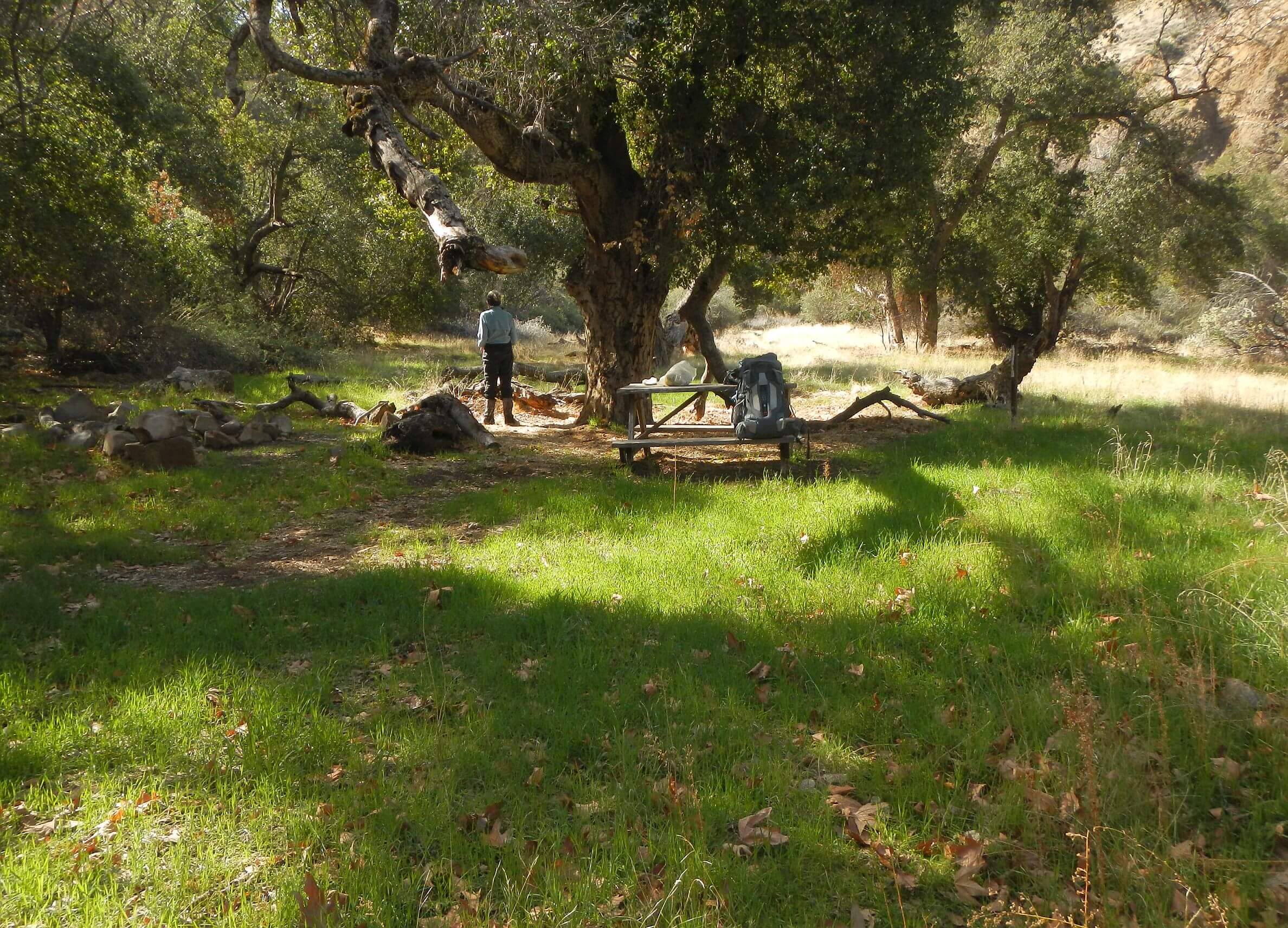
We drove from Tucson, spent a couple nights on the road then drove into the forest February 11. We left a bear canister with food resupply at Tinta-Deal trail intersection and took windy road to Gene Marshall-Piedra Blanca trailhead, end point for our trek. We had ride arranged with company that ferries mountain bikers around the forest; 2 hours later than planned because of road construction stops, we were ferried through Ojai and Santa Barbara to our starting trailhead on Manzana Creek; a three hour drive. Robert, our laid back friendly driver was grateful when we treated for lunch along our route. Near our drop off at Davy Brown campground, we passed a guy hiking; he said his car was stalled up the road. Robert offered him a ride to town after he dropped us off.
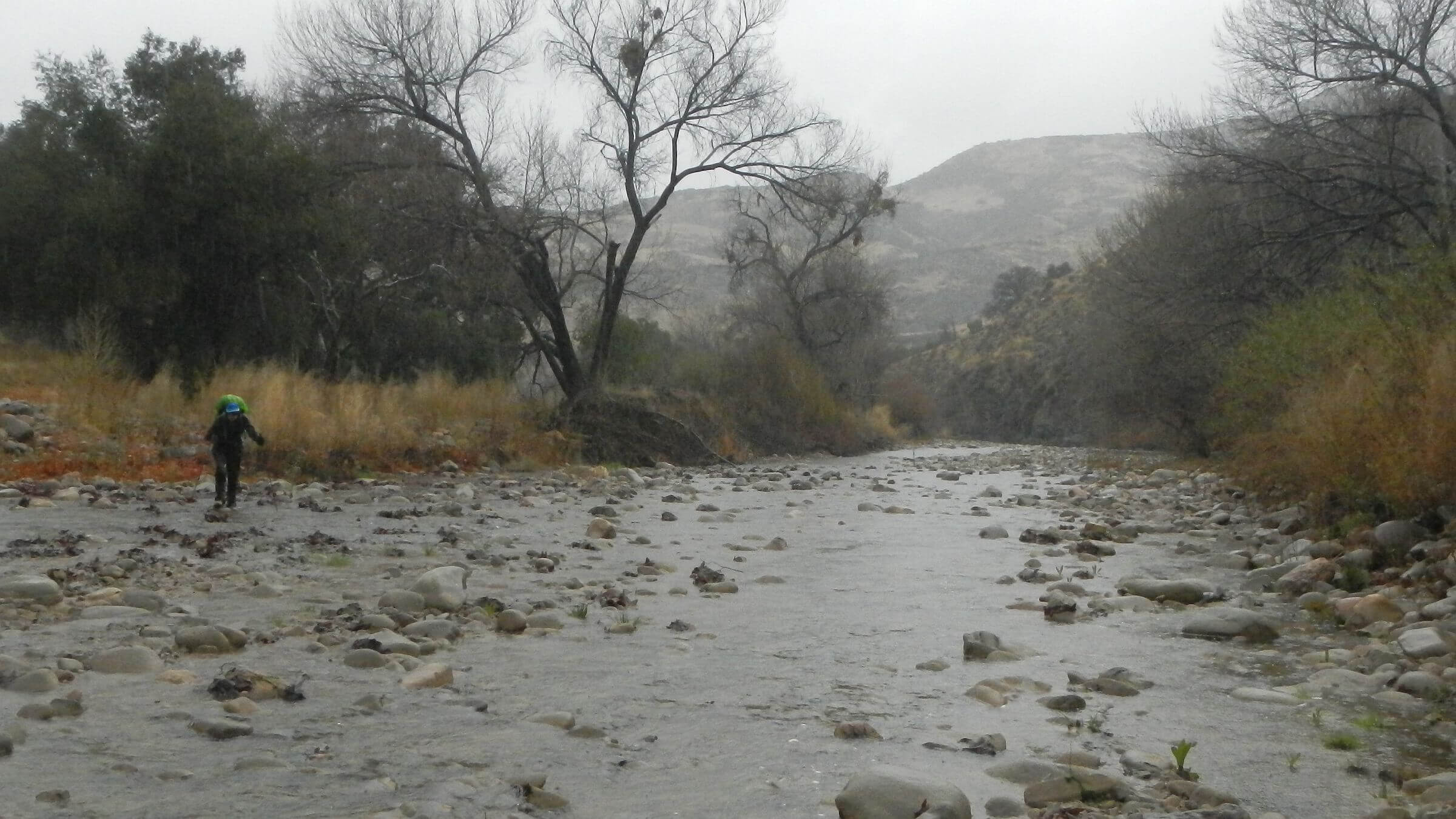
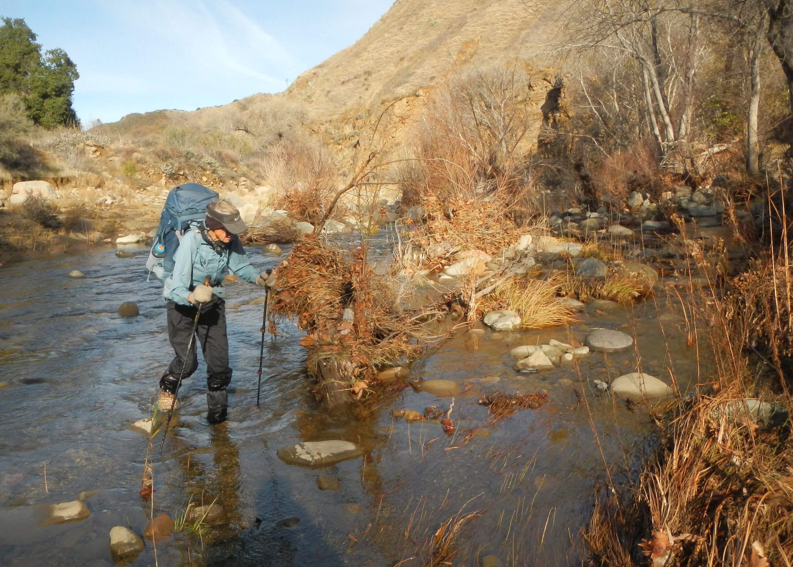
We were prepared for creek hiking with Sealskinz insulated socks and gaiters so didn’t mind many Manzana Creek crossings that afternoon. We pushed on past beautiful Cold Creek Camp. We camped in less pretty area but compensation was male and female owl calling back and forth. About 1 a.m., rain started. We broke camp in drizzle and put on raingear for the hike.
Infrequent showers on the Manzana and later on the Sisquoc, a broad ankle-deep river in a big river valley. Mostly cloudy for the afternoon and even hot in my Sealskinz when the trail contoured high on the bank for a couple miles. River shallow enough we mostly crossed on rocks although one turned under my foot and got my boots very wet. Camped under big oak.
Third day much rainier and colder but river still fairly clear and shallow for crossings. Late morning another rock flipped with me and this time I fell completely into the river! Not happy but my wet wool sweater under raingear kept me relatively warm. David and I were fantasizing about getting to South Fork guard station open to the public with a wood burning stove (but unlikely since we had lost a couple hours the first day waiting for our shuttle ride).
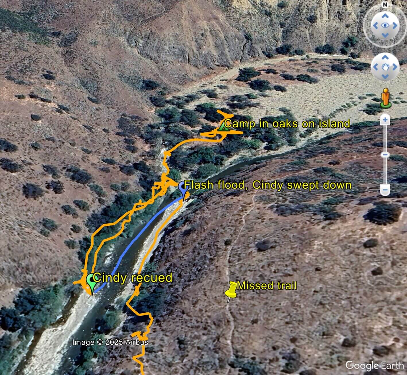
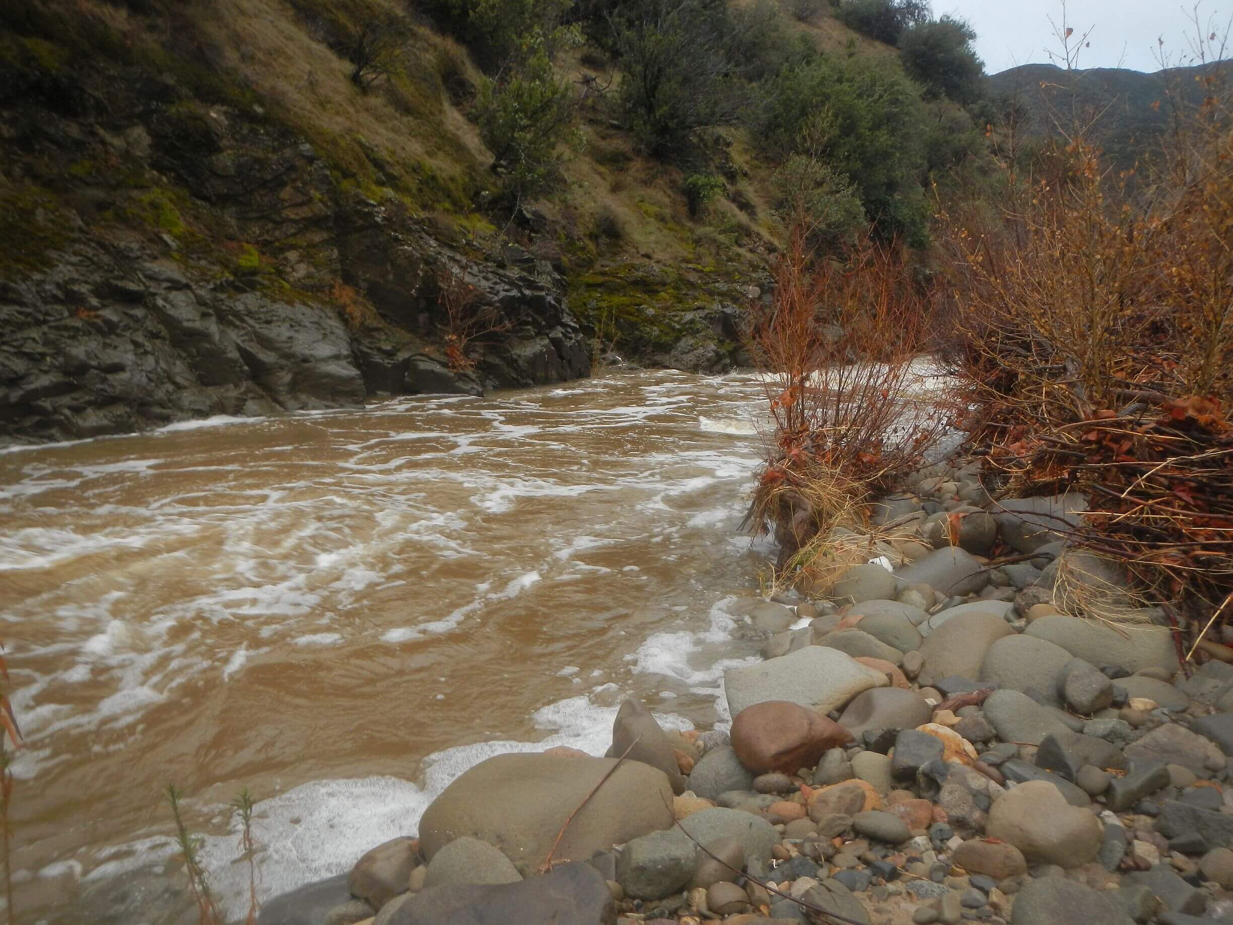
Midday the trail made big contour up a drainage, then we followed a thin slick muddy route clinging to the cliffside (later realized we miss switchback on actual trail going up bank, not down, and took game route to river. It dropped abruptly to a gravelly point bar (inside of river bend) to cross. At first point bar was just rain pools in gravel.
Midway across, flash flood hit. David saw it coming, a sudden surge of muddy shallow water; I did not but suddenly I was enveloped in roaring, waist deep water. Flow was so powerful I could not move despite David’s frantic “go upstream!” I took a step—the current immediately swept me down river on my backpack.
Strangely calm I tried to steer my craft towards shore but current was faster there. Finally I felt rock under my back and sat. I had been carried to some shallows. I tried to get up but pack swung off my arm and set me off balance.
As I was considering how to get up (taking off the pack would be disaster!) I saw David on the shore. Much stronger than I, he had forged across the current, dropped his pack and started back down to find me. Something told him to go back and put his pack on higher ground. (Good idea—area was under water when we returned!)
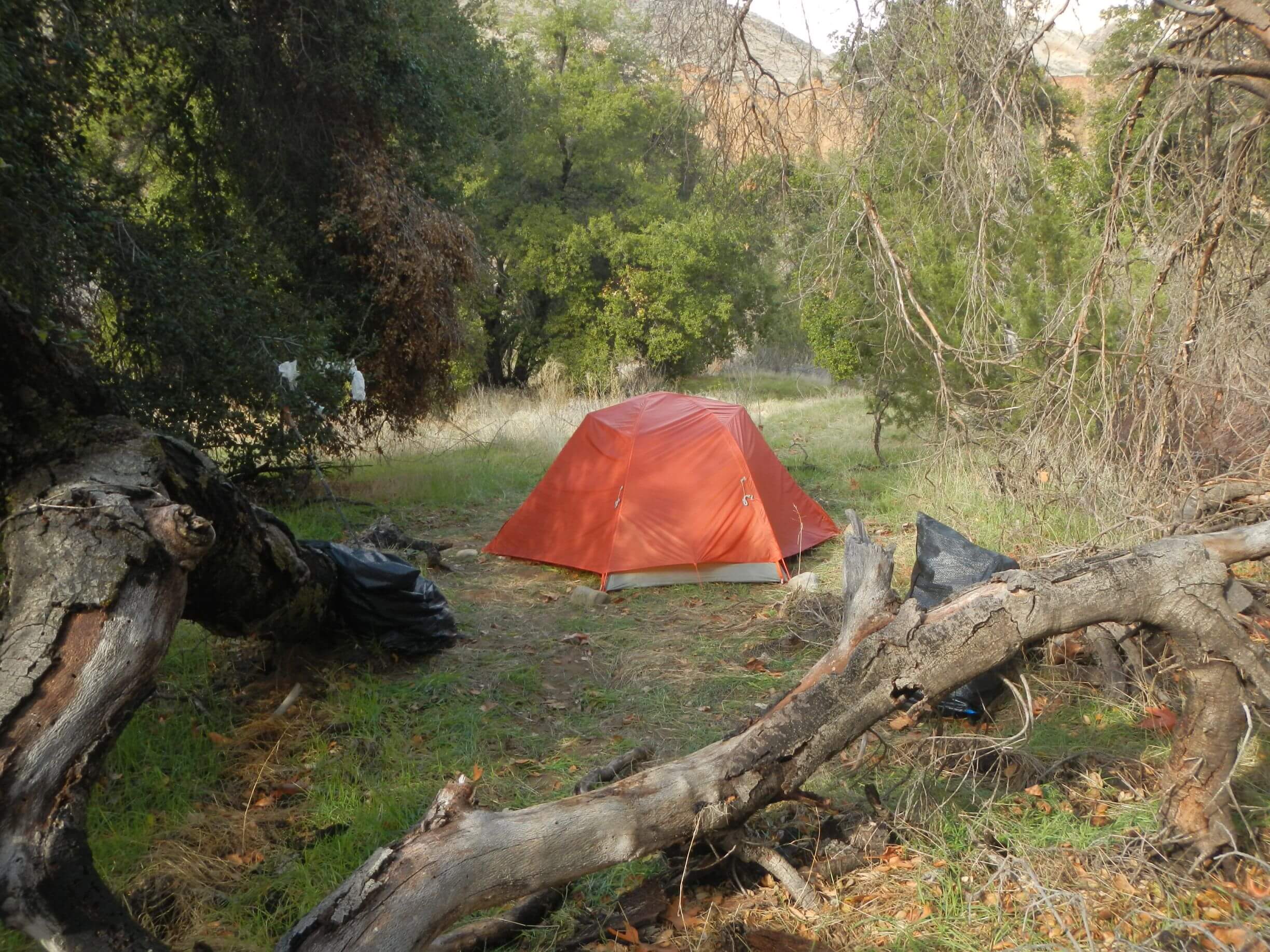
He waded out to me, took my backpack, and helped me slog across to land. Water was more than a foot deeper on what had been beach sand when he crossed. We had crossed near a large meander with some big evergreen oaks (which had been an island at very high water, maybe 4-5 feet higher than this flood). Grass was greening in sandy soil and no recent sign of water, but we still picked highest point. If needed, big flat would also be good place for helicopter rescue.
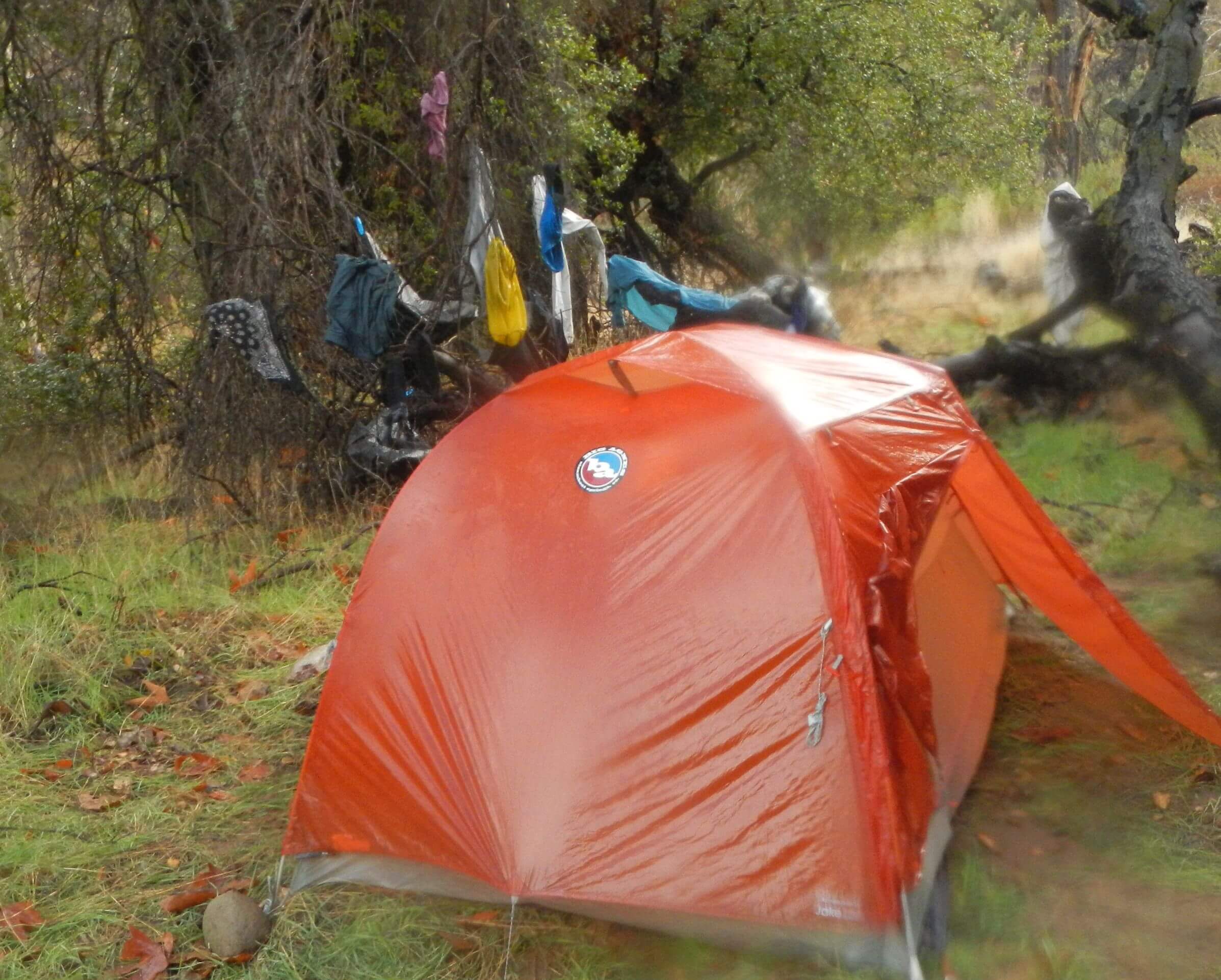
While David set up our tent during break in rain, I slogged up and down the island to keep warm. I probably had hypothermia but was not disoriented, my moves seemed sluggish and disconnected but I kept moving.
Got into my sleeping bag naked—David eventually found a dry shirt for me to wear. My clothes and gear were soaked and I had lost two water bottles, pair of gloves, shirt stuffed in a pocket, pack cover, and one pole to the river. We ate some snacks in the tent as rain started again. (Food, air mattress and sleeping bag packed in plastic in my pack interior was relatively dry).
Next day was February 14, my actual 70th birthday. More rain early morning. I thought “worst birthday ever” but then considered that God, an angel, or coincidence gave me a big birthday gift: my life. David clearly thought it was a miracle—when he noted me with neon green pack cover racing down the river, he thought I was gone. (Pack cover was later ripped off.)
GPS track showed I had floated down 325 ft and it was about 8 minutes from when I was swept down and until rescued on the rock.
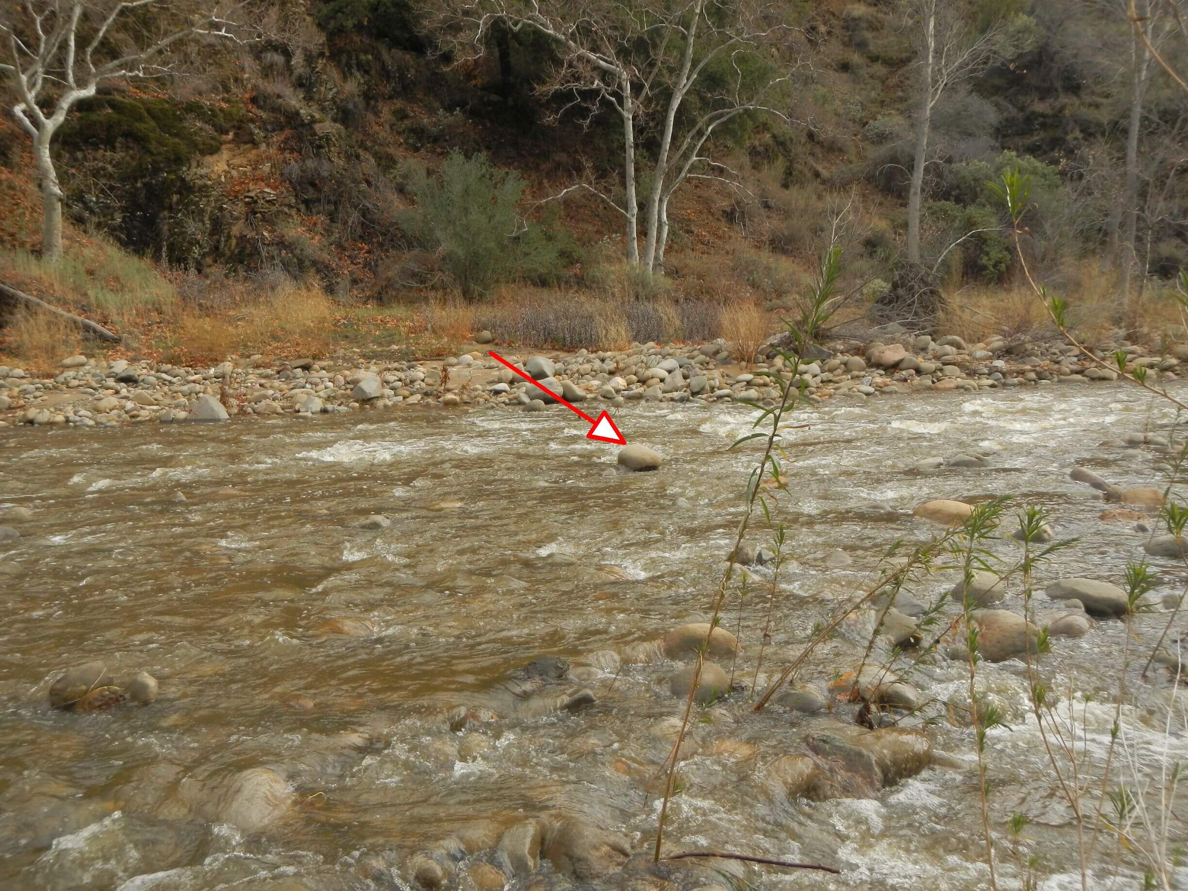
About mid-morning it partly cleared. We emerged from tent, hung up clothes and gear to dry and I made last night’s dinner (mac and cheese) for lunch. We took a little hike exploring escape options (I wanted to hike straight up the ridges but it was quite steep even following deer routes) and checking out the river which had dropped some but was still raging and muddy.
Next morning, river had cleared and dropped a few feet. We ventured upriver 2.6 miles with 10 crossings in knee deep water still faster than I liked. At beautiful Sycamore Camp (about 5 miles below South Fork Guard Station), we made breakfast and dried out tent fly and tarp. Then we hiked steep Jackson Trail out of the canyon to cold windy roads on top through herd of cows that ran down the valley and two scary bulls who watched us but did not charge.
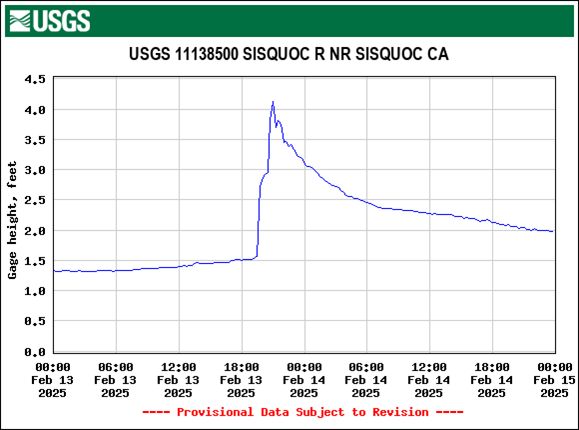
As we later learned from USGS water monitoring data, flash floods are quite common in Sisquoc River. There were more than 20 events of river rapidly rising 2-10 feet since 2007; this is extent of historic data but also coincident with 2007 Zacca Fire. We don’t know if the fire exacerbated flooding, if river always flooded periodically, if climate change is causing more floods, or exactly what is going on (Ironically, David had a research proposal in 2008 asking these very questions for several rivers within Zaca Fire footprint that was not even considered for funding due a bureaucratic clerical technicality).
Also, I recently conversed with a friend who was a wilderness ranger on the Los Padres National Forest in the late 1970s. She too was caught by a flash flood on the Sisquoc River in 1977 or 1978—she made it across; her dog was swept down but later found its way back to her!
Next two 18-mile days mostly on roads (but closed to vehicles), started with sticky Los Padres clay but was soon dry enough to walk road instead of on roadside vegetation. Good thing it was fast, we were able make up for lost day and catch up to our planned route at Ozena Fire Station. No South Fork Guard Station cabin or visit to Malduce Peak and big pines this time.
Next two days over Pine Mountain and around Reyes Peak we enjoyed beautiful pines but also hit slidy north-slope snow. David thought my alternate route might have meant a blizzard in the high country (instead of the flood we got on the Sisquoc).
I’m already planning a return trip next year. Starting lower on Santa Barbara District, visiting the pine ridges we missed. David wants to swing by South Fork Guard Station but I am dubious. Looks like 11 miles on Upper Sisquoc; compared to about 15 miles this trip.
Perhaps an April 2026 revisit—but no rivers unless it is very, very dry.
What a terrifying experience! Thank goodness for God, an angel or whatever divine assistant intervened.
What an incredible adventure! You are both very inspiring. -Cody (from the pool today)
Thank you Cody! We are heading to Marsh Creek tomorrow for 33-day hike across Frank Church & Selway Bitterroot wilderness. See ya at the pool in August!